
Everything about the Chambly Canal is small. The canal is very narrow, at times requiring constant attention just to keep the boat squarely in the middle. The openings at the bridges are narrow, requiring extreme care to pilot through the narrow opening between abutments, especially in a crosswind. And the locks barely fit the Joint Adventure and one small sailboat, cheek to jowl. Then we emerged into the St. Lawrence River, where everything is HUGE! The river is 600 miles long and 87 miles wide at its mouth! A “lake” within the river itself is 18 miles long and 7 miles wide. The current rushes up to 8 – 10 knots in places. The tidal range in Quebec City is up to 18 feet – so high that you must pass through a lock to get into the main marina in the old city. And the ships that ply the waters of the St. Lawrence Seaway are enormous!
The St. Lawrence was created along 370 miles of the St. Lawrence River for navigational purposes. I first visited the St. Lawrence Seaway on a family vacation when I was about 10 years old, as I recall. My Dad was intensely interested in its construction in the 1950’s, so on a week-long visit to the Adirondacks, we spent two days visiting sites on the recently-opened Seaway. I remember being mesmerized watching mammoth freighters squeeze into the Eisenhower and Snell locks north of Massena, NY.
A bi-lateral effort between the US and Canada to construct a seaway allowing ocean-going vessels to navigate between the ocean and the five Great Lakes was first proposed in the 1890’s, but until World War I, Canada had little interest in the project. After WWI, however, Canada was anxious to pursue the project, both to open up the Great Lakes to ocean-going vessels and to create hydroelectric power. However, a treaty between the two countries to build the seaway failed to be ratified by the required 2/3 vote of the US Congress, having been opposed by interests representing Atlantic and Gulf Coast harbors and railroad associations. Therefore, in 1952, Canada decided to proceed with the project on its own, with the benefits of cheap hydroelectric power to be generated by at the new dams being a key factor. Not wanting to be left out of the project, the US Congress finally approved a bi-lateral agreement to do so in 1954.
Construction began that same year, and the Seaway was completed in 1959. Having employed 22,000 workers, the seaway cost $470 million in 1954 dollars, over 70% of which was paid by Canada. The $470 million cost translates to a bit over $5 billion – a very large sum! However, to put it into context for us Bostonians, the final cost of the Big Dig was $24.3 billion – therefore, the cost of the Big Dig would be sufficient to build five St. Lawrence Seaways!
The opening of the seaway made the Erie Canal obsolete for commercial traffic, and started the decline of several cities in upstate NY, particularly Buffalo. However, the expansion of modern railroads and the decline of domestic manufacturing also contributed to the decline. Today, the Seaway is still important for shipping bulk goods, particularly grain exports and steel imports.
After joining us in Rouse’s Point, Pat Coates and Trish Koningisor became important and welcome participants in our journey. As we prepared to leave Sorel, Pat squeezed in some of her daily exercises on the bow of the Joint Adventure:

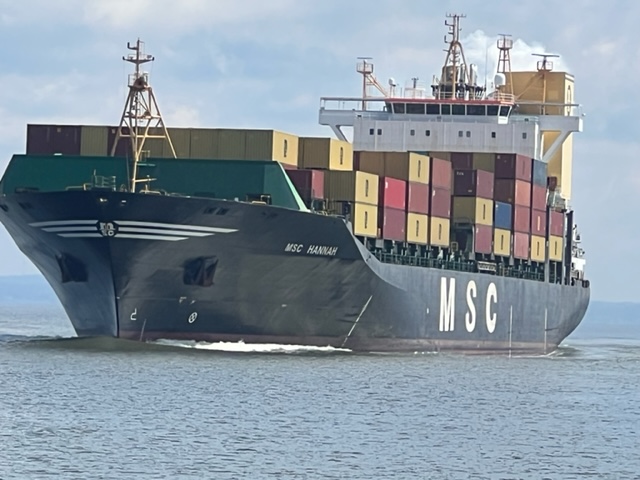
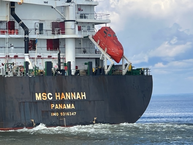
Running down the St. Lawrence, we generally pass several freighters each day. Despite the width of the river, there are often shoals on either side of the main channel, so we can only move to the side of the channel as we pass. The freighters generally insist on staying in the middle of the shipping cannels, so we often end up passing fairly close to the ships. Although they’re traveling only about 10 mph (which I suspect is the speed limit, since they all seem to be running at that speed), they throw quite a wake for us to cross.


Our first stop on the St. Lawrence after Sorel was Trois Rivieres. We arrived in windy, cool, and cloudy weather, and none of the channel markers shown on the chart as marking the narrow channel into the basin where the marina was located were there. In addition, the person at the marina who was handling the phones spoke no English at all. After a number of unsuccessful attempts at communication, the captain of the “Real Mountie”, tied up at the fuel dock, came to our rescue and translated for the next 20 minutes or so that it took to understand the channel (which in the end had plenty of water) and to get to our slip. We later met Norm and Ed from Real Mountie on the dock:

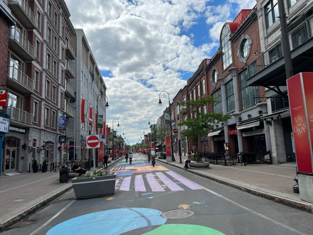
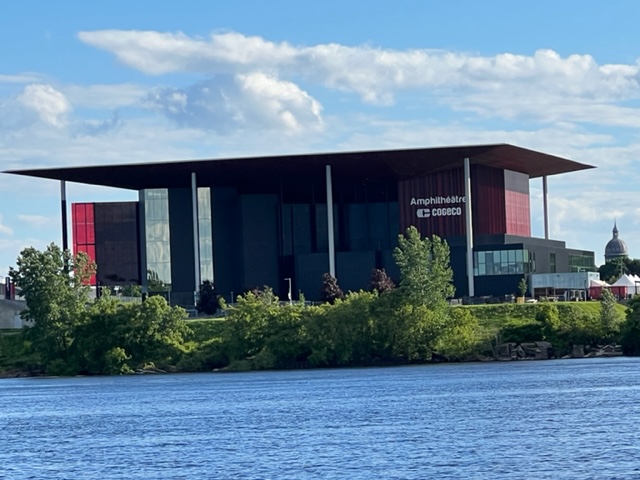
Trois Rivieres is a really cool city. An active waterfront, a downtown pedestrian-only street (similar to Burlington, Vermont), great bike and walking paths along the riverfront, and an enormous performing arts center all showcase the vibrancy of the city that we observed. Here are a few images:

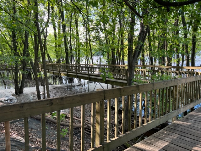

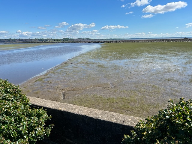
Our next stop was Portneuf, Quebec, a small town on the north side of the river. It has three restaurants and a convenience store, but not much else. There is a beautiful, historic catholic church that has obviously been closed for some time and is suffering from severe deterioration – a real shame. It did have an interesting bird-watching platform overlooking the shallows of the St. Lawrence River:
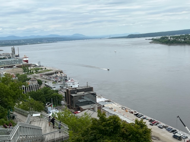
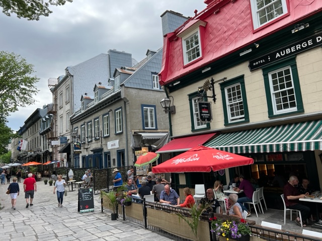
Our next stop was Quebec City, where we are as of this writing – a truly special place and a milestone on our journey. If you haven’t been to Quebec City, you need to go! We had planned to spend an extra day sightseeing here, but we actually arrived a couple of days earlier than originally planned since we hadn’t needed as many weather-days as we had built into our target schedule. Therefore, we’re spending an extra day or two here to enjoy the city. In addition, Chrissie Bell joined us in Quebec City and will be on board for the next segment of our trip!
There is far more history to Quebec City than I could ever cover in a meaningful way, so I’ll just provide some highlights and a few interesting facts. It is often referred to as the most historic city in the New World. The word “Quebec” is thought to be derived from the Indian word “kebec”, meaning “narrowing of the river”. Jacques Cartier was the first to sail into what is now Quebec City in 1535, and Samuel de Champlain founded the first permanent fur-trading post here in 1608.
Trying to populate New France was not an easy task. Here is one method that was used in the 1600’s:

When the French first arrived, they immediately recognized the defensive importance of the location, and over the years constructed defensive structures which were integrated into the protective walls which eventually enclosed the entire city; it is one of the few walled cities in the New World. Quebec City served for 150 years as the capital of New France, but the pivotal event that changed history occurred in 1759, when the British defeated the French on the Plains of Abraham, leading to the Treaty of 1763 in which France ceded all of it French colony to the British.


Here are a few historic plaques that can tell part of the story better then me:

After several false starts, agreement was finally reached to form a united Canada:

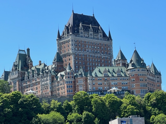
As we motored down the St. Lawrence into Quebec City, the historic Hotel Frontenac came into view and dominated the city-scape:
I could fill up the entire website with images of historic buildings and other interesting sights in the City, but I did the best to restrain myself. Here are some that I couldn’t resist:


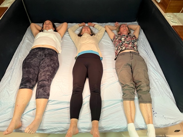
After dinner, we retired to the boat. The Joint Adventure has two enclosed cabins with queen-sized beds and the table in the main salon folds down to a king-size bed. After folding the table down, the women-folk had to try it out…. yes, we had some wine with dinner…..
Our next run will be to Tadoussac, Quebec, and a side trip up the Saguenay River through a fiord created during the last ice age. We’re watching some windy weather forecasts, so our departure may be delayed by a day or two extra in Quebec City.
More to come!!

Leave a comment