
Our lives are controlled by the weather. The progress of our journey, and how comfortable or uncomfortable we may be along the way, is totally dependent on the whims of the weather-gods. And we have learned that the St. Lawrence River creates its own weather pattern – and it’s quite varied and unpredictable. We have experienced nights that dipped into the 30’s (in late June!), and days that have had highs in the low 50’s with icy, 15-20 knot winds to days that are sunny and beautiful, with temperatures in the high 70’s – sometimes on the same day!
The upper level (the bridge) on the Joint Adventure has a full flexible-glass enclosure, so we don’t mind traveling in the rain – we’re perfectly dry, even in a downpour. Wind is our enemy, and wind direction is just as important as velocity. We can travel in winds up to about 15 knots if they’re from behind us, but winds on our beam or on our bow make travel uncomfortable and slow. Also, when the wind direction is the opposite of the direction of the current, large, steep waves close together build quickly, making travel VERY uncomfortable!
With strong wind advisories in the forecast (20 – 35 knots) from the northeast – meaning directly on our bow and blowing against the formidable St. Lawrence current – we opted to stay put in Quebec City for two extra days – there are worse places to be pinned down with a weather delay!
We spent the time exploring the city, including visiting some French cafes, an open-air bus tour, visitations to the Museum of Civilization, the Military Museum, and an art show called the “Immersive Experience – Monet”. A few images from our extra time in Quebec City:


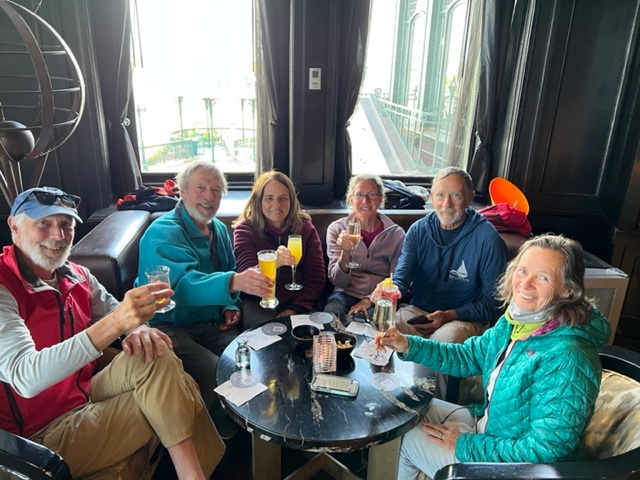
After the Monet show, we couldn’t resist having an afternoon drink and appetizer at the bar in the Hotel Frontenac:
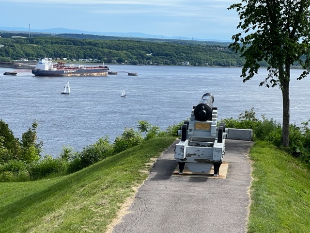
One more image showing the critical strategic military importance of Quebec City in the 1700’s – hence, when France lost the battle on the Plains of Abraham at Quebec City to the British in 1859, they lost New France for good.
A great sunset announcing good traveling weather enabling us to move on the next morning!

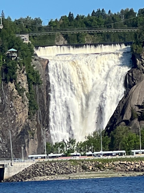
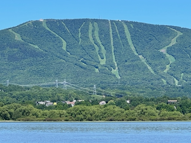
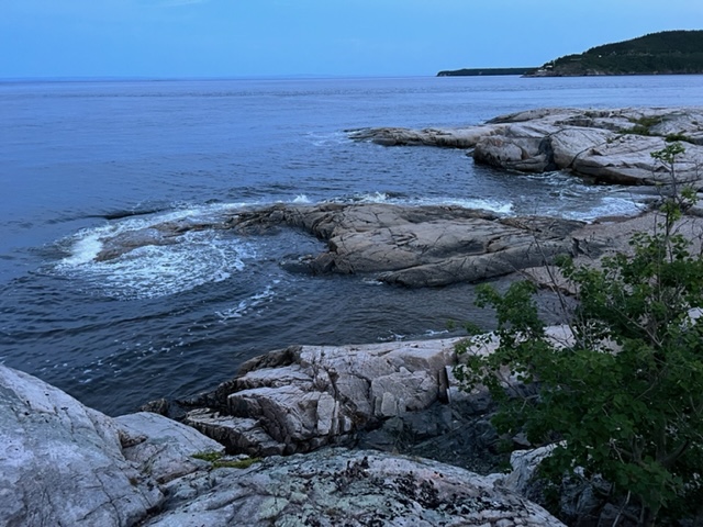
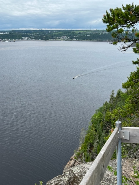
Leaving Quebec City, there is no protected harbor with adequate depth at all tides for the next 70 miles downstream. We left Quebec City in calm, beautiful weather, expecting it to last throughout the day. Instead, around mid-day, the skies got cloudy, the temperature dropped, and the wind suddenly kicked up to around 10 – 15 knots. Travel became uncomfortable, but we were committed. Suddenly, about 3 hours later, the wind subsided, the sun came out, and we cruised comfortably into our destination, the interesting Harbor of Refuge at Cap-a-l’Aigle.
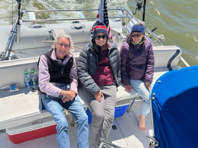
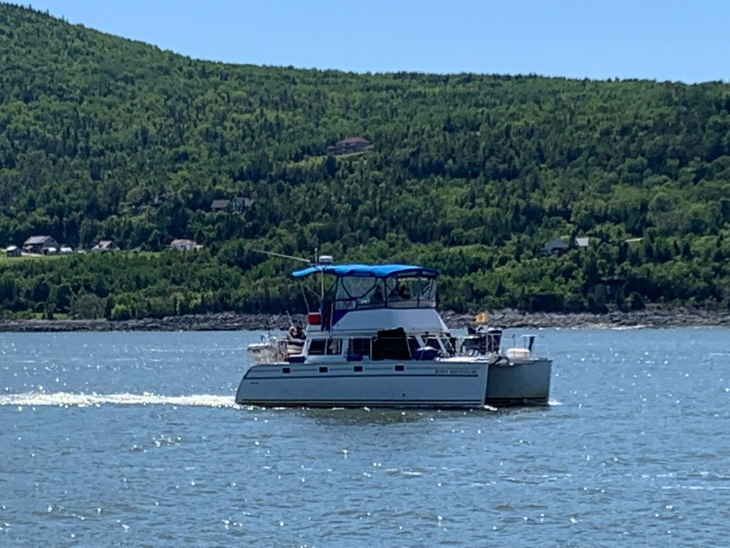
Some images from our 70-mile run down the St. Lawrence:


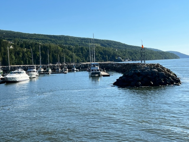
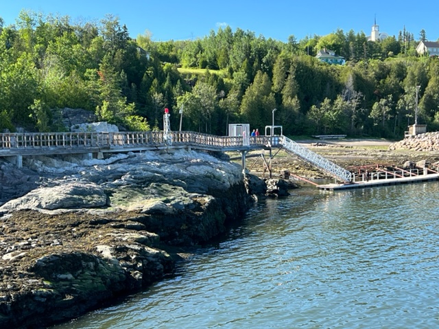
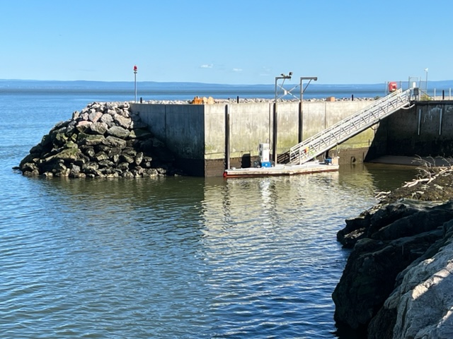
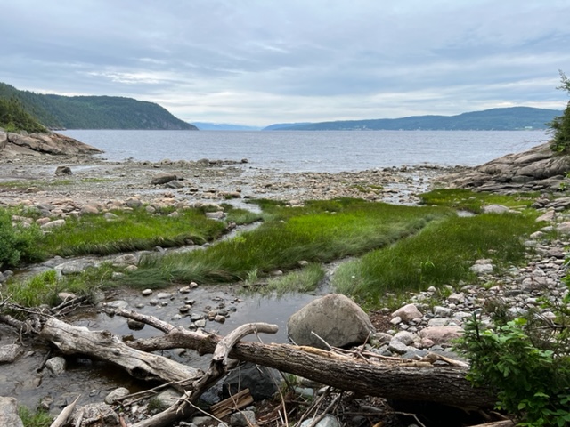
We arrived at the Harbor of Refuge Cap-a-l’Aigle late afternoon – it is a small, unique, man-made harbor where no natural one existed. Here are some images from our stay:

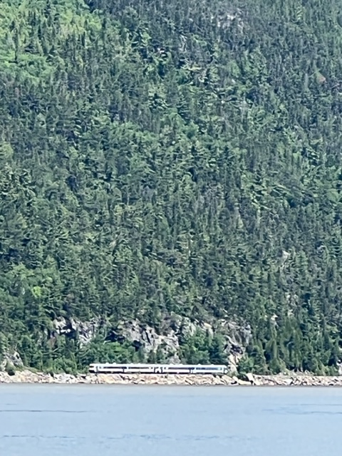
The following day, we left in marginal weather for a 40 mile run to Tadoussac and the beginning of the Saguenay River. With wind and waves on our bow, we considered turning back but slogged on. An hour later, the seas started to moderate, and a couple of hours after that, the weather had cleared and the seas were relatively calm, only to pick up again as we neared the mouth of the river. We saw a number of white beluga whales, one of which surfaced just 20 feet from the boat, then swam directly under us. I wasn’t quick enough with my camera to catch a shot of him!
A few images that I did manage to capture from the day’s run:


Tadoussac is a small resort town with some fabulous views and an interesting whale museum at the mouth of the Saguenay River:

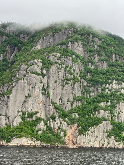
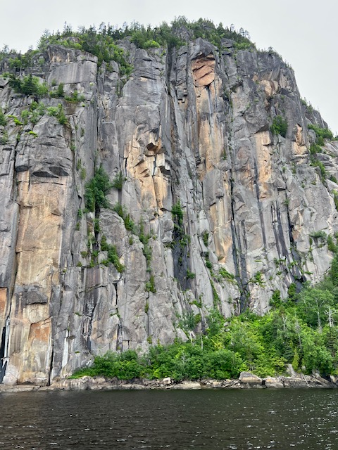
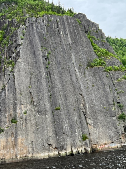
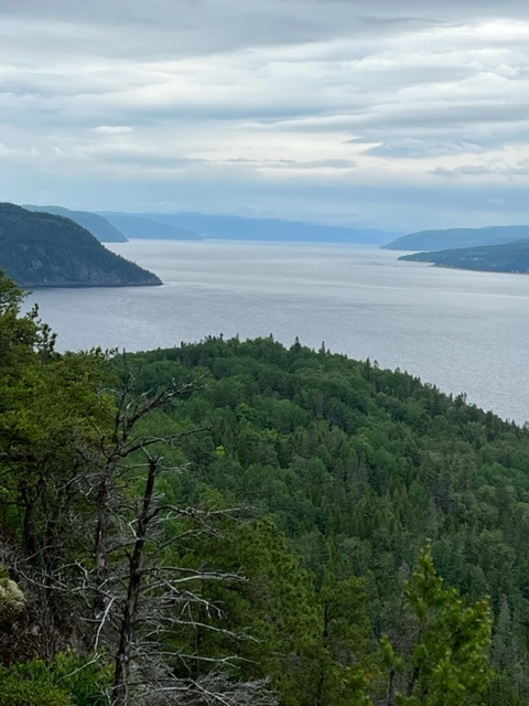
The Saguenay River is actually a fiord, the only one in North America. It was gouged out during the last ice age, and the cliffs along the river soar over 1000 feet above the river surface. The bottom of the fiord is almost as deep as the cliffs are high – the chart shows depths over 800 feet. In some places, the depth is nearly 300 feet immediately adjacent to the cliffs! The water is so deep that our depth finder quickly became useless (and superfluous!), as the signal was unable to reach the bottom and reflect back to the receiver.
Our first stop in the fiord was L’Anse-Saint Jean, a small town 22 miles into the fiord. The second day, we ran 40 miles through the cliffs to Baie des Ha! Ha!, which is at the end of a side bay of the fiord. After many jokes about the name of the town, we learned that Ha! Ha! in the local native language means “dead end” – which identifies the location of the town on the bay!
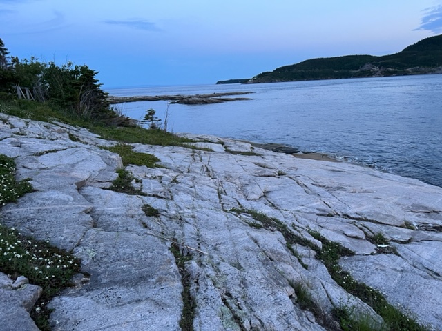
Images don’t do the height and the majesty of the fiord justice, but here are some of the fiord and the river as we cruised the 68 navigable miles to the head of the fiord, and of the hike we took from the village where we docked. No caption needed for many of the images:


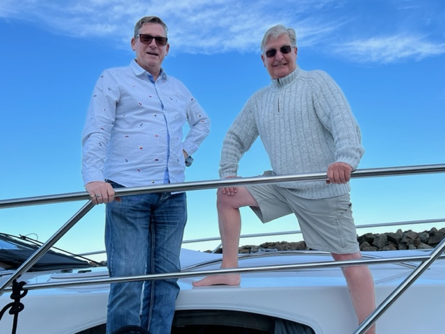
We arrived in Baie Ha! Ha! at noon, so after lunch aboard, Pat, Paul, Jim, and I embarked on a 4 1/2 mile hike up Cap Rasmussen. The hike was difficult, but the rewards were worth it:


We have now been on our journey for just over a month, having started on May 22. We’ve traveled a total of 819 nautical miles, which equals 942 statute miles.
More to come!!

Leave a comment