
A couple more images from our stop in Burlington, Vermont before I move on to our crossing into Canada.
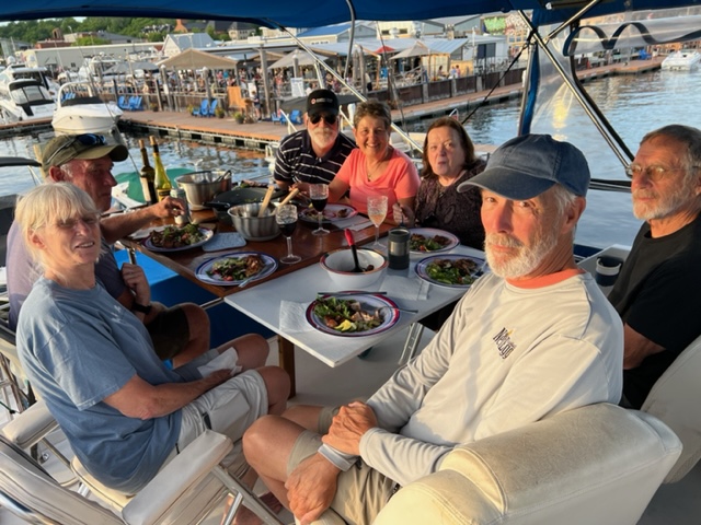
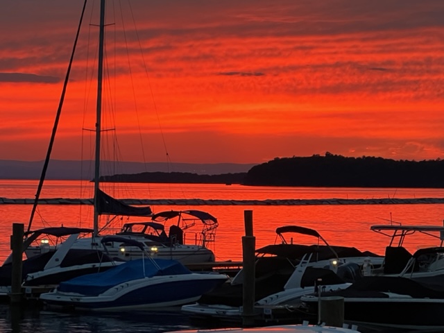
The second evening in Burlington, my fraternity brother Doug Roszman (Rosz) and his wife Kathy joined us for dinner on the boat; after dinner, we were mesmerized by an amazing sunset:

Rouses Point was our jumping off spot into Canada. Just before the border, Fort Montgomery is located on the western shore of Lake Champlain:
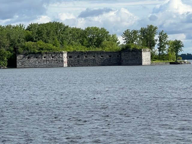
Fort Montgomery has an interesting legacy. The original fort was started in 1816 to protect against a possible attack from Canada by the British. However, it was discovered that, due to a surveying error, the fort was actually being constructed in Canada! When the error was discovered, all work on the fort immediately stopped, and construction of a new fort on the U.S. side of the border was commenced in 1844. The new fort has become known more by its nickname than its actual name – Fort Blunder!
It’s also interesting to note that construction of the fort took on a frenzied effort during the American Civil War amidst rumors of possible British intervention against the union.
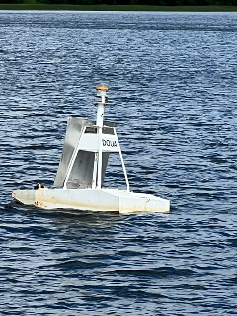
Just past Fort Blunder, we crossed the border into Canada. In case you’re wondering how they mark the border in the northern tip of Lake Champlain, here it is:
Immediately after crossing the border, we had to visit the Canadian Customs office, which is set up for boats coming from the U.S.:

When I went through here 7 years ago on the Great Loop, clearing customs took about 10 minutes. This time it took an hour and a half, and we never would have gotten into Canada if the wonderful officers on duty hadn’t had mercy on us, taking us under their wing, and helped us through the process. Due to Covid, Canada now requires each person to download and complete an online app which requires identification information as well as a complete vaccination history. Try as we might, we could not get the app to work, possibly because our U.S. internet service now had to mesh with the Canadian service. With infinite patience, Officer Parant and Officer Dugauy walked us through each step on the app until we all got checked in. In addition, a police boat happened to pull in while we were there, so they boarded the Joint Adventure and did a complete safety check of all required equipment- we passed!
The customs officers expressed an interest in our trip and our blog, so I provided them with information to access it. In addition to another “thank you!”, I have a personal message for them, however, that I hope they see if they read this post – we misplaced the email address to send you notifications, so please send it to me at jkoningisor@verizon.net!
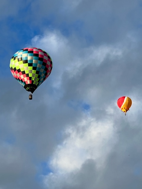
Lake Champlain quickly turns into the Richelieu River, which drains Lake Champlain northward to the St. Lawrence River. Our first stop on the Richelieu was Saint-Jean-sur-Richelieu, which is a small city. After biking around the city in the afternoon and enjoying a wonderful meal in a French restaurant, I went for a walk very early the next morning (6:00 AM). Upon hearing a strange noise and looking around in vain for the source, I looked skyward, which solved the mystery:

As I mentioned in my last blog post, the British tried to put down the American rebellion in 1776 in part by invading from the north using Lake Champlain and the Hudon River to get to New York and elsewhere. Since they controlled the St. Lawrence River all the way to Montreal, they could bring large ocean-going vessels to the mouth of the Richelieu River to bring in vast numbers of men and vast amounts of military supplies to that location. The ocean-going vessels were far too large to transport to Lake Champlain, so they built smaller warships and supply ships for use on the lake. However, since some sections of the Richelieu weren’t navigable due to rapids, they had to dismantle the ships and transport them part of the way over land, then re-assemble them when they reached the northern tip of Lake Champlain. Nonetheless, the Richelieu was an important strategic waterway both for military and economic reasons, serving as a key transportation route for trade goods, including furs and later the exchange of raw materials and manufactured goods.
In order to create a navigable connection between the St. Lawrence River and Lake Champlain, The Chambly Canal was completed in 1843 to bypass the rapids. Consisting of 9 locks in the Chambly Canal plus one additional lock further down the river, boats are lowered 84 feet to the level of the St. Lawrence in Sorel (12 feet above sea level). The canal is a historic gem, and most of the locks are still hand-powered.
The Chambly Canal is a highlight of any trip of which it is part, so here are a series of images to try to provide a flavor for the canal:


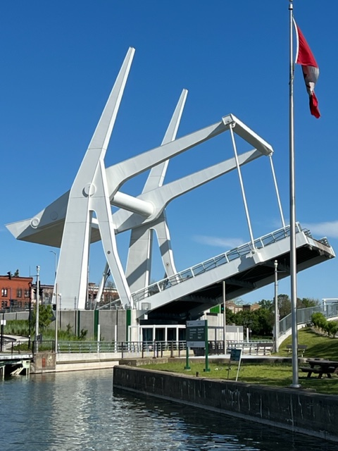


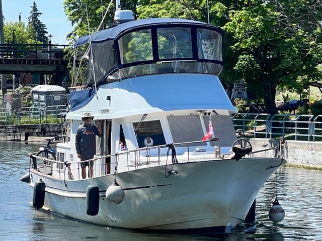


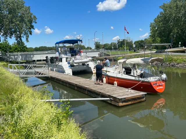


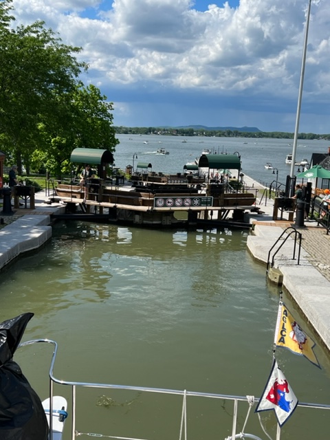

I know, quite a few pictures of locks and bridges! I couldn’t help myself, as the Chambly Canal is so cool!
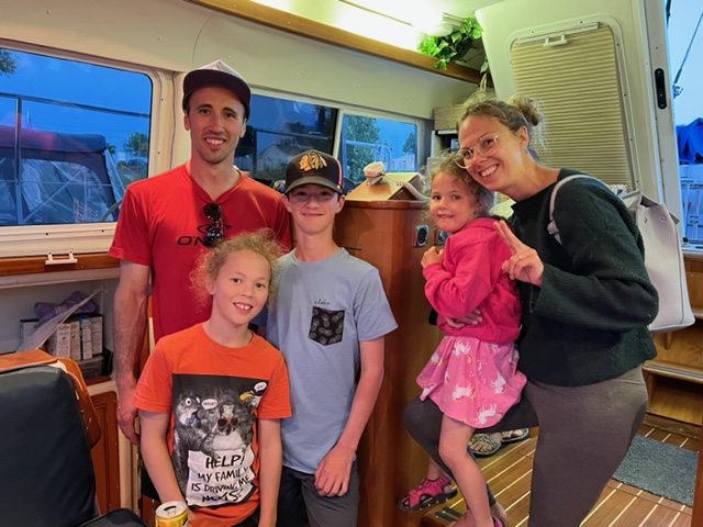
After transiting another 15 miles or so on the Richelieu, we stayed a short distance from the very small village of St. Charles that had one restaurant and one convenience store. At the marina, we invited a family who seemed interested in the Joint Adventure to come in for a tour. Matthew, a farmer who raises hay and other similar crops and has a boat at the marina, and his family spent 20 minutes or so chatting with us:
The next morning, we made the final run down the Richelieu River to the St. Lawrence. Along the way, we encountered a sea plane in which the pilot appeared to be practicing touch-and-go landings. On two of his runs, he appeared to be giving us a show as he passed by quite closely:

Around noon, we made our next major milestone on the trip – the St. Lawrence River, Sorel, Quebec:

More to come!!

Leave a comment