
As I wander around new places, sometimes a sign will catch my attention. Here are a few that I’ve encountered along the way:
This was outside a coffee shop – doesn’t seem to me like good marketing – why drink their coffee?

A costly mistake:

Seems to be a theme running here….

Beer deserves equal time –

The best defense is a good offense….

I don’t write the news, I just report it….

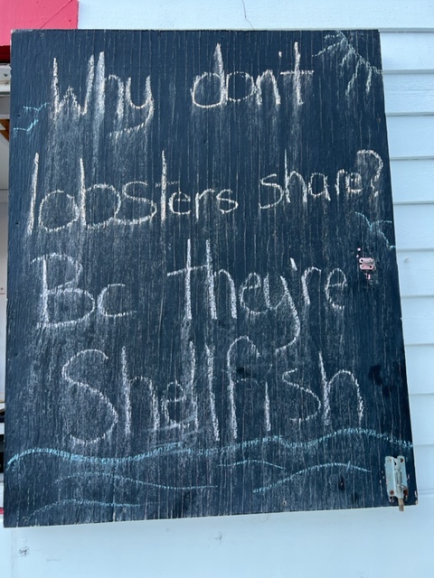
Sorry, I couldn’t resist….
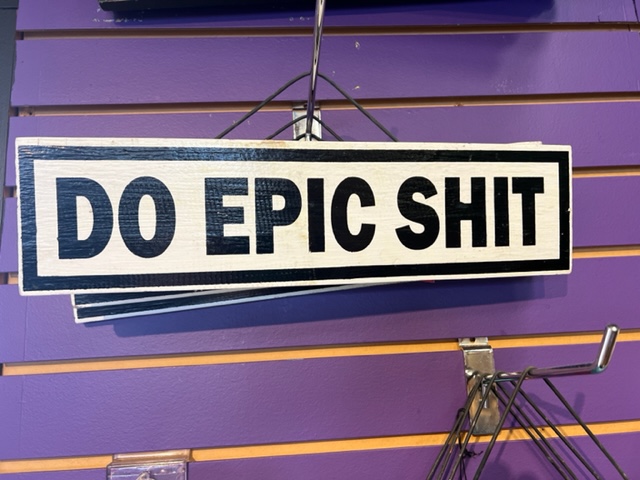
A motto to live by:
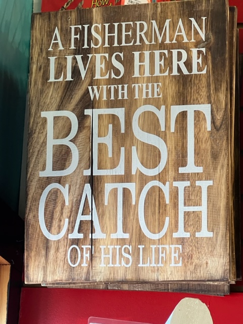
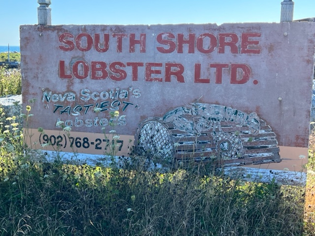
What all fishermen should be thankful for:
After a record hot summer, we can probably all agree with this:

As we cast off our lines and headed out of Halifax Harbor, we passed two other ships bringing visitors in:

Seems like this is a good time to leave!!
Our destination was Mahome Bay, a large indent in the coastline that has 4 or 5 small town scattered along its coast. Our destination was Mahome Bay’s namesake, Mahome Bay Town. It’s a small tourist-oriented town with several restaurants and a number of shops and boutiques. The names of two restaurants grabbed my attention:

I think this is a reference to Bluenose:

Our short 20 mile run the next morning to Lunenburg turned eventful. Shortly after we were underway, I detected a subtle vibration coming from one of the engines. I couldn’t tell which one, and there was no sound – just a vibration. I surmised that some seaweed or other small debris has fouled a propeller or shaft. Someone needed to dive under the boat to see if that was the cause, and if so, to clear it. I thought of waiting until we were docked in Lunenburg, but there is a dangerous risk associated with swimming at a marina with electricity on the docks – any leakage of electricity into the water from a faulty wire or connection or from a boat that’s plugged in can cause a swimmer to become temporarily paralyzed and drown – several people die every year from going into the water in a marina.
At the time that the vibration started, I was still in a protected cove in Mahome Bay and there was little wind or current. So it was clear that the best time to check it out was at that time. Unfortunately, Paul had gotten off the boat temporarily to rejoin us a couple of stops further down the coast, and Jim wasn’t feeling well and was sleeping below. So by default, I was elected. I have no wetsuit on board, but as noted earlier, the waters in this part of the world have not been as cold as we anticipated. So down I went, and sure enough – there was some seaweed wrapped around the starboard shaft, which I was able to clear. We were on our way again!
Although our route was more open than some previous sections of the Nova Scotia coast, we still had to pay close attention to navigation:
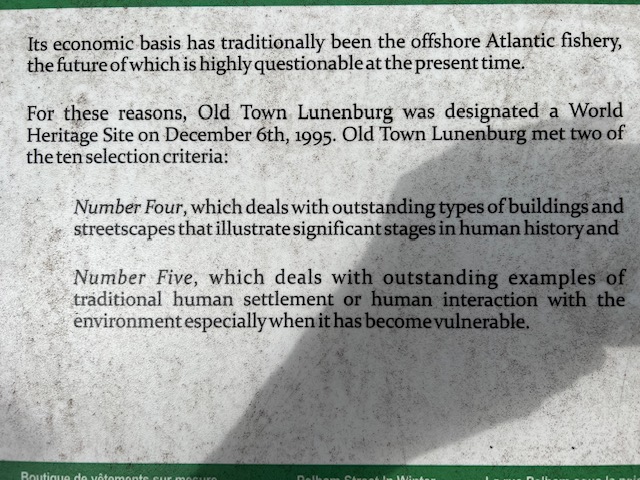
Lunenburg is the quintessential Nova Scotia tourist town. It was settled in the 1750’s by German, Swiss, and French settlers who arrived as farmers but soon prospered through the fishing bounty of the sea and shipbuilding, exploiting the vast stands of timber. Lunenburg quickly became Canada’s premier fishing port during the days of the Grand Banks salt fishery. Lunenburg is a rare example of a city that managed to retain the look and feel and to some degree the reality of the working fishing village that it was a century ago. The European influence is reflected in the well-preserved collection of old-world architecture, which largely remained unchanged as they have transitioned to contain a wide array of restaurants, inns, B&B’s, shops, boutiques, etc. In recognition of its unique character, Lunenburg was named a UNESCO World Heritage Site in 1995.
Exploring Lunenburg, I quickly discovered that it contains the steepest streets that I’ve ever encountered – noticeably steeper than in San Francisco, although the steep sections aren’t as long. The following two plaques explain why better than I could:

This is an image of a model in the Fisherman’s Museum that shows how the rigid grid of streets was imposed on some very steep and varied terrane:

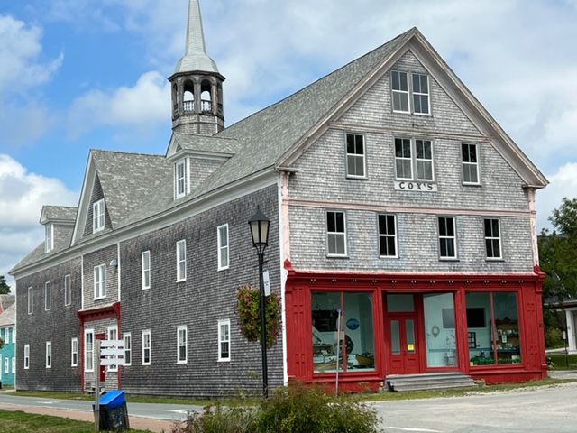
Here are some images of the well-preserved architecture that has been re-purposed in Lunenburg; notice the horse-drawn carriage which provides tours of the small city:


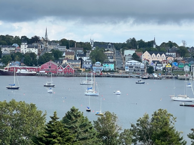
Here are two pictures of the town taken from across the bay from the city; it provides a good sense of how the city quickly climbs the steep hill as it steps back from the waterfront:

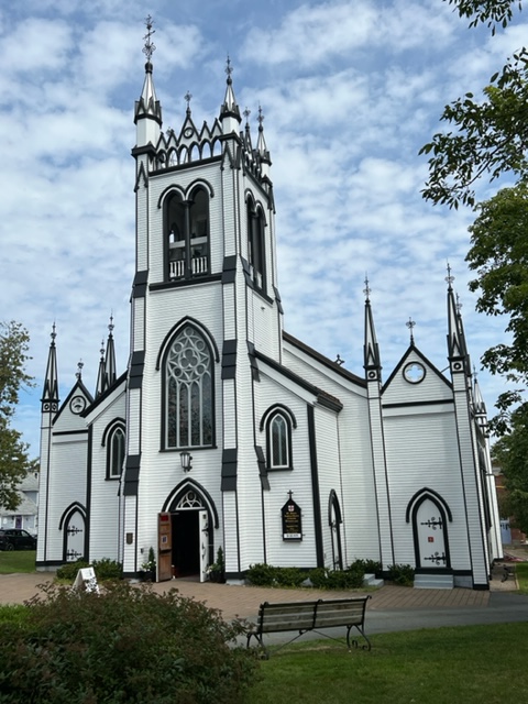
I usually don’t take pictures of churches because there are so many, but I thought this one was quite unusual:
This is the Lunenburg Academy building:

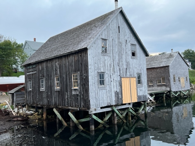
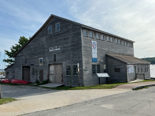
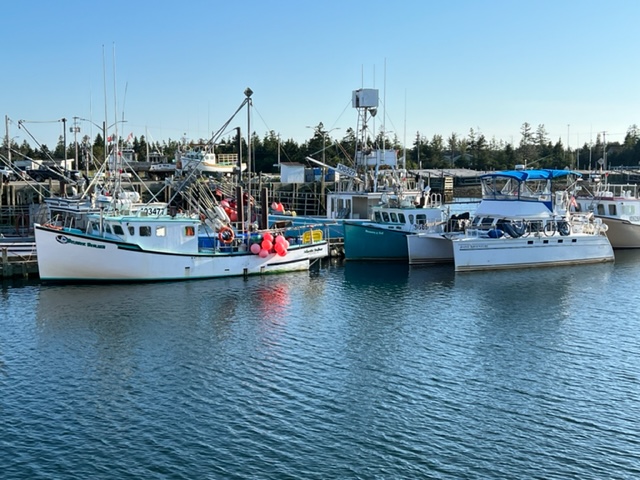
The Lunenburg waterfront is dedicated to sea-related uses and activities. Here are a few images:


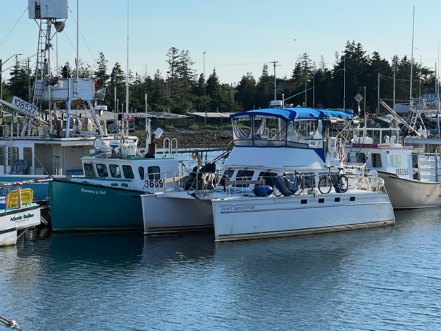
We qualify as a sea-related use! Here is the Joint Adventure docked at the waterfront:
So what does Bluenose have to do with Lunenburg?
As mentioned above, Lunenburg prospered as one of the most important boat-building centers in North America. The most famous ship built in Lunenburg and one of the most famous sailing ships of all time was named “Bluenose”. This plaque contains a brief history of Bluenose and its replica, Bluenose II:


So today, the southeast coast of Nova Scotia from Halifax to Cape Sable is known as the Bluenose Coast, and residents along the coast are sometimes referred to as “Bluenosers”.
But where did the name originate? Most people assume that it has a nautical origin, and are quite surprised when they learn its history – the name actually comes from a potato! Specifically, from a bluenose potato, so named because it has a blue coloring and it has a nub, or “nose”. The story starts in 1816, with an unusual weather pattern in which there was snow in most parts of Canada all 12 months of the year. Migrants back then often carried large quantities of seed potatoes with them to eat on their journey and to plant when they settled. Nova Scotians who arrived in Ontario the next year had large quantities of blue potatoes, which they shared with starving settlers who had run out of food as a result of the weather the year before. As a result, the term Bluenose, which previously had been derogatory, was honorably applied to people from “down east”. Soon the nickname “Bluenose” was applied to all Nova Scotians.
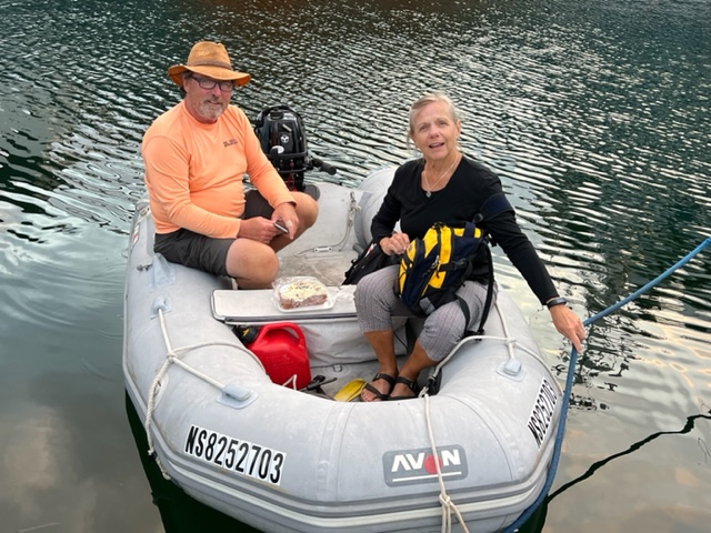
One last image from Lunenburg – we first met Alan and Judy, who are likewise headed south, in Beddeck and in Bra d’Or Lakes, and we have since re-united with them several times as we both leapfrog south. Here they are in their dinghy, getting ready to cast of the next day, as we were:
Our next stop was Liverpool, a 35 mile run from Lunenburg in open water. Jim was still not feeling well and Paul hasn’t rejoined us yet, so I again ran the boat solo on this segment.
The marina is small and has a small snack bar with friendly proprieters, but the town of Liverpool is a three mile bike ride from the town. Despite light rain and drizzle, I headed out, being reminded what my daughter Jenny said to me so many times when she was growing up and I hesitated about an outing due to rain – “C’mon, Dad – it’s only water!”
The old section of the town is small but quaint, and I visited the only museum that is still open. Founded in 1759, Liverpool also became a boat-building center. Interesting, much of the small but well-done museum focused on boats built for privateers, and on the privateers who plied the waters in the late 1700’s and early 1800’s, especially during the War of 1812. Liverpool seems quite proud of this history; here are a couple of plaques regarding privateering during this period:


We left early the next morning for Shelburne, still operating solo for a 7 hour run along the south coast. The weather and seas were calm, and it was a pleasant passage.
Shelburne was founded in 1783 when thousand of British Loyalists fled the newly-independent colonies at the end of the American Revolution. The town quickly grew to over 10,000 inhabitants, and at one time was the fourth largest city in North America. Many of the Loyalists were well off, and the town prospered from fishing and boatbuilding. As a result, many of the homes which are well preserved today reflect the upscale tenor of the town as it prospered in colonial times. Also, many of the historic homes were spruced up in 1994 by Hollywood movie-makers, as Shelburne became the setting for the movie “The Scarlet Letter”.
While appealing to tourists, the flavor of the town is genuine – it feels more like an attractive and functioning residential community than a tourist town. Here are some images of the modest waterfront area:

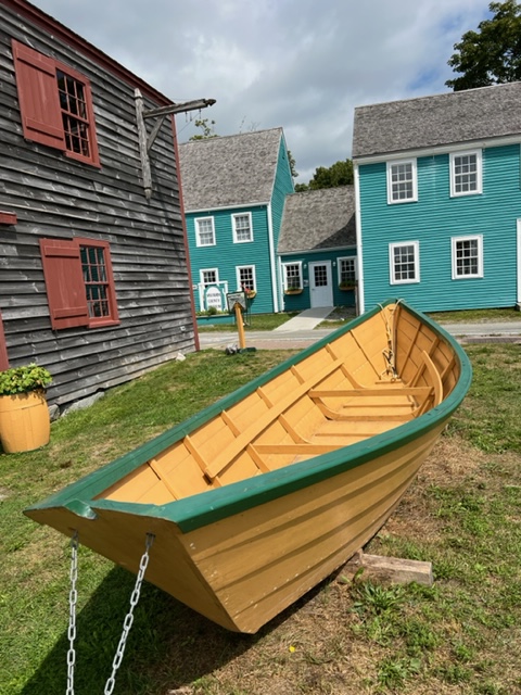
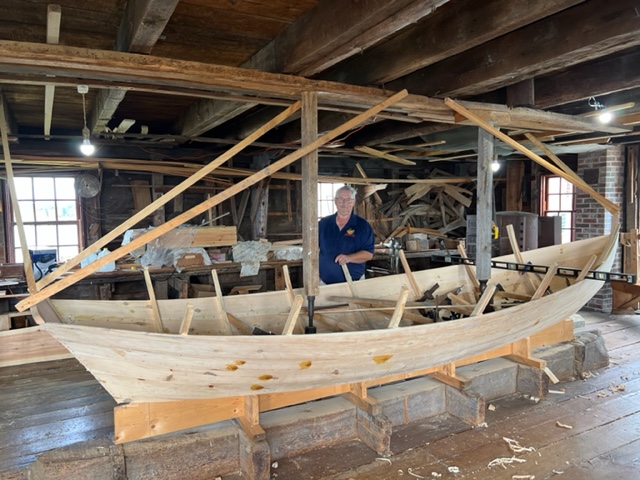
There are three small but very well-done museums clustered along the waterfront. My favorite was the Dory Shop Museum which displayed the history and products of the historic Dory Shop. Started in 1887, the Dory Shop built over 50,000 high quality dories until falling demand caused it to close in 1971. However, the museum opened in 1983, and it includes a workshop on the second floor where, as part of the museum experience, you can watch and ask questions of the craftsman who today builds handcrafted dories in the museum. Here are some pictures:


Notice the historic buildings behind the dory which is next to the museum –
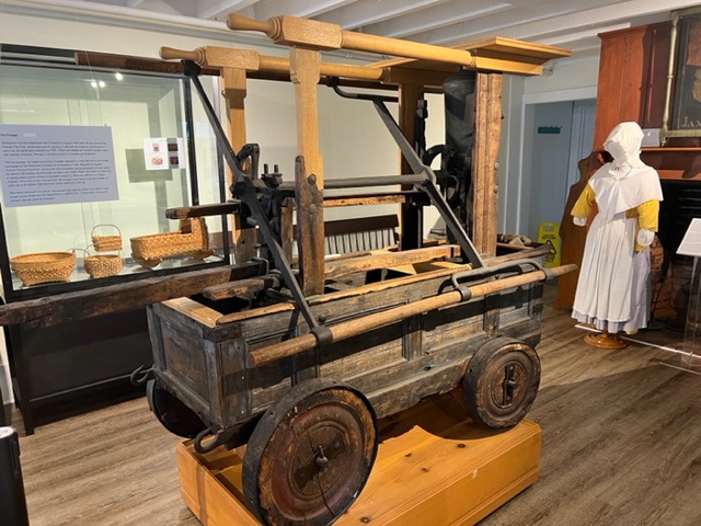
The Shelburne County Museum has some interesting exhibits as well; I thought these images of a hand-operated fire pumper and the plaque with a brief explanation were particularly interesting – fortunately, we have far better ways to fight fires today!!

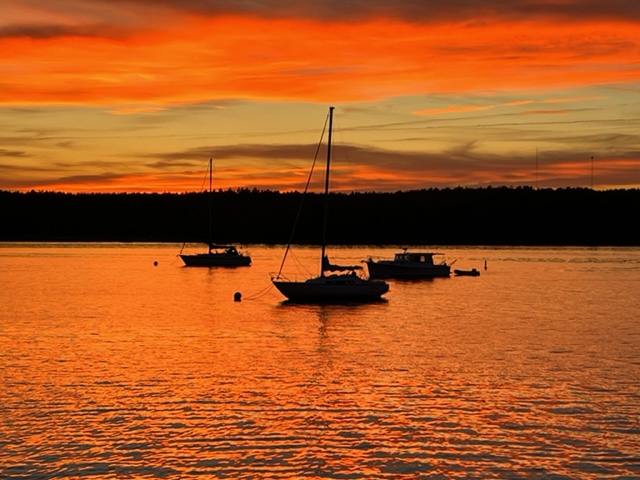
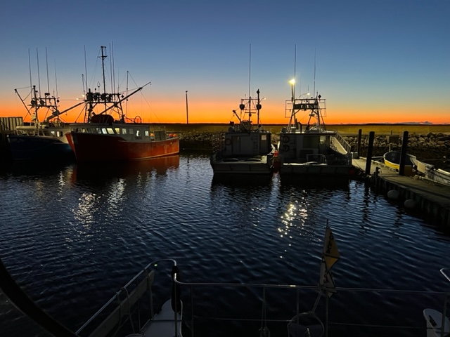
We were fortunate to enjoy this beautiful sunset in Shelburne the first evening of our stay:
Strong winds and a day of monsoon rains kept us in Shelburne for two days waiting for the weather to break. On the third day, we headed out in thick fog at 7:00 AM for a 26 mile run to the fishing harbor of Port La Tour. Visibility was as low as 100 feet from time to time, as the fog varied in intensity. However, we relied on our GPS/chart plotter for navigation and on our radar to identify other vessels; as usual, there were very few – two, to be exact! The seas left over from the storm the day before ran 5′-6′ at times, but they were swells more than waves, so the Joint Adventure handled them OK. The fog finally lifted as we rounded the corner of the bay towards Port La Tour.
Here’s a picture of a lighthouse on the headland when we were about to turn into the bay; the lighthouse and the rocks next to it just started to become visible as the fog began to lift:

Ahead in the distance as the fog began to lift, we saw this strange white ball in the sky; we had no idea what it might be – a UFO stalking us??
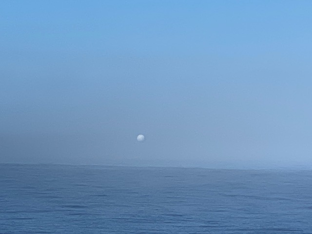
Exploring the area later that afternoon on our bikes solved the mystery; in the fog, only the ball was visible, creating the optical illusion that so baffled us!

It’s actually a military radar installation, apparently dating from World War II but still in use today; the site is fenced and active, with warning signs all around to stay out!
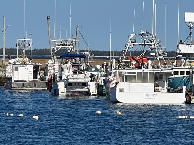
The harbor in Port La Tour is man-made with concrete wharfs and high rock breakwaters, and is purely a commercial fishing harbor. Every spot was filled with large fishing boats, so we rafted up to the “Rosemary & Gail” in a location that wouldn’t block any other fishing boat that might go out. Shortly after we tied up, the owner of the boat, Robert, and his son Mathew, happened to show up. They welcomed us to Port La Tour, and welcomed us to stay tied to their boat as well. We had a 20 minute chat, but I must confess that both Jim and I could only decipher about every third word due to their thick, Nova Scotia fishermen’s accent! So we nodded and smiled alot….
Here’s a picture of Robert and Mathew:

Here are some pictures of the Joint Adventure rafted to Rosemary & Gail among the fleet of fishing boats:


I’m starting to worry that the Joint Adventure might be having an identity crisis. At her home port on the Charles River in Cambridge, she is surrounded by only power boats, so she feels very much at home. Cruising New England waters, she encounters many sailboats, so she understands them and is OK with them around. But ever since we headed east from Quebec City, harbor after harbor, she’s surrounded by nothing but fishing boats, mostly large, muscular fishing boats, so I think she might be starting to question her identity….
In our bike travels, Jim and I came upon a small National Historic site called Fort St. Louis, which consisted of a path to the end of a peninsula, with a single historical marker. Here is the message on the plaque:

It would be interesting to know the rest of this story.
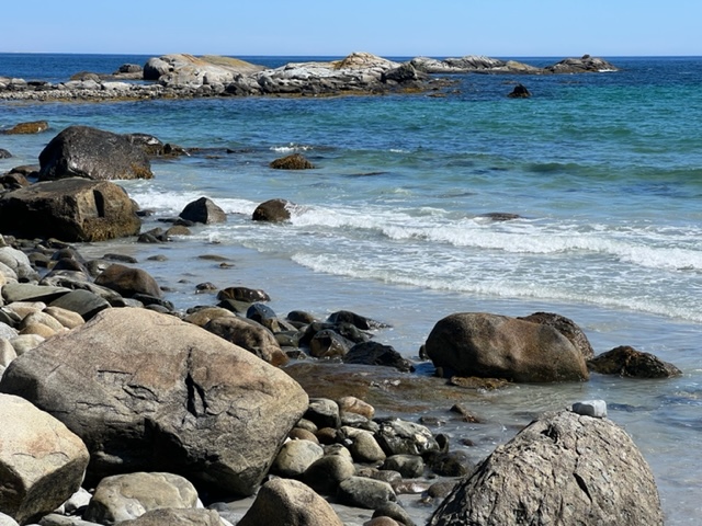
We next arrived at Crow’s Neck Beach, which we were told is one of the prettiest beaches in Nova Scotia. It turned out to be a hidden gem – so remote that it’s mostly empty, as it was the beautiful sunny afternoon when we visited. The sand is as fine and smooth as we’ve seen anywhere (except the white flour-sand of Fort Myers Beach). We walked the entire length of the mile-long beach, our feet in the quite-cold water; no longer the warmer waters of Prince Edward Island, Bras d’Or Lakes, or Eastern Nova Scotia:

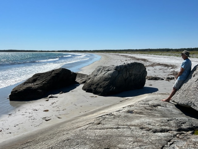
The far end of the beach:
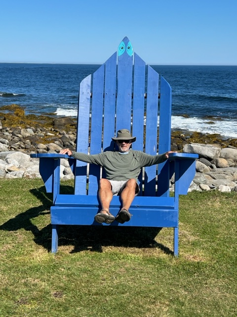
We visited the lighthouse at the headland as well, and Jim got a chance to again relax on his favorite type of chair; you might recall him getting in touch with his inner artistic self on a similar chair earlier on the trip:
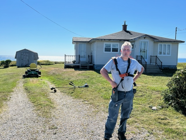
Another story about the amazing people of Nova Scotia and the Maritime provinces – so I was riding along on my bike passing a house in which a man was mowing the lawn on a riding mower. When he saw me, he stopped the mower, shut off the engine, and came out to the street to talk with me! He is a local lobster fisherman which he has been doing for 40 years, and we chatted for about 20 minutes, each learning a bit about each others’ lives. He also gave me some important advice about rounding volatile Cape Sable, which we intend to do in the next couple of days. Meet my new friend Bobby; notice his idle lawnmower in the background!:
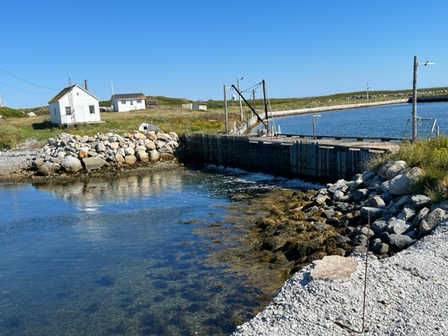
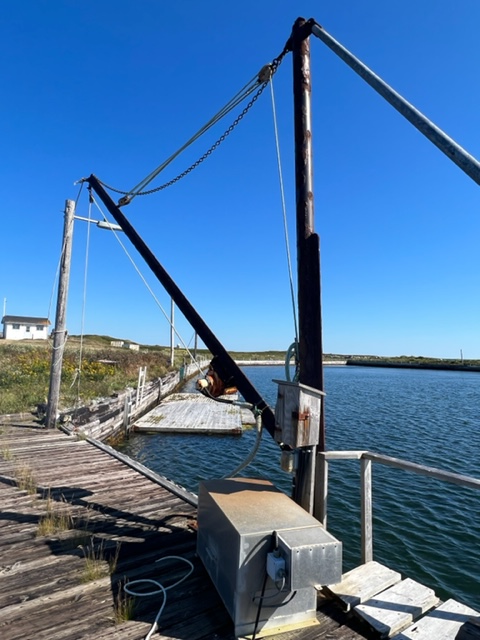
Exploring a dead end road, I came upon a relic of a defunct lobster pound, which included a completely enclosed man-made harbor, a wooden bridge, hoisting equipment to unload lobsters, and several buildings. It must have been quite an operation at one point – sad to see it closed and deteriorating:
Further on, turning down another path towards the water, I was stopped dead in my tracks by three large birds protecting a brood of about 8 or 10 newborn chicks:

I have no idea what kind of birds they are, but the three adult birds made noises like I’ve never heard from a bird before – I was no match for them, so I quickly retreated with my tail between my legs!
The next day was a milestone – we planned to run 65 miles and round Cape Sable, which marks the southwestern tip of Nova Scotia. It also brings us to the eastern edge of the Bay of Fundy. The combination of those two geographical conditions produces big currents and turbulent waters; they’re manageable in settled weather and in wind that isn’t too heavy and isn’t in the opposite direction of the current.
In order to round the Cape in as settled conditions as possible, we needed to arrive at low tide, which was 7:49 AM; Port La Tour was 16 miles from Cape Sable, so we needed to leave at first light – and so we did! Pulling out of the harbor at 6:15 AM (Atlantic time):
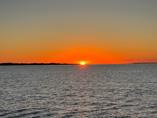
Out at sea, we welcomed the sunrise:
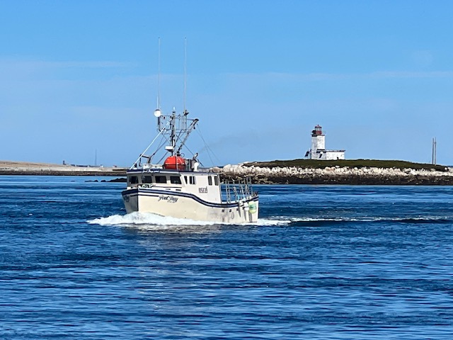
Cape Sable Light, marking the southwestern-most point of Nova Scotia; we rounded the Cape and turned north toward Yarmouth, which would be our departure point for crossing the Bay of Fundy:

After rounding Cape Sable, we entered a narrow channel that winds among a series of islands, rock ledges, and headlands called Schooner Passage. Here is another scenic headland we encountered along the way:

The turbulent waters attract fish, and fish attract fishermen; this friendly fisherman waved and tooted his horn as we passed. As usual, we saw no other boats other than a few small local runabouts carrying recreational fishermen:
With a population of about 7,000 people, Yarmouth is the largest town in southwestern Nova Scotia. It is also the terminus of the ferry from Bar Harbor, which brings both passengers and vehicles to Nova Scotia. If you’re thinking of visiting, it’s a great way to get here! Below is a picture of the enormous ferry coming into Yarmouth:

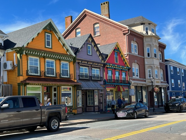
The first European visitor to Yarmouth was Samuel de Champlain in 1604. It quickly became an important fishing port, and its heritage is displayed in the array of well-preserved homes from its heydey. Today, Yarmouth is a down-to-earth, working-class fishing and industrial town that takes advantage of its strategic location. The waterfront is a gritty, no-nonsense working harbor. However, one street up from the waterfront is a surprisingly long and varied Main Street that boasts a varied selection of shops and working establishments – not tourist boutique-type shops, but well-kept shops that support the working-class residents of the region, with some restaurants, breweries, and the like mixed in throughout restored, historic buildings. Here is an image from along Main Street:
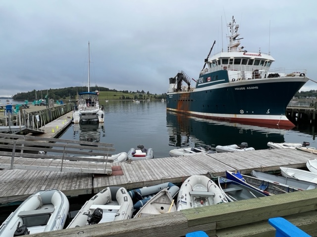
Upon entering the harbor, we encountered this fishing vessel that’s a bit unlike any we’ve seen to date:

Apparently, the boat on the stern is lowered into the water when the ship arrives at its fishing grounds. A long net is attached at one end to the mother ship, and the other end of the net is attached to the tender. The tender then drags the net in a large circle, encircling the schools of fish in the area. A “purse string” at the bottom of the net is then pulled tight, closing the bottom on the net and trapping the fish.
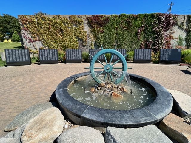
Exploring town, I came upon this Fishermen’s Memorial, honoring fishermen who have died at sea while fishing. Virtually every town we’ve passed through since Quebec City has a fishermen’s memorial of some sort, but this one was different – notice the seven black stone markers engraved with names – there are over 2,500 names inscribed in the memorial!
So the next segment of our journey will be an interesting one – we’ll be crossing the notorious Bay of Fundy with its legendary tides of 30 feet at the mouth and up to 50 feet at its terminus. We plan to do the crossing in three separate passages. The first takes us to Brier Island, 35 miles northwest of Yarmouth. The second takes us across the center of the Bay of Fundy to Grand Manaan Island, and the third will take us to Lubec, Maine. Because of the vast tidal movements and the accompanying strong tidal currents, we have to time our passages to coincide with favorable currents in the direction we’re going, and we need wind that is light and not contrary to the direction of the current. Therefore, we expect some downtime as we await our favorable weather windows.
More to come!

Leave a comment