
After bidding adieu to Trish, Pat, and Chrissie in St. Peters Village as we emerged from 9 days in Bra d’Or Lakes, we cast off the lines and headed to Canso, a small town on the western end of the Nova Scotia mainland. Canso was founded in 1605, and it became an important fishing port because it was the closest settlement to the Atlantic fishing grounds. A fish processing plant provided many jobs in Canso until it closed in the 1990’s due to declining fish stock. Like so many other places we have visited, many local residents left the town since there was little economic base. The plant partially reopened in 2011, and now processes “new and underutilized” species, mostly for the Asian market.
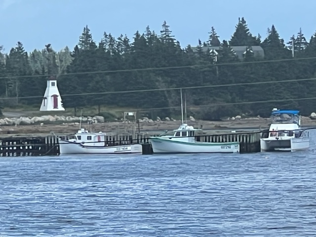
Today, Canso is still a fishing harbor, with halibut an important species. Below is a lineup of fishing boats rigged for halibut in one of the three commercial wharfs in Canso:


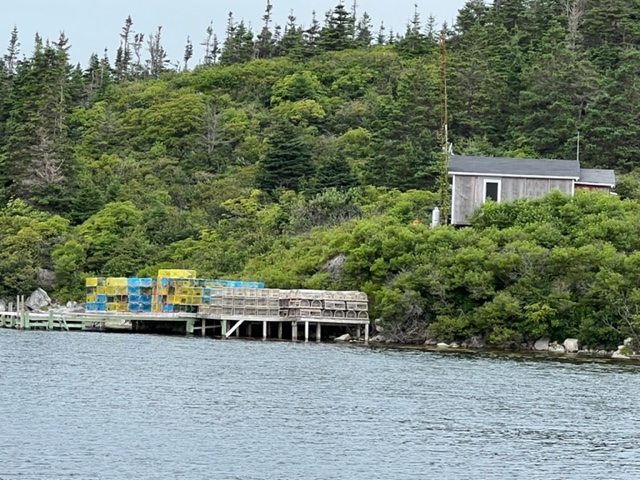
Rather than tie up to a wall in one of the commercial harbors, we docked at a small marina/RV park further up the waterfront; as usual, we were the only cruising boat there:

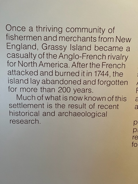
Across the bay from Canso is a small island referred to as the “Grassy Island”. As mentioned above, in colonial days, Canso was an very important fishing harbor both for the catch that was brought in from surrounding waters and as a drying and processing facility; Grassy Island was the center of it. A Parks Canada museum/interpretive center tells the story quite well, and boats depart from there to take people out to Grassy Island, now a national historic site. This brief plaque tells the story of the fishing center’s demise and rediscovery:
While riding through the town, we saw many of these signs in front of homes in Canso:

I stopped to ask a couple of residence about the signs, and was told that Ukraine, of all places, plans to build a satellite launching facility in Canso. Many residents have opposed it, while others have supported it due to the promise of jobs. Apparently, Ukraine has now received all of the permits it needs, and was planning to start construction this summer; however, the war with Russia interceded so the future is uncertain.
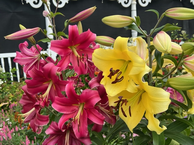
One last image from Canso – I couldn’t help but take this picture of an amazing flower garden in front of a modest but well-kept home:
Leaving Canso, we started on the next phase of our trip, along what’s known as the Sunrise Coast of Nova Scotia from Canso to Halifax; it forms the first half of the Eastern Shore, the other half being Halifax to Yarmouth.
Historians believe that Norsemen were the first Europeans to visit the Eastern Shore in the 11th century. Basque fishermen came to the Eastern Shore in the 1500,s for the summer cod season, but did not establish settlements or permanent facilities. Acadians established the first settlements in the 1700’s, followed by British Loyalists fleeing the 13 colonies after the Americans won independence. In the 1800’s, English, Scottish, Irish, and Germans settled here as well.
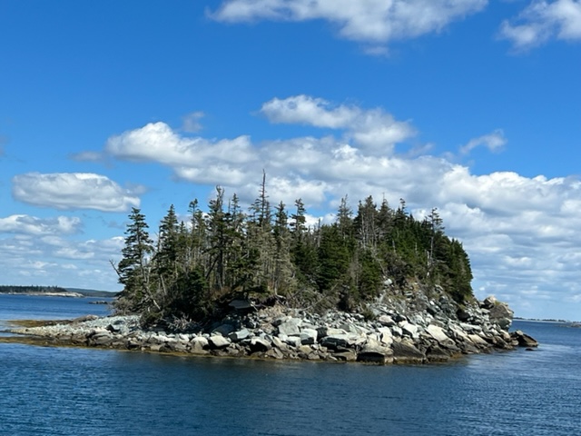
The Sunrise Coast is known for its remoteness, its sparse population, its pristine forests, and its rocky and untouched coastline. Among boaters, it’s also known for its lack of boating facilities and re-provisioning opportunities. As a result, most boaters tend to travel long distances to bypass the Sunrise Coast. However, it also has many bays and coves where boats can anchor, and there are a number of “government wharfs”, sometimes identified as “public wharfs”, where boats can tie up. The “”government”, however, not wanting to pay to maintain the “government wharfs”, have turned them over recently to local fishing associations or other local non-profit groups to manage and maintain. As a result, since these organizations are run exclusively by volunteers and have no source of funding other than donations, most of the wharfs are poorly maintained and many are in marginal to poor condition. However, we have found them to be strategically located and although remote, there is always something interesting to be explored nearby, and always interesting people to meet. Sometimes there is one or two fishing boats tied to the wharf, but we’re always the only cruising boat.
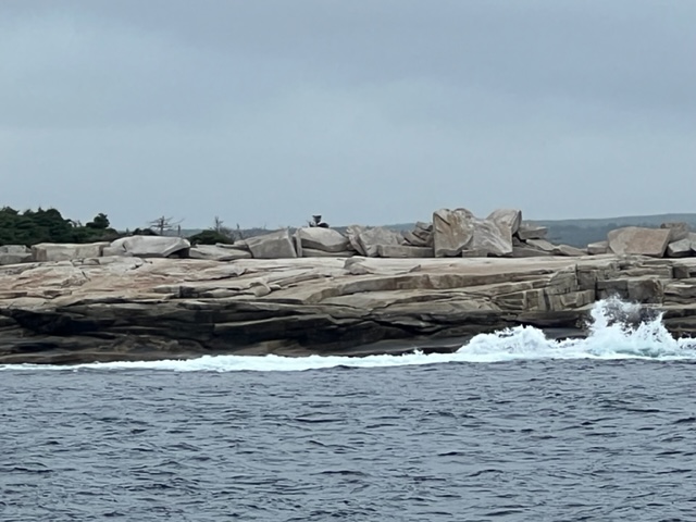
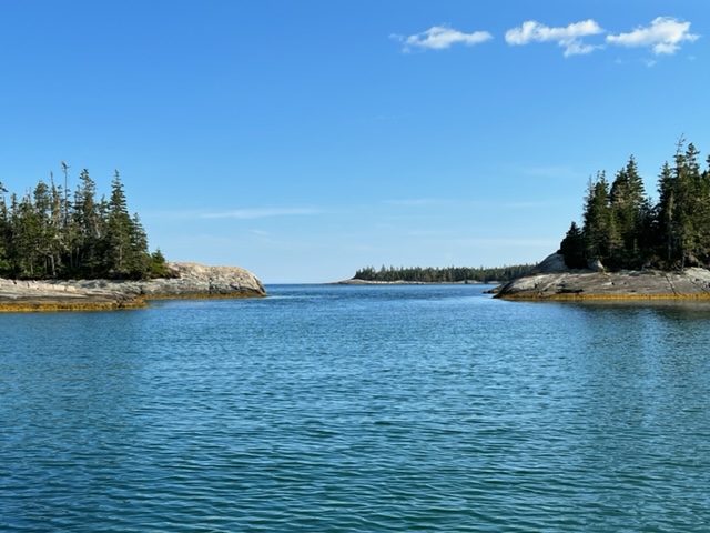
Leaving Canso, we passed through Andrew Passage then Dover Passage, marked by tree-studded islands, rocky shoreline, and many outcroppings of rock; careful piloting is a must!:


An interesting house along the way – awaiting the next lobstering season!
Our first stop along the Sunrise Coast was at Charlos Cove in Tor Bay, where there is a small community overlooking the ocean. We tied to a public wharf which we shared with two fishing boats:
We chose Charlos Cove because there is a small inn called the Seawind Landing Country Inn with a restaurant a short bike ride away. We didn’t end up eating there, but we had no phone or internet service at the wharf, so we frequented the Inn for communication.
A bike ride around the small village revealed the following plaque which provided some information about the village:

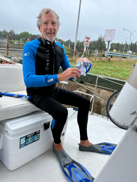
The next day, we cruised to Goldboro in Isaac’s Harbor. However, when maneuvering the boat up to the wharf, we suddenly heard a clanging sound from what sounded like the port (left) engine or running gear. It wasn’t really loud and it only occurred when the port engine was in gear, but it was an unmistakable and alarming clanging sound. After tying up, we opened the port engine compartment but couldn’t find anything amiss. A phone conversation with my ace mechanic, Adam, brought consensus that the next thing to check was the propeller and running gear. Jim brought a wetsuit and scuba gear for just such an occasion, so down he went:
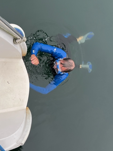
Great news! The piece of zinc which is attached to the rudder to prevent the corrosion of the other underwater metals on the running gear through electrolysis had come loose and just needed to be tightened; after tightening it and checking the underwater gear of the starboard (right) engine, we were good to go! All’s well that ends well!
We chose to stop at Isaac’s Harbor because the cruising guide said there was a visitor center with a snack bar, so we figured there must be a small village and some attractions there. Instead, the wharf was in poor condition with a portion of it fenced off, and the ‘visitor center” was little more than a tiny snack bar, although they did have ice cream! That being said, I picked up a brochure of attractions on the South Shore of Nova Scotia and leafed through it while I ate my ice cream. I came upon a picture of a restored fishing village with a boardwalk, shops, restaurants, etc., named Fisherman’s Harbour. Wait a second! I remember seeing a Fisherman’s Harbour recently on the charts; I looked it up – Fisherman’s Harbour was just three miles away! Although it was late afternoon, I convinced Paul and Jim that we should cast off the lines and go there – so off we went! But as we approached the harbor, it didn’t look anything like the picture in the brochure! In fact, as we got closer, we realized there was nothing there but a poorly maintained wharf and a few run-down storage shacks. With a little research, I then learned that the Fisherman’s Harbour in the brochure was actually Fisherman’s Cove, a tourist-oriented replica fishing village just outside of Halifax!
I’ll be hearing about that for the rest of the trip and beyond!
Anyway, we stayed at the wharf at Fisherman’s Harbour that night – along with one lonely fishing boat:


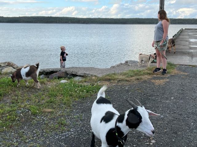
In the early evening, a young girl and her 5 year old brother came by the wharf while walking their pets – two dogs ant two goats:
Bob was not only pleasant, but was a very interesting guy. He got the boat bug only 3 years ago, but quickly bought a 31′ ranger tug, signed up for classes on operating the boat, navigating, boat safety, etc., and took off on the Great Loop with his girlfriend. He’s now one of the few boats doing the Down East Loop. He also told me of his adventures flying, in which he first attempted to fly around the world in a small Cessna, but crash landed in Kenya. His second attempt 8 years later was successful, in which he told me he flew over 155 countries and all 7 continents! And I thought we were adventurous!
In Liscomb, we had a tough weather decision to make. The next morning was a day that we could make our next passage of 45 miles to Sheet Harbor, but it would be an uncomfortable ride. More importantly, however, a major storm and a string of very nasty and windy weather was predicted to start that evening, which would have us pinned down for at least three more days, maybe more. Unfortunately, the only place to stay in Sheet Harbor was to anchor, to pick up a mooring, or to tie to a secure but poorly maintained wharf with no power, water, restrooms, showers, or any services nearby, with the nearest village a 15 – 20 minute walk. At Liscomb, however, we have power, water, internet, restrooms, showers, laundry facilities, a restaurant, and more. We decided to stay rather than be isolated for 3-4 days on the wharf. As I write this, we’re still here 4 days later; we’re hoping to head out tomorrow, but the seas are still wild, so we’ll make that decision in the morning. Prior to this, we had never been delayed by weather for more than a day at a time, and only occasionally.
In any case, the first day we were here was dry, so we went on a 6 mile hike on a loop trail up the Liscomb River. At the halfway point is a canyon, a suspension bridge, a waterfall, and a fish ladder at the site of a very small former electricity generator powered by water. Here are some images:
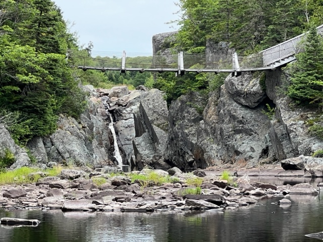

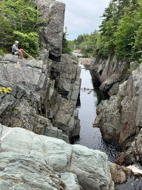


It was well worth the 6 mile somewhat challenging hike!
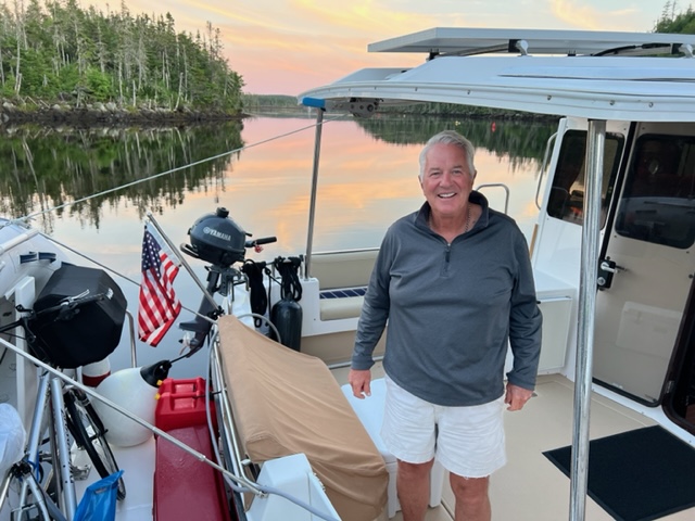
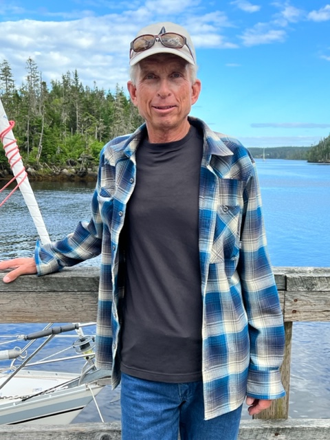
We also met Chip in Liscomb, who is sailing to Baddeck, where he plans to leave his boat for the winter. A seasoned sailor in Nova Scotia, he gave us a great deal of information and recommended places to stop on our voyage south:
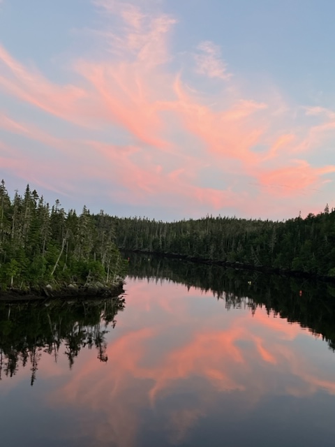
While not as bright and stunning as some of the sunsets we’ve seen, this one over the Liscomb River struck me as unusual:
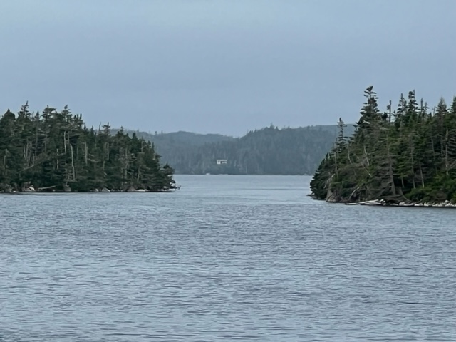
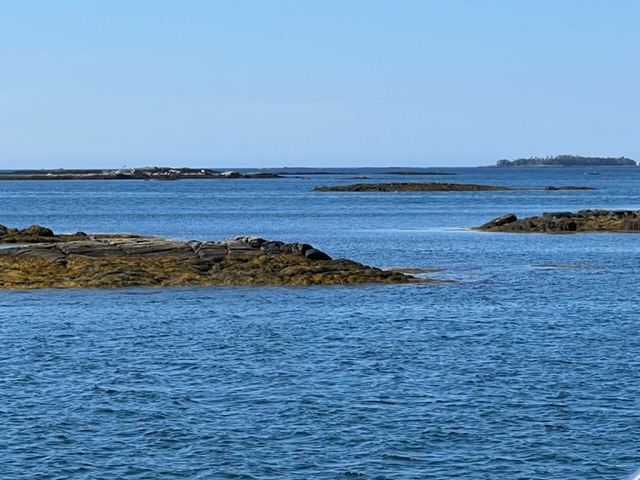
After arriving at Liscomb on Monday afternoon, we finally were able to move on the following Saturday. The coastline is littered with literally thousands of small islands and rock out croppings, some above and many below the surface, so most boats elect to run a more direct and straighter route outside the islands and obstructions; however, we elected to pick our way carefully through a winding and often narrow but very scenic inside route, trusting our chart plotter and careful piloting to help us find our way through safely. Here are some images:


We anchored that night in Shelter Cove, a secure and picturesque cove that had been mentioned to us by Ross (the Halifax harbor pilot) and a couple of other sailboat cruisers that we had encountered. There were three sailboats at anchor in the cove when we arrived, but there was plenty of room for us to anchor comfortably:

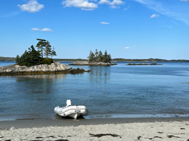
There are three separate, white sand beaches at Shelter Cove; two are long crescent beaches accessible from a short path through the woods, and the third is a small “pocket beach” nestled in the rocky shoreline a short dinghy ride from the entrance to the cove. Here is Jim locating the path for us:
Images of one of the two large crescent beaches:


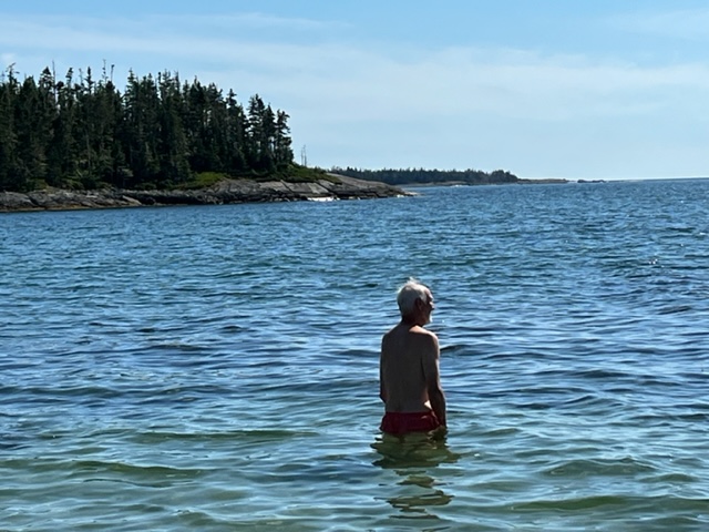
Paul swimming at Shelter Cove:
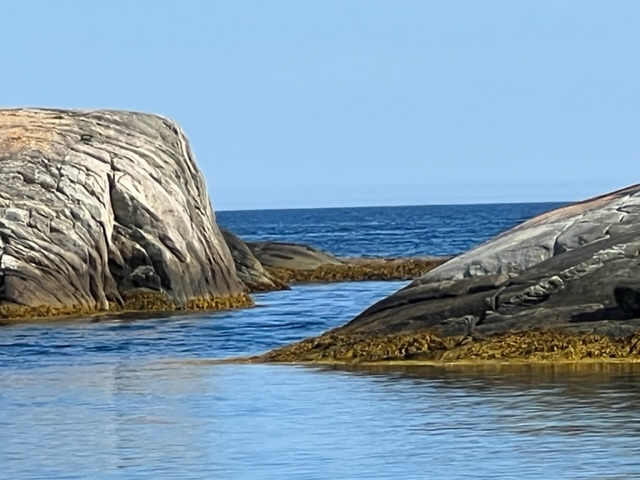
These are images of the “pocket beach” nestled among the rocks:

A view from the pocket beach:
Ever the fisherman, Jim tried his hand off the rocks at the pocket beach:

I took this picture as dusk was falling at the anchorage:
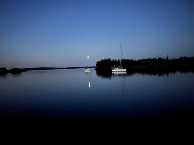
I woke up during the night and saw the crescent moon just rising above the horizon, so I went outside to see how a picture might come out:

Although impossible for me to capture in a picture, there are zillions of stars visible at night from an anchorage because there are no lights for miles around – it is pitch black out until the moon rises.
We raised anchor the next morning and ran 63 miles to Halifax, again choosing a winding, scenic path through islands and rock outcroppings:


YIKES!!

We have seen dozens of eagles along the way, perched in trees or soaring over the water looking for fish. Here is a large nest along the shoreline:

As we got closer to Halifax, we started to see more signs of civilization. We passed this beach along the mainland coast with campers and boaters enjoying the calm sea nestled in the bay:

Halifax is the largest city we’ve visited since Quebec City almost two months ago. The current population is 417,000, contrasted with the Charlottetown’s population of 39,000; in fact, the population of the entire province of Prince Edward Island is just 168,000.
Halifax became such an important city militarily and economically, both in colonial times and today, due to its harbor, considered one of the best in the world – it is deep, well-protected, easy to access, ice-free, and huge – in World War II, over 1000 ships were anchored in the harbor at one time! In addition, it is strategically located – it is the closest major harbor in North America to northern Europe, including Great Britain and Scandanavia.
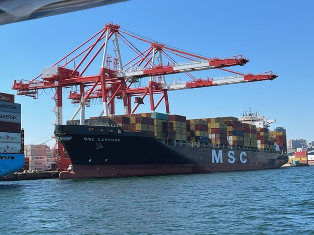
Upon entering the long harbor, the dominant image was the colorful cranes where ships are loaded and unloaded; Halifax is a major shipping port on the east coast:

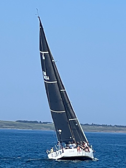
On the way into the harbor, we watched a race among identical sailboats, all with unusual black sails:
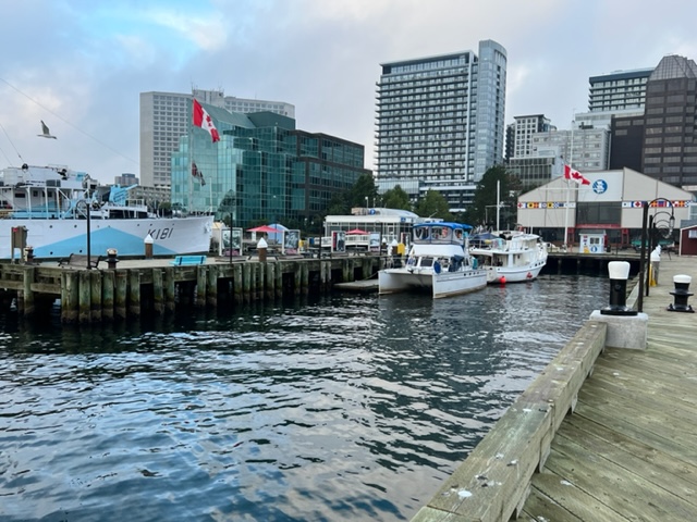
Since we planned to spend three days and four nights in Halifax, we wanted to dock on the waterfront directly in front of the city – so here we are, despite it being a bit rolly at times:
One of the great tragic events in human history happened in Nova Scotia on December 6, 1917. In the midst of World War II, a French munitions ship named the Mont Blanc, packed with explosives, collided with another ship in the narrowest part of Halifax Harbor. The impact didn’t cause the explosion, but sparks from the metal scraping against metal caused a fire on the Mont Blanc. Fed by gasses from the cargo, the fire quickly got out of control, causing the ship to explode around 9:00 AM, nearly about 20 minutes after the initial collision. The resulting explosion was the most powerful explosion ever detonated by man, anywhere, prior to the nuclear era.
I just finished reading the book “Curse of the Narrows” by Laura M. MacDonald, a superb recounting of the events leading up to the collision, the explosion, and its aftermath. The book is spellbinding, and I recommend it highly. Following are a few quotes from the book to convey a sense of the power of the explosion, all of which are in quotation marks.
“Altogether, 2,925 tons or 5.85 million pounds of powder exploded, giving off over 9,000 degrees F. of heat. All 6,880,627 pounds of the Most Blanc’s iron hull shot up over a thousand feet, roiling within the initial flame ball until much of it vaporized.”
“As the cloud lifted and cooled in the clean air, white-hot fragments of the Mont Blanc showered down across the streets of Halifax-Dartmouth”
“On land, the sound arrived first. It rippled through the earth at the punishing speed of 13,320 miles per hour – twenty three times the speed of sound….The air blast blew through the narrow streets, toppling buildings and crashing through windows, doors, walls, and chimneys.”
“Every building within a mile was severely damaged. Houses out of range of the flame ball still caught fire when their stoves overturned. Other toppled under the blast.”
“Two small tornados touched down.”
“When it was over, not one of the twelve thousand buildings within a sixteen mile radius was left intact. Over three quarters of them had lost every pane of glass. Sixteen hundred houses lay in splinters.”
“In the harbor, the heat of the explosion was so intense that a twenty-foot radius of water around the Mony Blanc instantly evaporated….A semicircular tsunami rippled outward across the harbor, picking up more water and force until it was twenty feet high.”
Nearly 2,000 people died, one out of every 30 people; many were killed instantly, and 6,000 were injured. Over 9,000 people were left homeless. Windows were shattered 62 miles away, and hundreds suffered serious eye damage or lost one or both eyes due to flying glass particles. Parts of the Mont Blanc were distributed over an area covering 8 miles. To make matters worse, a bitter cold snowstorm buried the city in almost 1 1/2 feet of snow that evening and through the night, all but halting rescue efforts and slowing the arrival of trains, doctors, supplies, and other help from outside Halifax.
However, a massive rescue effort ensued, and MacDonald’s book recounts the heroic rescue efforts with the same thoroughness as she recounts the event itself. Relief efforts came from throughout Canada and the US, but none was more rapid and comprehensive than the rescue effort from Massachusetts, and especially Boston. By the evening of the day of the explosion, a rescue train with doctors, nurses, medical supplies, clothing, blankets, food, etc. was on its way from Boston to Halifax. Many more supply mission followed over subsequent weeks and months. As a tribute to Boston for its rescue effort, Halifax, to this day, sends a 50′ Christmas tree to Boston every December, which is erected and lit with much fanfare on Boston Common.
Jim and I biked to the Fort Needham Memorial Park in North Halifax, which is dedicate to memory of those lost in the explosion. Here is a picture of the Halifax Explosion Memorial Bell Tower high on the hill in the park:

We spent three days exploring Halifax, with the lively waterfront as our base. On our first night, I went to an outdoor improvisation show, the stage for which was a small fort that was part of the system of fortifications to defend Halifax in the 18th and 19th centuries. Improv, to me, is always a gamble, but this one paid off – the actors were superb and the audience (including me) laughed hysterically. The audience was allowed to take pictures, so here are a couple:


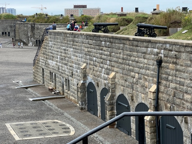
The following day, I rode my bike up the hill to visit the Citadel, the main fortification built to defend Halifax in colonial times. Since the founding of Halifax by the British in 1749, there have been four fortifications built on Citadel Hill. The fourth and final fort took 28 years to build, finally being completed in 1856.
With the loss of the thirteen American colonies n 1783, Halifax Harbor was considered a key position, both militarily and economically, to the remaining British holdings in North America. Britain feared a possible attack from both France and America, particularly during and after the War of 1812 with the US. In addition, Halifax was considered critical to offset the major French fortification in Louisburg on Cape Breton; therefore, Britain made the huge investment of treasure and military personnel to build and man the enormous fortification at the Citadel. However, it was never attacked, so, as a deterrent, the investment seems to have paid off.
Here are a few images from the Citadel:

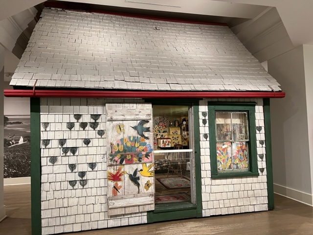
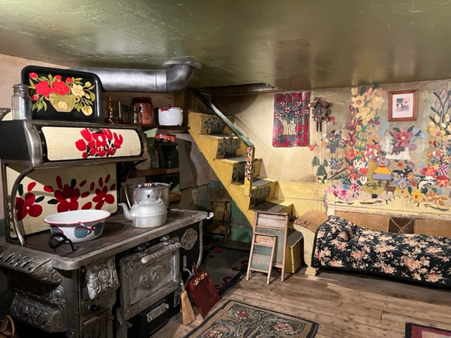
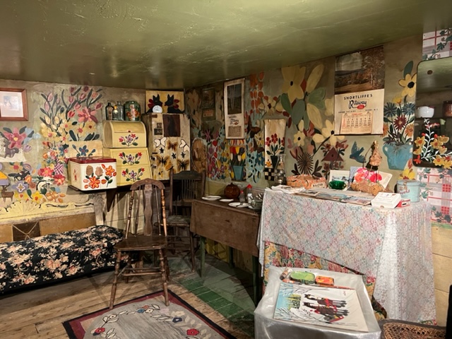
After visiting the Citadel, Jim and I went to the Art Gallery of Nova Scotia. While far from an art connoisseur, I was struck by the exhibit and the story of Maud Lewis. Maud was physically small and frail; she was born with what is now believed to be juvenile rheumatoid arthritis, a painful and degenerative condition. She lived in a small house with no electricity or running water – the only source of heat was from the wood stove which was used for cooking. The house was her largest artwork – she painted the doors, windows, and nearly every interior surface with her artwork. For the exhibit, her entire house was restored, disassembled, moved to the art museum, and reassembled. Here are images of her house in the museum:
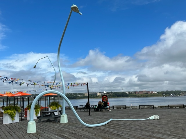
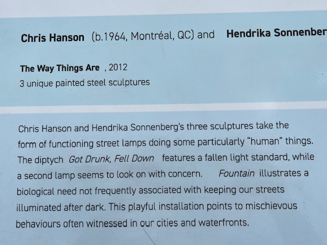
Speaking of artwork, I came upon the following two pieces of outside art while exploring Halifax on my bike. The first consists of three “drunk” light poles, explained in the plaque below:
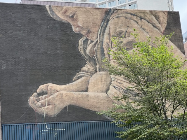
The second piece of outdoor artwork I encountered was this enormous mural, which took up the entire side of a building:
Upon arriving back at the docks, I was pleasantly surprised to see our sailing friends Martini and Dave chatting with Jim! They had sailed into Halifax the same day that we had – this was our third encounter with them, and so great to meet up again as we both head south!
Another museum that I had the opportunity to visit is the excellent Maritime Museum of the Atlantic, which was directly on the waterfront near the Joint Adventure. In addition to exhibits regarding the collision and explosion of the Mont Blanc, it had a number of historical exhibits about the history of man’s interaction with the sea, the age of sail, the age of steam, fishing, and many other maritime-related topics. There was also an exhibit regarding the Titanic, since many of the survivors and the deceased were initially brought to Halifax where temporary morgues were set up on the waterfront.
One of the topics covered was the Mi’kmaq tribe’s ongoing battle for fishing rights. Here is a plaque from the museum regarding recent events:

Another section of the museum focused on the legendary adventurers in the early days of sailing – the days when ships were made of wood and men were made of steel. Included is the story of Joshua Slocum, the first man to sail around the world solo from 1895 – 1898, a trip that took him over 46,000 miles. His book “Sailing Alone Around the World”, first published in 1900, is a classic for sailors and non-sailors alike, since he describes his observation of unexplored lands, his interactions with natives that he refers to as “savages”, and his many adventures and misadventures. The book is available through Amazon and any major bookstore, and I recommend it highly.

Another early adventurer was Howard Blackburn, who was fishing from a dory launched from a mother ship off Nova Scotia when a snowstorm separated his dory from the mother ship. He rowed for two days and two nights, his hands frozen to the oars, until he reached land. He lost most of both hands to frostbite. The book “Lone Voyager” by Joseph Garland is another classic sea story which tells of his survival as well as the other amazing adventures upon which he embarked, including twice sailing solo across the North Atlantic with no fingers! I recommend that book highly as well.
So as I write this, we are preparing to cast off again tomorrow morning; our three days and four nights enjoying the attributes of Halifax and exploring the city and its surroundings are coming to an end. We hope to reach Lunenburg in two days, where our friend Jake Mycofsky will join our journey for a week or two.
More to come!!

Leave a comment