
I again had internet problems when I tried to publish Post #10, but the wonderful and talented folks at Good Geeks in Hull – Todd and Kat – bailed me out yet again! If you need help with your computer or anything related, they’re the people to call – 781 925 4511 !
A couple final thoughts from Sediac, New Brunswick: Yet another example of the warmth and friendliness of the people in this part of the world – because of the high winds we experienced during our visit there, the person who owns the boat docked next to us – Eugene – and his son Evan came to the marina to check on his boat. They seemed to be quite interested in the Joint Adventure, so I invited them aboard for a tour. It turns out that they live just 10 minutes from the marina, so Eugene insisted that I take his cell phone number and that I call him if we needed help with anything: a ride somewhere, shopping needs, or anything else!
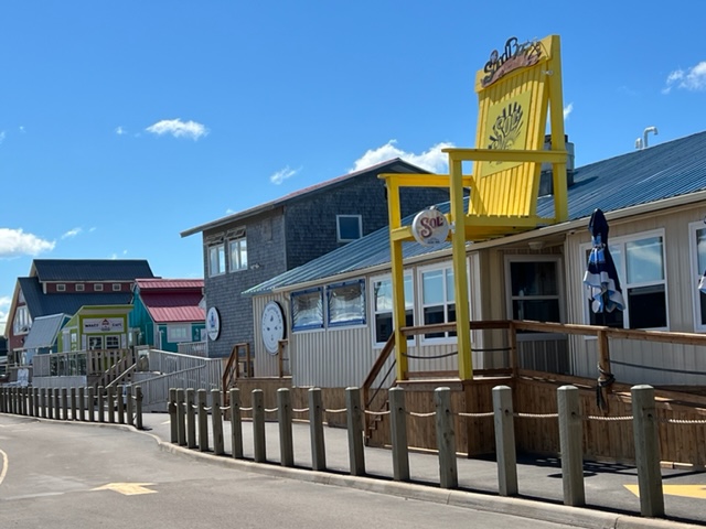
I mentioned the lively pier with restaurants, pubs, tour boats, charters, etc. which forms one wall of the harbor in Sediac. Here are a couple of images:


Lastly, we were treated to another special sunset in Sediac:

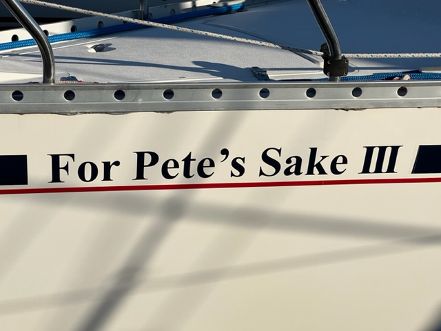
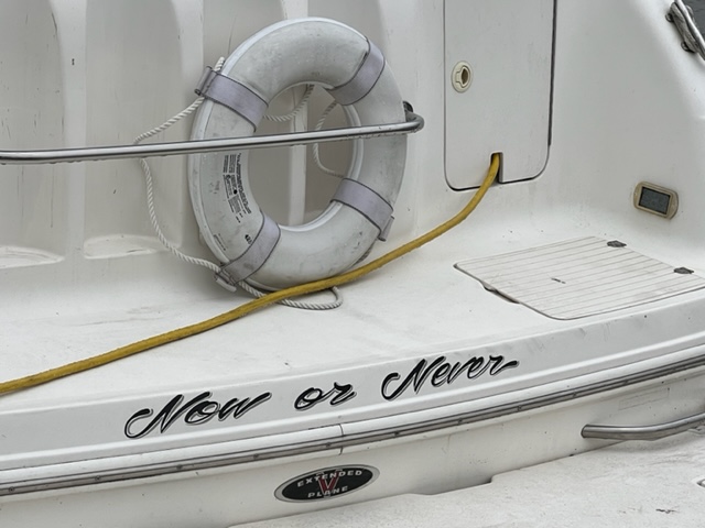
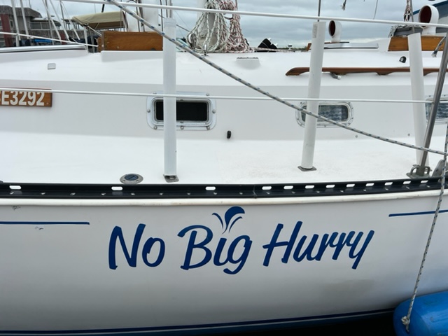
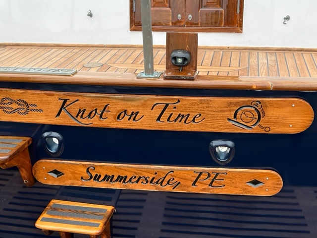
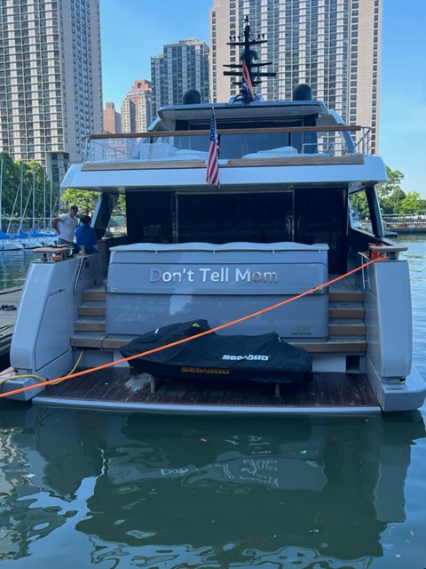
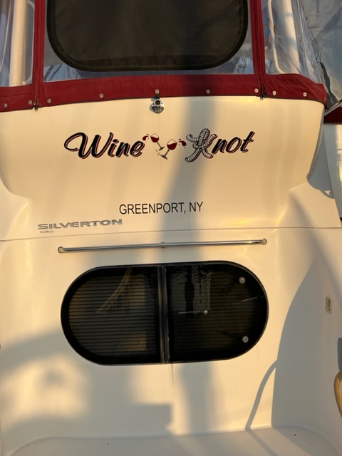
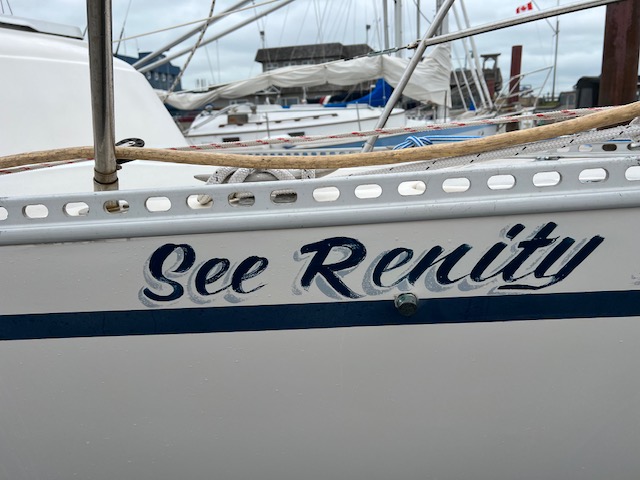
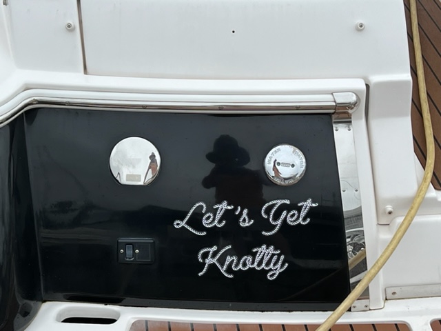
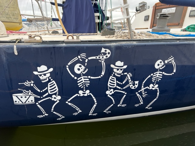
As we travel around, I can’t help but notice the names of other boats that we see along the way. Here are a few that caught my attention:

I’m guessing this guy is a skier as well as a boater –

Hmmmm….

I’m guessing this guy’s name is Pete….
This guy doesn’t like to procrastinate –
Here’s a guy with the opposite point of view:
I guess this guy agrees –
Where is he going to hide this?!??
I think he misspelled “Whine”….
I actually saw two boats in the same marina in Shediac with this name:

Not sure about this one – maybe someone is named Renity, and she’s serene…
Boaters will understand this one –

No comment….
This boat is appropriately named “Cajun Spirit”:
Two of my favorites from previous trips are:
- Plan B
- Insteada Kids
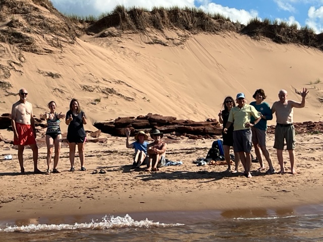
During our last evening in Shediac, our wives/Significant Others – Trish, Pat, and Chrissie – drove from western Mass. and Boston to join us again for the next three weeks or so on the Join Adventure! YYAAYYY!!! The next morning, we crossed the Northumberland Straight, about 35 nautical miles, to Prince Edward Island! YYAAAYYYY again!! We plan two stops here, each three days long, both of which we intend to use as a base of operations as we take day trips on land to explore PEI.
Prince Edward Island is the smallest province in Canada, measuring only around 250 miles long and ranging from 6 to 60 miles wide; the population is less than 160,000 very friendly people. It’s known for its red sand beaches, fertile soil, farmlands, iconic lighthouses, and seafood, especially lobsters and mussels. The rich soil is ideal for growing produce, especially potatoes; the red color is due to the high concentration of iron in the soils.
Originally inhabited by the Mi’kmaq peoples, the French claimed the entire maritime region in 1604 and started settlements on PEI in the 1720’s. After the British took control of New France in 1763, including PEI and Nova Scotia, English-speaking settlers came to PEI from other parts of Canada, Scotland, and Ireland. In addition, a significant number of British Loyalists from the 13 colonies migrated to PEI after the colonists won the American Revolution.
In 1864, Prince Edward Island hosted the Charlottetown Conference, which was the first meeting in the process which culminated in the Confederation of Canada in 1867. However, PEI, unhappy with the terms of Confederation, declined to join the Confederation and chose to remain a separate British colony. In the following years, it considered various options, including becoming a separate Dominion of its own, and even negotiated to join the United States. After Canada agreed to a number of significant economic incentives, however, PEI agreed to join the Confederation in 1873. Having hosted the first meeting in Charlottetown which eventually resulted in the Confederation of Canada, PEI presents itself today as the “Birthplace of the Confederation”.
Our first stop in PEI was Summerside – with a population of just 16,000 people, Summerside is still the second largest city in PEI. We were fortunate to have four of our close friends – Jake and Elissa Mycofsky and Bob and Audrey Hall – drive to PEI to meet and spend the week with us, Bob and Audrey staying in their RV and Jake and Elissa in B&B’s.
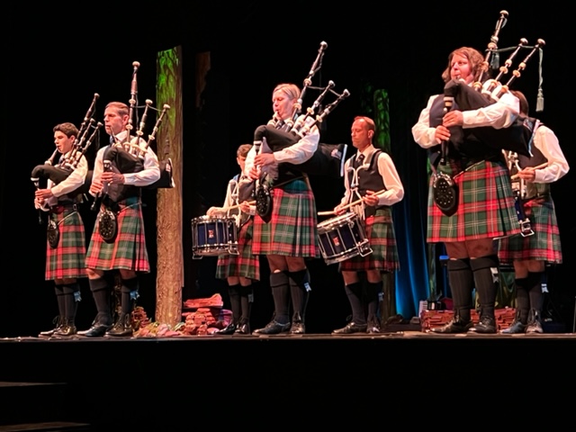
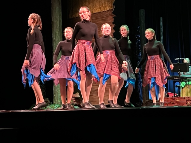
Our first night here, we attended a music and dance performance at the Canadian College of Piping and Celtic Performing Arts, which celebrates the Scottish and Irish heritage of PEI – 45% of the population here have their origins in Scotland and 25% have their origins in Ireland. The College is the only one in North America with a curriculum that is dedicated to teaching the bagpipe, and it attracts bagpipe students from all over the world. The stellar performance combined Celtic music and dance with the story of the original settlers’ journey toward creation of a new home on PEI. Here are some images:

We spent the first three days in PEI exploring Summerside and taking day trips to various parts of the northwestern half of the island.
Below is a mural covering the entire side of the Fire Department in the center of Summerside; it commemorates the heroics of the firefighters, using horse-drawn equipment, in fighting the Great Fire of 1906. The fire is believed to have been started by sparks from a train, and burned a good part of the city before finally being extinguished:

Maybe the direct approach to advertising will work….


There are numerous small museums in Summerside, including the International Fox Museum and Hall of Fame. It turns out that, in the late 1800’s and early 1900’s, furs from the silver black fox were prized among the elite as symbols of fashion and wealth. However, the breed was very rare, so from 1910 – 1914, there was a “world race” to figure out how to successfully breed and raise them in captivity. According to information in the museum, the effort was “filled with colorful characters, secrecy, high stakes, and incredible sums of money, and Summerside was at the center of activity for several decades”. Entrepreneurs from Summerside learned through experimentation and observation that silver black foxes mate for life and need very specific environments to breed – once they learned how to breed them, they sold breeding pairs for thousands of dollars each – a huge sum in the early 1900’s
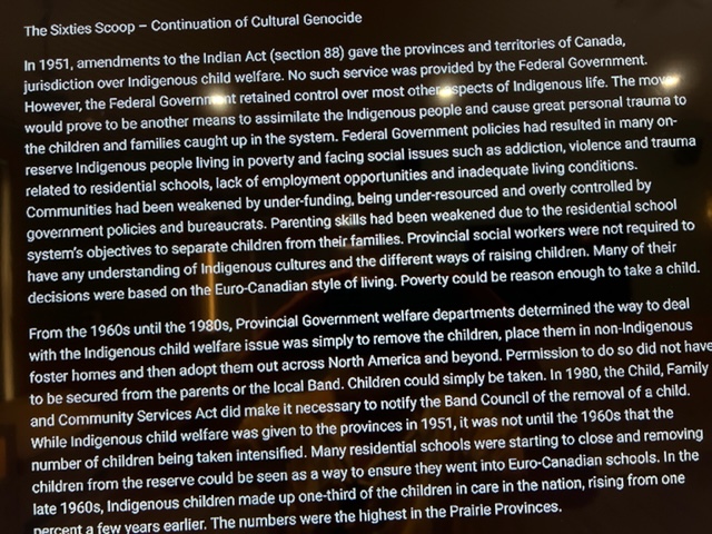
On a more sobering level, the Fox Museum also has some exhibits on other aspects of the history of PEI. One interactive exhibit exposes the mistreatment of indigenous children caused by the Indian Act of 1951 and its effects; the plaques below tell the story better than I could:

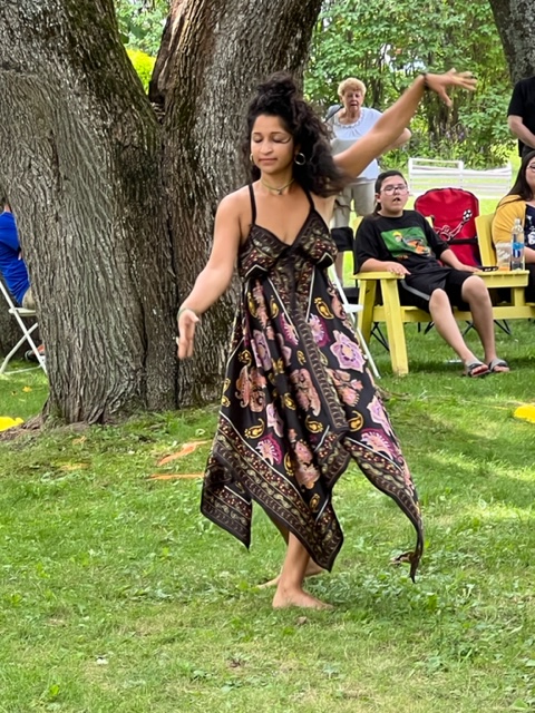
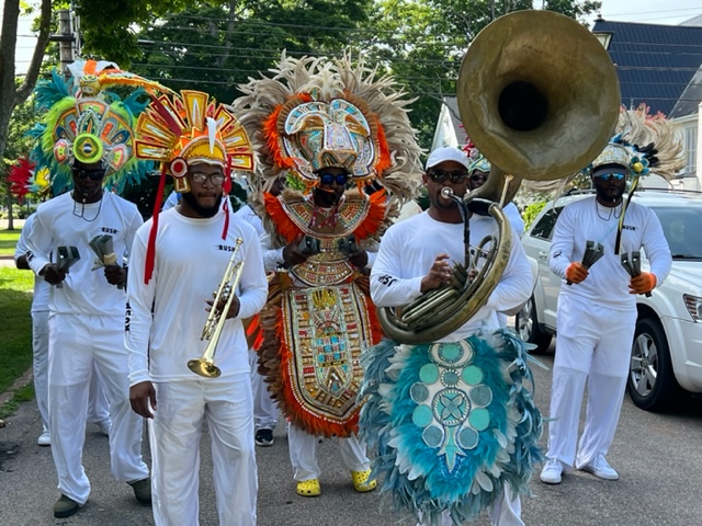
As part of the healing process, Summerside holds an annual Diversity Festival, featuring music, dance, foods, crafts, and stories from various cultures, which took place during our visit. Here are a few images:

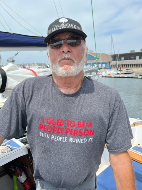
While preparing dinner on the Joint Adventure, a boat pulled into the dock next to us. I couldn’t help noticing the captain’s T-shirt, and I couldn’t resist asking him if I could take a picture:
Our attraction to ice cream is well-known, and PEI is a hot-bed of really good ice cream. We first went to well-known Holman’s Ice Cream Parlor in Summerside, located in a historic home; if it weren’t for the small sign, you’d never know it’s an ice cream parlor:
The ice cream was superb. However, we then learned that PEI is home to the #1 rated ice cream parlor IN THE WORLD, called “Cows”:

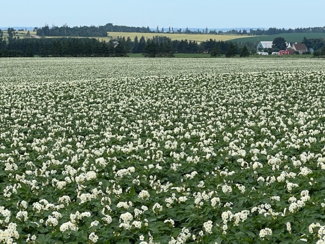
Prince Edward Island is known for its spectacular beaches and many fascinating geologic formations along the coastline, but it is also known for its gentle rolling hills and scenic farmlands that dominate the island away from the coastline. It’s difficult to capture the essence of the interior farmlands in a picture, but here is an image of a large potato field, an example of the many throughout the interior of the island:
Here is an interesting summary of the history of the potato:

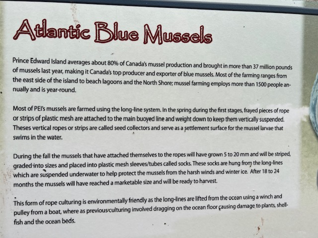
Another major economic driver for PEI is the farming of mussels, both for consumption on PEI and for export. At the risk of including too many narratives in this post, I found this quite interesting:
Most saltwater bays and ponds that we pass as we drive around PEI contain mussel farms like this one:

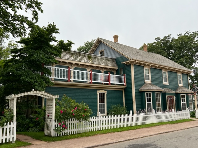
During the Covid lockdown, many people, including us, watched the Netflix series “Anne With an E”, which re-enacted the story of Anne of Green Gables. As you may know, the book by Lucy Maud Montgomery takes place on Prince Edward Island. The book, published in 1908, became so popular that many of the places where Montgomery grew up and which formed the background and setting for the book are now historic landmarks and open to the public. We visited the homestead which formed the basis if Anne’s journey in in the book:


Much of Anne’s struggles growing up reflect the challenges in Montgomery’s own life. While Anne of Green Gables is the most famous of her works, she published 20 novels, 530 short stories, 500 poems, and 30 essays. Anne of Green Gables has been translated into 36 languages and has sold over 50 million copies, making it one of the best selling books worldwide. However, Montgomery struggled to get it published:

As mentioned above, Prince Edward Island has incredible beaches and some amazing rock formations. Here are some images from Cavendish Beach:


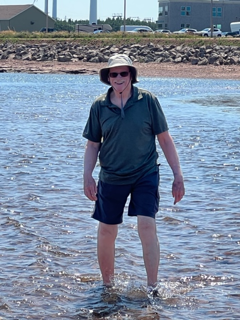
The water on the north side of the island – the North Atlantic – was a bit cold but quite tolerable – much warmer than the water along the coast of Maine. However, as mentioned in an earlier blog, the water on the south side of the island, in the Northumberland Strait, is incredibly warm. In fact, along the shore, it is almost like bathwater; we stayed in the water for over a half hour and never felt chilled at all. I’m not sure why that is, but the claims of warm water in PEI are true!
The next day, we visited the northernmost point on Prince Edward Island, called North Cape. Due to its prolonged and steady winds, it is the site of 16 wind turbines, which are capable of producing 7.5% of the island’s electrical needs. There is also an excellent Interpretive Center, and outside the center on display is an gigantic turbine blade as well as the enormous housing for the generator at the top of each tower.
At the very tip of Cape North is a shoal formed by small stones that extends a couple hundred yards into the North Atlantic and is exposed at low tide. We arrived at a rising tide with the bar partially submerged, but we still persevered and walked out to the northernmost tip:

Jake making the trek:
A number of old lobster traps have washed up on the shoal, and are likewise exposed when the tide gets low:

The northern tip of the North Cape is a favorite hang-out for shore birds:

A friendly fellow adventurer was kind enough to take a group picture for us – we couldn’t help notice his Toronto Blue Jays T-shirt, and he didn’t hesitate to remind us of the 28-5 drubbing they administered the night before to the Red Sox. Here’s the photo:

An interesting rock formation at tip of the North Cape:

The following day, we visited Thunder Cove beach; it is not shown on any of the local maps or literature, but we learned about it a week or two ago from a fellow boater who was familiar with local waters. Apparently, they keep it off the tourist maps and brochures due to the limited access points and perhaps a desire to keep it more “local”.
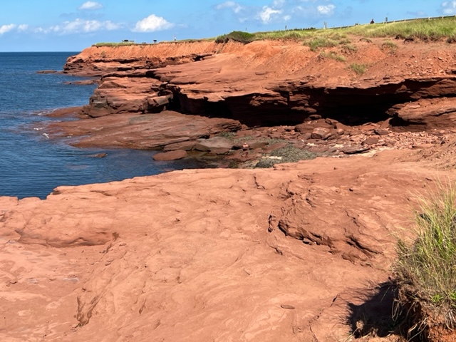
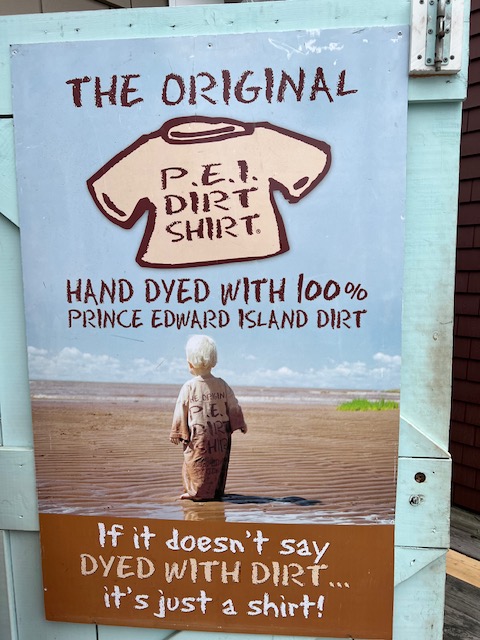
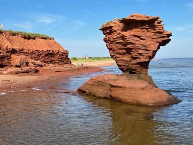
The rock that underlies the island and which is exposed by the ocean along the coast is a soft sandstone with a high iron content; when the iron oxidizes, it forms rust, which gives the soil its reddish color. Wind, waves, and ice wear the soft sandstone, carving it into the fascinating forms as it wears away the coastline. The North shore of the island erodes an average of about 3 1/2 feet every year – incredibly fast in geologic time! The erosion turns the sandstone back into sand, which forms the beaches and dunes along the coast. Since the sand is fine and has a distinctive reddish color, PEI capitalizes on it by calling it “PEI Dirt”:
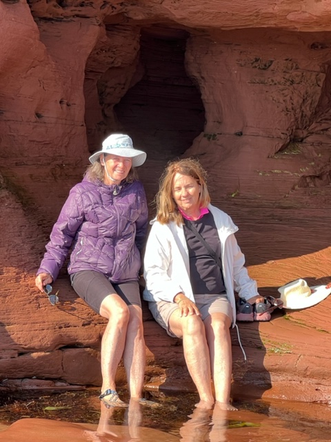
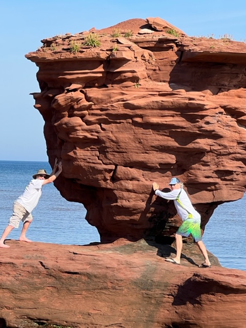
Here are some images from Thunder Cove Beach, the most dramatic of the geoplgic formations that we’ve seen so far:


Pat and Trish taking a break –
I swear, Bob and I saw this rock shake a bit – we stabilized it so future visitors could enjoy it as well….
We’re docked in front of the restaurant at the yacht club. Saturday evening, we met Lilao, who we invited her onto the boat for a drink. We had previously learned of a system of walking/bike paths that crisscross and go around the perimeter of the island. They total about 700 kilometers (435 miles), and it takes about 32 days to walk the entire system. Although she’s never done anything like this before and it’s way outside her comfort zone, Lilao flew here alone from Oregon to attempt it, and is now halfway through the extended walk. Her husband and two teenage sons back in Oregon are supportive, but apparently wanted no part of this adventure. Go for it, Lilao!
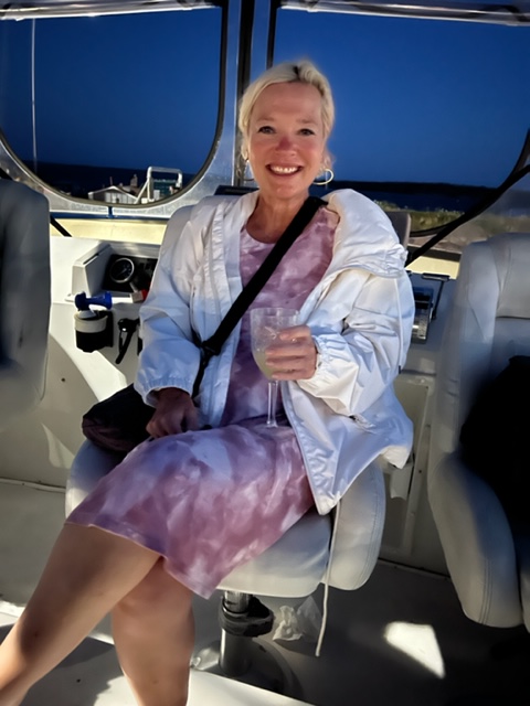
Lilao enjoying a drink with us on the Joint Adventure, preparing for the next day on her solo adventure:
We had planned to make the 45 nautical mile run from Summerside to Charlottetown today, but strong winds approaching 25 – 30 knots and a thunderstorm warning have kept us tucked in at Summerside. While hanging out on the Joint Adventure this morning, we were visited by Bill:

Bill owns a bakery in town and keeps a boat in the marina; he apparently had chatted with Pat and Chrissie yesterday while passing by the Joint Adventure. In another incredible act of kindness and generosity which is so prevalent in this part of the world, Bill came by this morning and brought us a box of fresh baked goods from his bakery, including incredible cinnamon buns, pastries, rolls, biscuits, a carrot cake, a loaf of bread, and half dozen rolls. Another inspiration – we need to find a way to pay it forward!
On to Charlottetown as soon as the weather breaks, expected tomorrow. More to come!

Leave a comment