
YIKES! My latest post was three weeks ago, just after we left Summerside, Prince Edward Island! We’re now along the “Sunrise Coast” of Nova Scotia, but I haven’t had a strong WIFI location throughout that entire period! So I’m going to try to catch up with two or three separate posts whenever I have good WIFI, which I have at the moment
After extending our stay in Summerside for a day due to high winds, we made the 45 mile run to Charlottetown, the capital of Prince Edward Island. The first hour was difficult as we battled 3′-4’waves on our bow and beam, but once we turned the corner to a downwind course, the ride smoothed out, the wind diminished, and the ride became smooth and pleasant.
Our route to Charlottetown took us under the Confederation Bridge, which spans the Northumberland Strait and links PEI to the mainland of New Brunswick. Spanning over 8 miles, it is the longest bridge IN THE WORLD over ice-covered water! Taking 4 years to build at a cost of $840 million (in 1993 dollars), the bridge opened in 1997. The deepest of the 44 piers rests on the ocean floor 115 feet beneath the surface. While it takes just 10 minutes to drive across, the toll for a passenger car is a $50.25!
This image is from our vantage point passing under the bridge; the rise in height to nearly 200 feet is to allow ocean freighters and other ships to pass under:

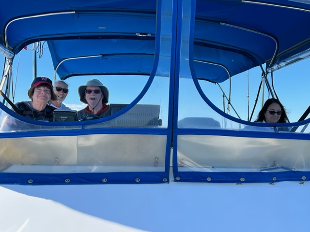
Since Jake, Elissa, and Audrey joined us for the voyage from Summerside to Charlottetown, I couldn’t resist posting these two images with Jake at the helm, flanked by Elissa on the left and Audrey on the right:


Charlottetown is a VERY different city from Summerside! Neither is large by our standards, but Charlottetown, with a population of just 39,000, is active, lively, and full of young people. The waterfront is busy with live music in the public square every day in the afternoon and early evening, surrounded by restaurants, pubs, ice cream shops, etc. The portion of the waterfront shown below is actually an extension of the waterfront onto a large floating platform; the rest of the festive area is on land adjacent to the floating platform:

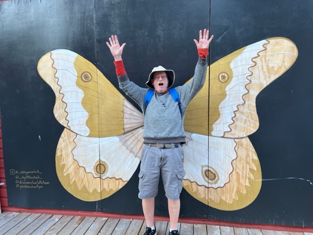
Jake is getting into the festive atmosphere; inspired by the numerous art galleries, Jake is trying to connect his inner self with the artwork:
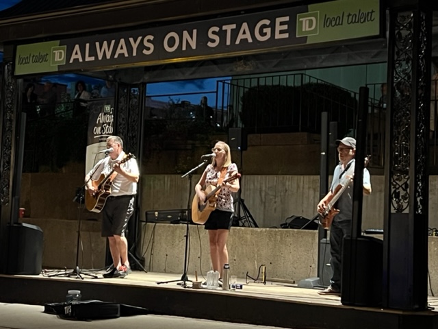
Several of the streets in the downtown area adjacent to the waterfront are lined with outdoor seating for the adjacent restaurants and pubs which are contained in restored, historic buildings; live music performances in the evening prompt dancing in the street:

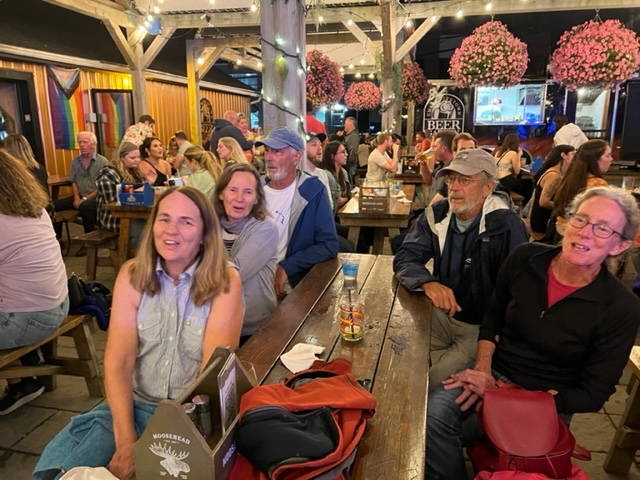
After a night out (OK – two nights out…), Trish, Pat and I had a drink along this street, across from the stage where a different band played each night. The second night featured the band “Faces”, the lead singer of which is Kim Albert. Kim has a great stage presence and has a Janice Joplin-type voice, so we couldn’t help but to join in the dancing in the street.
We enjoyed Faces so much, we talked with Kim after the show to find out where they were playing the next night; we then dragged the whole crew there, staying until they closed out the evening with a rousing rendition of “Sweet Caroline!”
Afterwards, we talked to Kim and planted the seed of them taking a vacation next summer in Vermont – if so, we told them, we would engage them to play at our annual Mecca Mash party in July!
We did some more exploring in the city the next day. This was a plaque next to one of the pubs in the downtown entertainment district; maybe we should try this approach to legislating….:

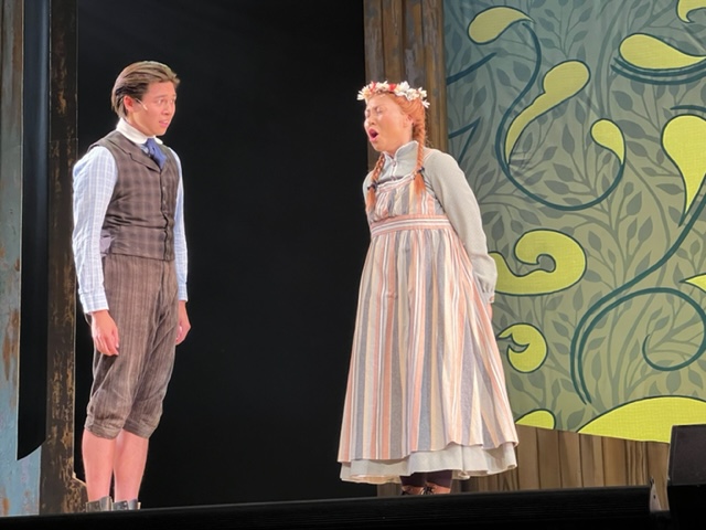
Charlottetown also has a strong performing arts culture; Trish, Pat, and I went to two stage performances during the four nights we were there – one was an excellent musical version of Anne of Green Gables:

We also saw a marvelous one-woman show called “Betty’s Song”. It was written and performed by the daughter of one of the few female lobster boat captains in PEI – or anywhere, for that matter. She told and acted out the story of her childhood after her Dad died when she was very young, and her salty-mouthed mother took over running the lobster boat. She had us laughing hysterically through most of the play, but close to tears at other times as she brought us through the journey of her amazing childhood and young adulthood. She might take the performance on the road to various cities, so I recommend it highly if it comes your way.
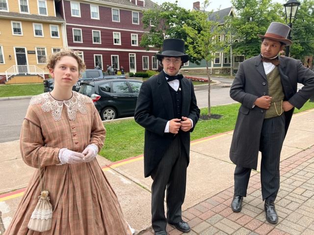
Charlottetowne has much history to offer as well. As I mentioned in a past blog post, PEI hosted the first meeting of the various independent Canadian provinces to discuss forming a Confederation, which occurred in 1864. PEI originally declined to join the Confederation, but later reversed course, for the reason explained below:

While walking around the city, we happened to run into three actors who were in character as politicians and merchants in 1873, greeting people on the street (including us), and debating amongst themselves and among the people they met on the street whether to join the Confederation; in doing so, ever in character, they encouraged us to vote for or against. We had a lively and fascinating discussion, in which two of the actors were in favor and one was against:
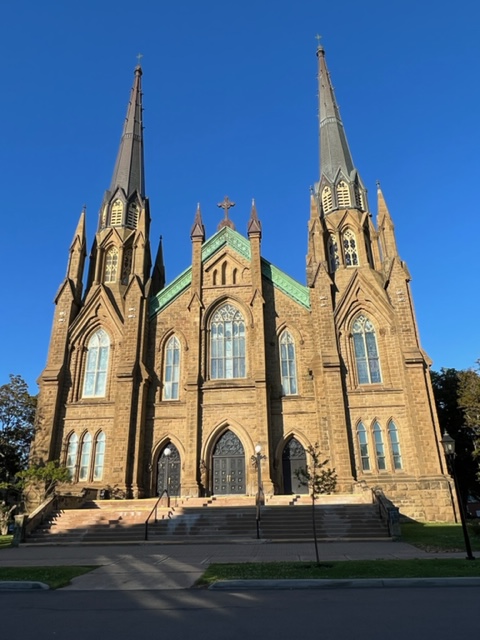
I generally don’t include pictures of churches because there are so many magnificent churches along the way, but the Basilica in Charlottetown is truly special. It took 10 years to build between 1897 and 1907 when it opened. After being severely damaged by fire in 1913, it was restored by the determined citizens of Charlottetown:
We used Charlottetown as a base of operations to explore sights on the southwestern half of PEI. While not nearly as impressive as the North Point as described in my previous post, the East Point – which is the easternmost tip of the island – has a significant lighthouse in which you can climb to the top. Here is the view from the lens:

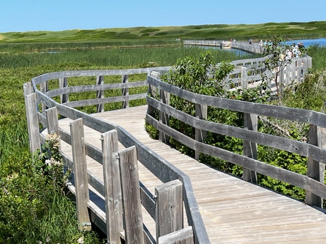
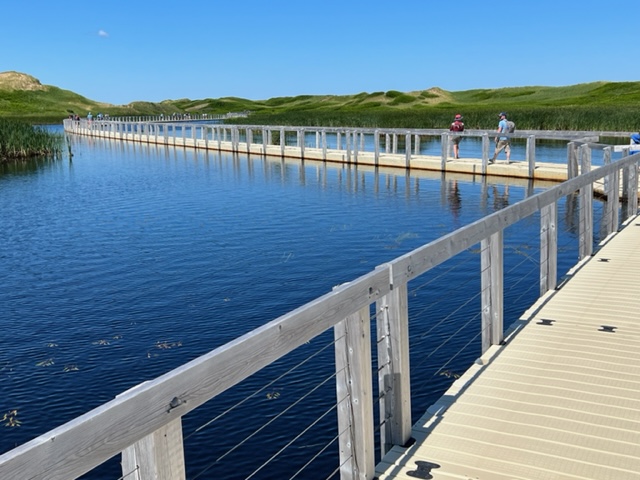
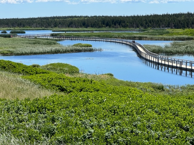
We then visited Greenwich Beach, one of the most stunning on the island, both for the beach itself with its large Cape Cod-style sand dunes, and for the amazing access to the beach. The sand was beautiful, the water cool and refreshing but not cold, as we all went in for a swim. Here is the incredible accessway to the dunes and the beach. The walkway starts out on piers above the wetland vegetation, but changes to a floating walkway when it reaches a pond to be crossed:
Also at Greenwich Beach was a display of the culture of the Mik’maq tribe, the First Nation inhabitants of Prince Edward Island and other parts of eastern Canada and the Maritime Provinces:

The way in which Canada is dealing with their history regarding the treatment of the native inhabitants in the days of settlement and colonialism is impressive. Rather than tending to ignore the subject of broken treaties and stolen land as we tend to do in the US, Canada is working to acknowledge their true and difficult history. These two plaques are displayed at the building in Charlottetown where the first meeting to discuss Federation was held (the building is currently undergoing renovation):


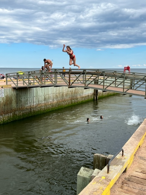
After our visit and swim at Greenwich Beach, we stopped at another unique place called Singing Beach – it got its name because the sand, due to its high silicon content, is supposed to squeak – or “sing” – as you walk on it when it’s hot and dry. Try as I might, I couldn’t get the sand to sing to me – maybe because I was born totally devoid of musical talent, even being graciously escorted in sixth grade out of mandatory Chorus class to an extra study hall period so that my attempt at singing didn’t disrupt the Chorus class. However, at Singing Beach, I enjoyed watching the young people jumping into an old canal lock and riding the outgoing tide into the Atlantic!

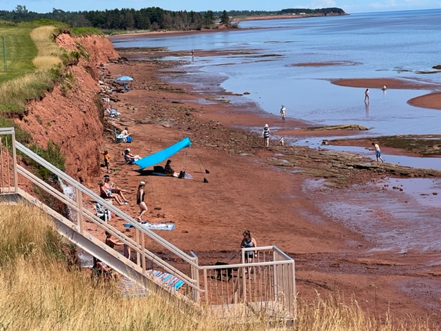
We next visited Argyle Beach on the Northumberland Strait side of the island. Notice the rich, red sand so visible at low tide. A swim here revealed again that the water on the side of the Straight is noticeably warmer than the ocean side, though both are comfortable for a swim – significantly warmer than the water along the coast of Maine; I don’t know why, but maybe I can find out and put it in a future blog.
Bob, Audrey, Jake, and Elissa – since they drove their vehicles to PEI to meet us here – chauffeured the group of 10 of us around the island while they were here. However, they left a day or two before we did, so we rented a car for the last day of touring the island on land. Since no rental cars were available from conventional car rental agencies, we rented through Turo, a website-based company that operates like AIRBNB but with cars – you rent the privately owned vehicle directly from the owner through the Turo website. While the website was difficult and awkward to use, we got through it and met Nicholas, who personally delivered his car to us and with whom we enjoyed some time together. We invited Nicholas onto the Joint Adventure for a tour, and he went out of his way to make our trip successful and enjoyable:
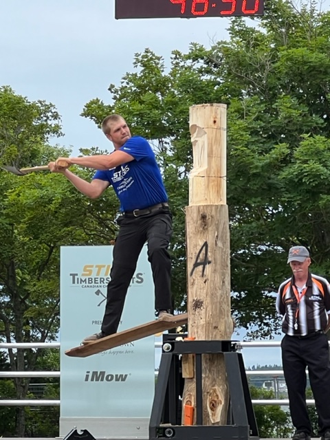
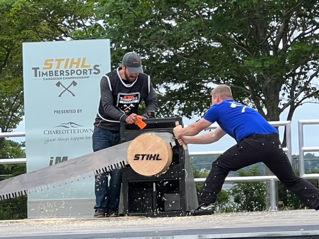
While in Charlottetown, we were fortunate that the Canadian competition for the STIHL TIMBERSPORTS World Championship took place here during our visit. Events included cutting timber in various configurations with an ax and with a long, steel saw. It seems there is an entire culture built around these events, and the participants are serious athletes, both men and women, who train rigorously year round. The timing of the women’s competition conflicted with other plans, but here are a couple of images from the men’s events:
While in Charlottetown, we were fortunate to have Jim Small’s son Matt, his bride Kayla, and their incredibly cute and astute two year old daughter Kennedy visit us – Kayla’s grandmother Wilma lives in Summerside, PEI, so Matt & Kayla timed their annual visit to coincide with ours.
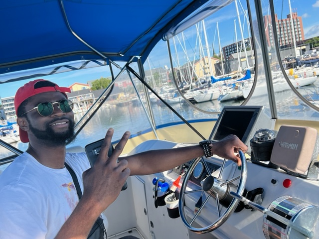
Kennedy tried her hand at driving the boat (securely tied to the dock…):

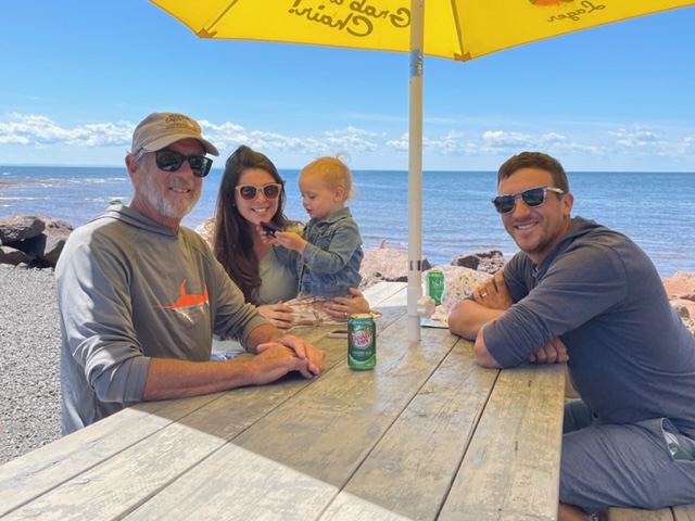
Jim, Kayla, Kennedy, and Matt at the beach:
One last image from Charlottetown – a beautiful sunrise over the harbor:

As much as we loved Charlottetown and Prince Edward Island, the time came to move on. Our next stop brought us back across the Northumberland Strait, a run of 45 nautical miles to the mainland, and our first landing on Nova Scotia! We have now visited 5 states and 4 Canadian provinces. Our destination was Pictou, NS, an interesting town in transition. The only marina in town that accepts transient boats over 30′ is due to be reconstructed, so we stayed on a mooring adjacent to the town’s waterfront:

We accessed the town from the Joint Adventure via our trusty dinghy:

The story of Pictou today is the story of this pulp plant across the bay from the town:

The pulp plant was closed a couple of years ago after environmentalists and activists worked for years to force its closure based on claims of extensive environmental damage caused by water and air pollution from the plant. One of the biggest factors appears to have been the smoke and the terrible smell which reportedly enveloped Pictou whenever the wind blew is the direction of the town. We spoke at length with Doug Desbarres (see below) who bought the old Pictou Custom House years ago and renovated it into a gorgeous Inn. He told stories about guests who checked in over the years only to leave a few hours later, saying they couldn’t breathe due to the airborne smoke and chemicals from the plant. As a result, the town, despite it’s stellar location, its it’s inviting waterfront, and its magnificent historic buildings, has been unable to make it a tourist destination and therefore suffers from economic decline as the industries of yesteryear have moved on. However, the closing of the plant should mark a sea-change for Pictou, and a bold new waterfront development plan which is on the drawing boards should be a catalyst to spur tourism and further development, moving Pictou to a new plateau.
I invite Doug and Michael Rushton, who we first met in Quebec City and has family in Pictou, to add any thoughts or comments they may have.
Here are is an image of the historic Custom House on the Pictou waterfront that Doug renovated into the beautiful Inn that it is today – a great place to stay if you want to visit Pictou!

Here is the lounge in the Custom House Inn, set up as a pub but not currently operating as one. Doug was kind enough to give us a tour!

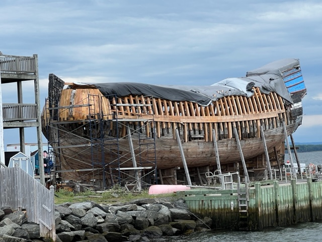
One of the main historic attractions in Pictou is the Hector Heritage Quay Museum and the story of the ship Hector, including a full size replica which is currently being rebuilt at the museum. The original Hector brought the first wave of emigrants to Nova Scotia from Scotland in 1773. It was an arduous trip that took 11 weeks, due in part to the age of the ship and a gale off the coast of Newfoundland; during the trip, 18 of the 189 passengers died of dysentery and small pox. The replica was launched in 2000, but reportedly due to insufficient funding and neglect by the government, the ship fell into disrepair and is now being rebuilt by the non-profit organization that runs the museum. Here is an image of the current state of the reconstruction:
Pictou also has a Fishermen’s Museum on the waterfront, but that was closed on the day of our visit.
While on the waterfront in Pictou, we were pleasantly surprised to re-unite with David and Martini, the young couple who live in southern Quebec next to the Vermont border whom we first met in Rimouski on the St. Lawrence, as they travel on their 26 foot sailboat on their year-long Down East adventure. They were tied to the mooring next to us overnight in Pictou:

Our next stop was Ballantynes Cove, a small fishing harbor south of Pictou. The 40 mile run was unpleasant, as the 4′-6′ seas significantly exceeded our expectations. Although the seas were on our stern, the Joint Adventure got tossed around, creating a very uncomfortable motion. We couldn’t put the boat on a plane to speed up the passage because of the size of the waves – the propellers cavitate, which means they lose their bite on the water momentarily, putting a great deal of strain on the engine when they spin free then re-engage the water. We were never in danger, but it was an uncomfortable three hours.
Here is an image of the small fishing harbor of Ballantynes Cove; the Joint Adventure is docked in the middle of the picture. Notice how the seas calmed down after we got in!

There is no town near Ballantynes Cove, so the harbor seemed to be the focal point for the local folks who live in the rural area in the vicinity of the small harbor. There is a small take-out snack bar adjacent to the harbor where we treated ourselves to ice cream in the afternoon and ate a take-out dinner on the adjacent picnic tables that evening. It was a Sunday evening, so there was a constant stream of take-out customers from the area picking up their Sunday meal; there are no other restaurants within many miles, I was told.
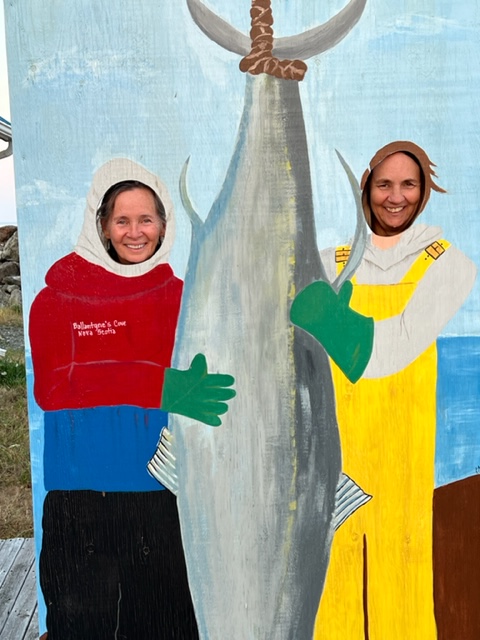
There was also a small bluefin tuna Interpretive Center adjacent to the harbor; I was able to coerce Trish and Pat into posing for me:
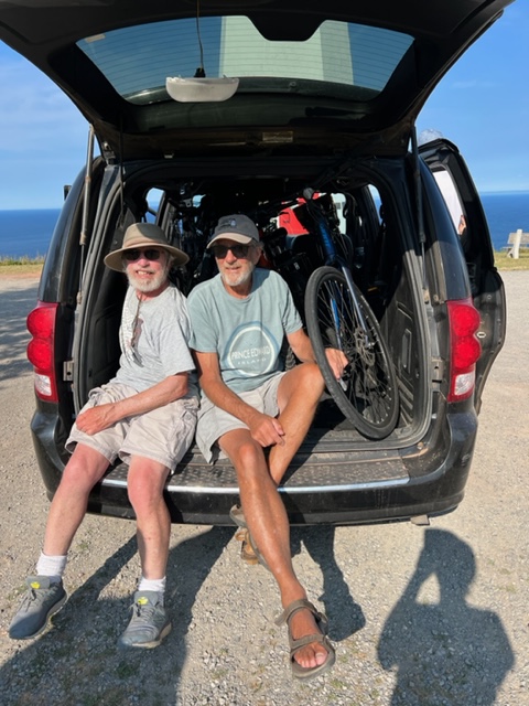
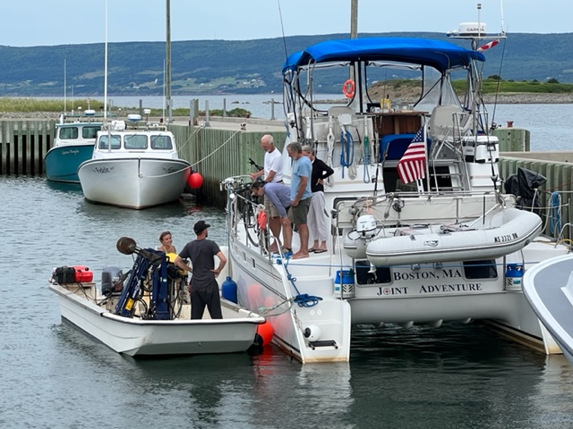
In another of the remarkable encounters with the incredibly friendly and generous people in the Canadian Maritimes, we met local resident William on the docks while he was walking his dogs. We had been talking about making the long uphill walk or bike ride to a lighthouse high on a hill overlooking the ocean when William insisted that it would take too long as it was already late afternoon; he insisted that he would drive us and our bikes up to the lighthouse and we could ride the bikes downhill back to the harbor. Despite our skepticism, he successfully squeezed 5 bikes and 5 of us into his Dodge Caravan; it was not the safest ride I’ve ever taken – Jim and I drew the short straw, and held on for dear life:
The view from the lighthouse was spectacular, although difficult to capture in a picture:

Our next stop was a very small harbor called Havre Boucher, just 20 miles south of Ballantynes Cove. Here is an image of the very small harbor, in which we again were the only cruising boat among the small fishing fleet:

A young couple, Steve and Kiley, ran an oyster farming business out of the Havre Boucher harbor, running their boat back and forth from the location of the farm in the bay to the harbor. Jim and Paul bought a dozen live oysters from them for dinner:

From Havre Boucher, our next run would take us to St. Peters Village and into the beautiful and serene Bras D’Or Lakes (pronounced (bradoor), which we planned to explore as a side trip for the next 9 days or so. The first segment of the run was down the 14 mile long Strait of Canso, which separates Cape Breton from the rest of Nova Scotia, technically making Cape Breton an island (in the same sense that the Cape Cod Canal made Cape Cod an island). The Strait of Canso is used regularly by large oceangoing ships, and includes a large lock sized for such vessels. We saw a few docked at two or three industrial ports along the way, but we saw no commercial vessels underway. From the Strait of Canso, we entered the 16 mile long Lennox Passage, a picturesque waterway with scenic coves and anchorages on both sides. The last segment took us through the short St. Peters Canal and into the Bra D’Or Lakes. Prior to construction of the canal and lock system in 1869, small vessels were pulled on skids by teams of oxen to get into the lakes. Today, approximately 1000 cruising vessels and around 400 small fishing boats pass through the canal each season. In talking with the operator of the drawbridge over the canal, he informed me that only about 20% of the cruising vessels are power craft, with 80% or more being sailboats.
Our next adventure will be cruising Bra D’Or Lakes before we start heading along the southeast coast of Nova Scotia towards Halifax and the Bay of Fundy.
More to come!!

Leave a comment