
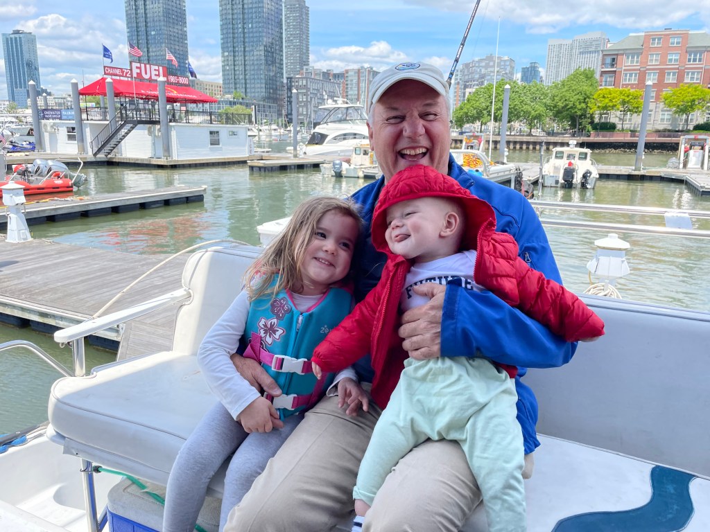
Our journey north towards Canada continues! But first, I want to add a few pictures from NYC that were sent to me after my last blog post:


Back to the next leg of the trip!
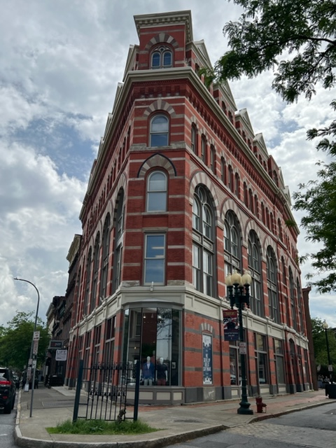
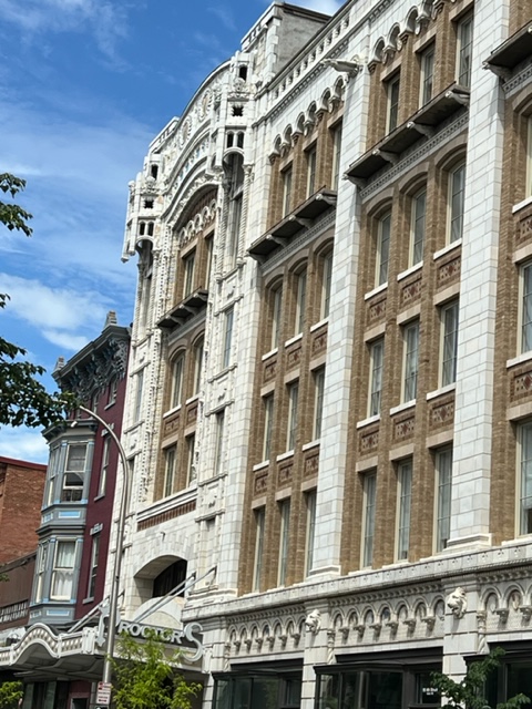
Due to its location at the confluence of the Hudson and Mohawk rivers and subsequently the Erie Canal, and due to the availability of waterpower to fuel the industrial revolution, Troy was reported to be the fourth wealthiest city in the US at the turn of the 20th century! The spectacular architecture from days gone by show it:
The area which is now Troy was originally inhabited by the Mohican Indians. Upon the arrival of Europeans, it was first settled by the Dutch, but the Dutch colony was conquered by the English as early as 1664. Originally called “Ashley’s Farm”, the name “Troy” was adopted by popular vote in 1789; in the years following the Revolutionary War, this renaming followed a strong trend toward naming cities and towns after European counterparts – other examples in upstate New York include Rome, Utica, Syracuse, and Ithaca.
An interesting legend originates from Troy: during the War of 1812, a local butcher and meatpacker named Samuel Wilson handled supplies for the military, in which barrels shipped to him stamped “The US” were jokingly taken by the troops to stand for “Uncle Sam”, meaning Sam Wilson. As a result, Troy claims to be the historical home of Uncle Sam.
We docked in Troy at the city-owned Troy Downtown Marina, which consists of new docks along the river wall which replaced those which were destroyed by the floodwaters of Hurricane Irene:

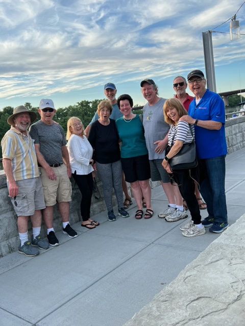
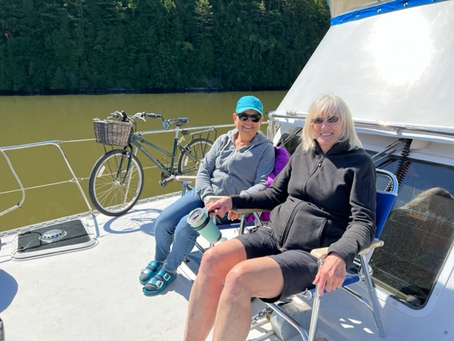
We added our friends Bill Burke and John McCallion to our crew in Troy; they were driven there by Trish’s sister Mary Beth Southerton, Bill’s wife Kathy, and John’s wife Susan. In addition, we were fortunate to have my friend and colleague Kathleen Sheehan and her brother Joe join us for dinner in Troy. Now a group of 10, Kathleen arranged dinner for us at a great BBQ place overlooking the river:

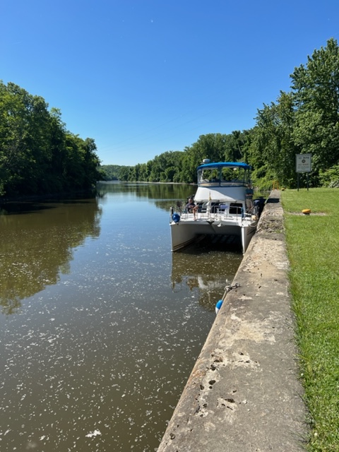
After passing through the Federal Lock the next morning, we shortly came upon the famous split in Waterford in which the Erie Canal heads west and the Champlain Canal heads north:

The 64 mile Champlain Canal connects the Hudson River in Troy with the southern tip of Lake Champlain in Whitehall, NY. The canal was completed in 1923, and originally contained 23 locks with a controlling depth of just 5 feet. The original canal boats were 70 – 80 feet long, and were pulled by mules or horses from the adjacent tow path. Farmers along the way sometimes earned some extra income by hiring out their teams to pull canal boats. In the early 1900, the first steam tugs appeared on the canal.
The canal had a huge positive impact on the economy of the northern part of New York State and Vermont, as it provided cheap and easy transportation of goods to New York City and to other domestic and international destinations. Lumber, iron ore, coal, hay, clay, paper, granite, farm products such as apples and potatoes, and even block ice in the winter were shipped south on the canal, and manufactured goods and supplies were shipped north.
During the next 100 years, the canal was rebuilt several times; today it contains 11 locks and almost exclusively serves recreational vessels. The first 8 locks raise boats 139 feet above what is essentially sea level at Troy, then the last 3 locks lower boats 44 feet to the elevation of Lake Champlain. However, the height of bridges limits the size of boats that can use the canal. Depending on the water levels in the various segments of the canal, the controlling height can be as little as 15′ or as high as 17 feet. We had to lower our radar tower to pass under the lowest bridges.
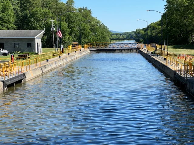
Here are some pictures taken along the Champlain Canal:
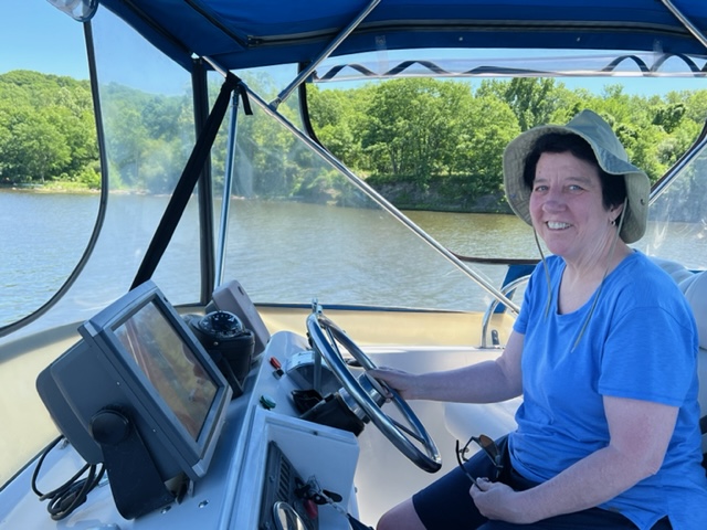
Leaving Troy on the way to our next stop in Schuylerville, we stopped at the city dock in Kathleen Sheehan’s hometown of Mechanicsville to pick her up so she could ride with us to Schuylerville. She demonstrated that she has many skills that she didn’t know she had:
The family-owned marina in Schuylerville has a local flavor in a wonderful, wooded setting. I had stopped there 7 years earlier on the Great Loop trip, during the time that the EPA was dredging the river and canal to remove PCB’s that had been dumped into the Hudson River and the canal by General Electric decades earlier. We passed much of the dredging operation as we went north. Judy, the proprietor of the marina at that time, explained that most of the residents in the area opposed the dredging, believing that disturbing and removing the PCB’s was more dangerous than leaving them in place. The EPA proceeded anyway. All evidence of the dredging was gone by time we passed last week.
A terrific and very readable book about the history of pollution and cleanup of the Hudson River is “Riverkeepers” by Robert Kennedy Jr. Kennedy, an environmental lawyer, became alarmed by the pollution of the Hudson in the 70’s. As a result, he formed an organization called “Riverkeepers” and proceeded to file lawsuits under the Clean Water Act against cities, towns, manufacturers, and businesses to stop the pollution and clean up the river. The Riverkeepers were enormously successful, and today there are Riverkeeper organizations fighting pollution in many American cities and harbors. The book is not technical, and is filled with interesting anecdotes and stories about the river, the court battles, and the cleanup. My Dad read it, and enjoyed it so much that he read it a second time as soon as he finished it the first time.
Here is a picture of the Schuylerville Yacht Basin where we stayed:


Our next stop was on our way north was Fort Edward, NY. Rather than staying in a marina, we tied to a free wall provided by the town alongside a lovely waterfront park. The town provides electric hookups, water, restrooms, and showers to encourage boaters to stay and patronize local businesses. That being said, there were very few businesses in the very small town of Fort Edward, and most of those were closed. However, there was a small brewery and pizza shop that delivered to the brewery, so we neither starved nor went thirsty.

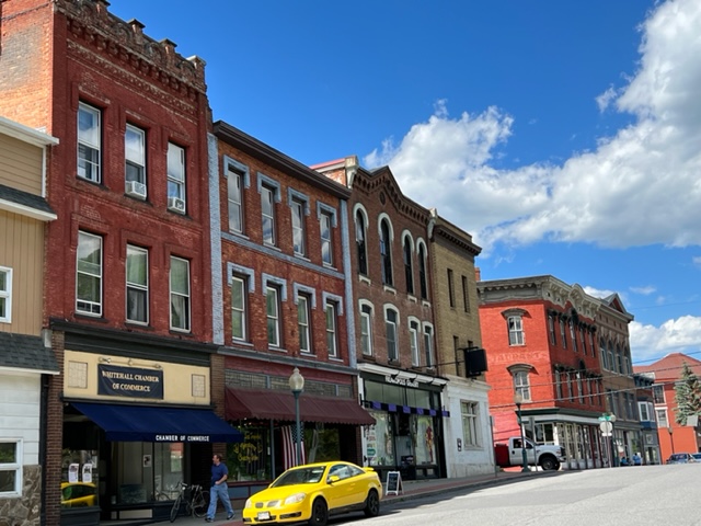
Our next stop was Whitehall, NY. The last lock on the Champlain Canal is in the center of Whitehall, which marks the southern tip of Lake Champlain. Of all the struggling towns along the canal, Whitehall is the poster child for economic decline and stagnation. Once a key inland port both militarily and economically, the town has beautiful historic buildings along Main Street, which fronts on the canal. However, most of the storefronts are vacant and boarded up, and many of the buildings and even homes in the vicinity of the downtown are vacant and in various stages of collapse.
Prior to construction of the canal, goods were shipped south on Lake Champlain or north on the Hudson River, then carried overland. Whitehall served as the loading/unloading center at the Lake Champlain end. After the canal was built, goods were unloaded from lake boats and put onto much smaller canal boats for shipment south, and vice versa. Whitehall also served as a center for building boats, both for commerce and for military use on Lake Champlain.

Our friends Louise Bombardieri, Janey Chellman , and Al Johnson joined us in Whitehall:

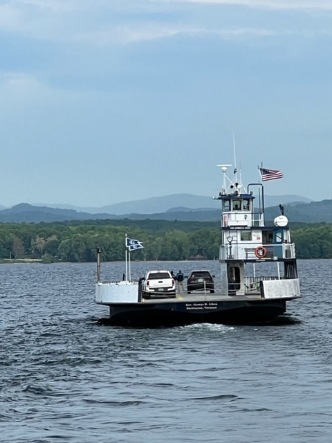
The southern portion of Lake Champlain is more like a river than a lake. Boats in this area are often plagued by weeds that grow in the shallower areas, but were not a problem for us this early in the season.
Lake Champlain played a much larger part in defeating the British in the American Revolution than most people appreciate. Also, when the name “Benedict Arnold” is mentioned, most Americans only know of him as a traitor to the American cause, which, of course, he was. But there is much more to the story than that. Before he reverted to the British, he was a rising military commander who was responsible for many key military strategies and decisions, and who scored a number of military victories on Lake Champlain. He was sent to Lake Champlain by his superiors to prevent the British from coming down from Canada to attack New York and the other colonies from the north. However, he had to build his own ships with few skilled shipbuilders and fight the British with a small, inexperienced, and demoralized force which was riddled with smallpox. Miraculously, he was able to hold the British off just long enough to delay them from attacking until the following summer. The key encounter was the Battle of Valcour. The inscription on a memorial in Burlington says it better than I could: “In the fall of 1776, a British naval force left Canada and embarked onto Lake Champlain in an effort to divide and conquer the rebelling thirteen colonies. Positioned off of Valcour Island was a fleet of gunboats under the command of Benedict Arnold. On the morning of 11 October, the two fleets began what became an intense three-day engagement fought over 30 miles of Lake Champlain. At the end of the third day, the British had gained control of the strategic waterway. But with the season advancing, they were forced to return to Canada for the winter. This action had a profound impact on the outcome of the Revolutionary War and winning American independence. The little American navy on Lake Champlain was wiped out: But never had any force, big or small, lived to better purpose or died more gloriously, for it had saved the lake for the year. That the Americans were strong enough to impose the capitulation of Saratoga was due to the delay secured to them by their little navy on Lake Champlain.”
Benedict Arnold was a hero. But he was from the working class, so was looked down upon by generals who were generally aristocrats. Arnold felt he was treated poorly and passed over – the rest is history, and his name now lives in infamy.
There is an excellent and very readable of book about the battle for Lake Champlain, the key role it played in the outcome of the American Revolution, and Benedict Arnold called “Valcour – the 1776 Campaign that Saved the Cause of Liberty” by Jack Kelly. Paul, Jim, and I all read it in preparation for this trip (I’m actually not quite finished), and we highly recommend it!
Our next stop as we worked our way north on Lake Champlain was Westport, NY. We originally had planned to stop earlier, but the weather was perfect and strong winds were forecast for the following day, so we went 10 miles further north to the small town of Westport on the NY shore. After a bike ride through the small town and dinner on the boat, we retired early since we planned an early start to hopefully avoid the worst of the wind.
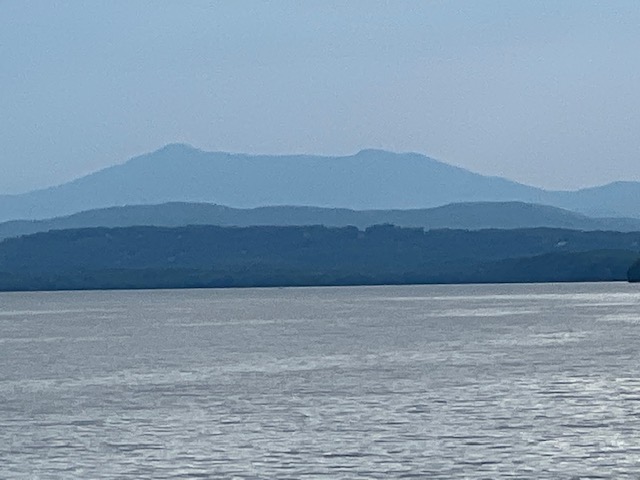
Here are some images of our run northward up Lake Champlain:


We cast off by 7:00 AM on Tuesday morning, since 20 knot winds with gusts to 30 were forecast to build through the morning. However, the winds were from the south and therefore would be on our stern, so we felt we could handle them. Our 25 mile run to Burlington was quite pleasant, but the wind really hit about 30 minutes from our destination. By the time we needed to dock, the winds were everything that was predicted. Backing into a slip in those conditions was a challenge, and it took 4 “bailouts” until we finally got it in on the 5th try! We’re not at all bashful about bailing out and starting over if things are going as planned!
Burlington is perhaps my favorite small city. We visited downtown during the afternoon and discovered it was “Jazzfest Week”. Burlington has a long pedestrian-only street that is lined with shops (including two ice cream shops), and in which they host celebrations, festivals, music venues, performances, etc.:

A highlight of our stop in Burlington was a visit by my friend and colleague Darcy Jameson, as well as a visit by a college fraternity brother, Doug Roszman. Darcy drove all the way from Sugarbush to join us for dinner! The weather was tough, with strong winds still lingering and plenty of rain, but we had a fun dinner together on the waterfront, outside but under cover!

Tomorrow we head to Rouse’s Point, which is our jumping-off place to enter Canada and the next phase of our trip!
More to come!!

Leave a comment