
Lubec, Maine is a special place – we discovered that four years ago when we and a dozen or so of our biking friends spent the first half of a week-long bike trip based in the town, and were welcomed by so many of the friendly, upbeat people who make Lubec their home. Although a bit out of our way and not on the normal Down East Loop itinerary, we made visiting Lubec again a goal of our voyage.
Pat Coates, Jake Mycofsky, and Bob Hall drove to Lubec to meet us; Bob joined us on the voyage for the next several days, while Jake joined us for the next couple of weeks.
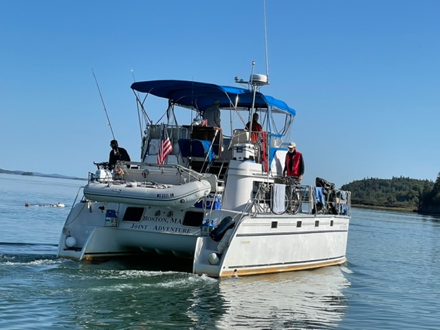
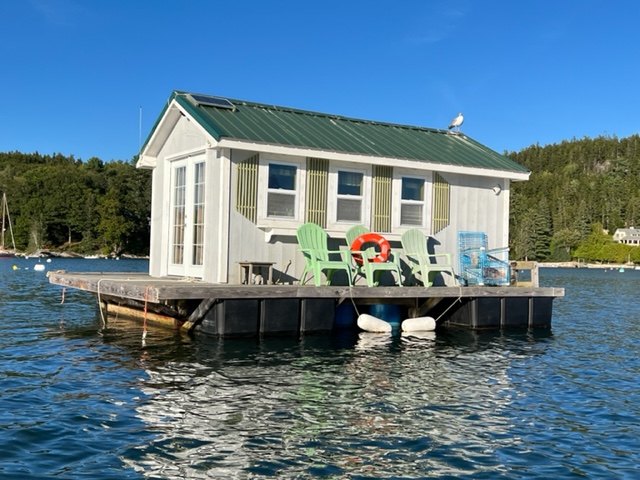
Pat took this picture of the Joint Adventure coming in:
Upon passing through Lubec Channel, we went directly to the town dock, as required by the Customs and Border Patrol, flying our yellow “quarantine” flag as required of all boats until we cleared Customs:
Lubec sits directly on the Canadian border at Campobello Island, so there is a US Customs office at the bridge to the island. As required, we brought our passports and boat documents to the office and cleared entry of us and the Joint Adventure back into the USA!
The town dock is for temporary dockage only, so after clearing Customs, we moved the Joint Adventure to one of the two moorings that the town provides for a small overnight fee of $25:
The tidal range in Lubec is about 20 feet, the highest tides that we will encounter on our voyage. As we head south, the influence of the Bay of Fundy on both the tidal range and the currents will begin to diminish, although they will be substantial for quite some time, as you’ll see. Although not taken at dead low tide, this will give you an idea of the tidal range:
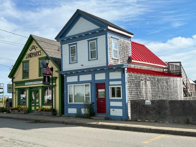
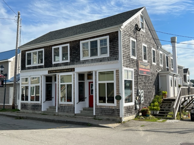
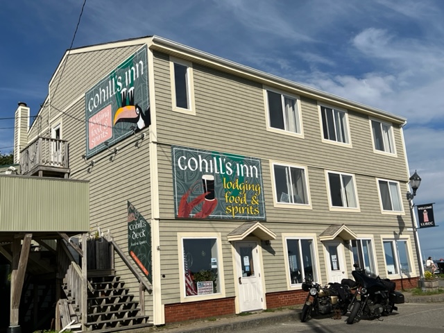
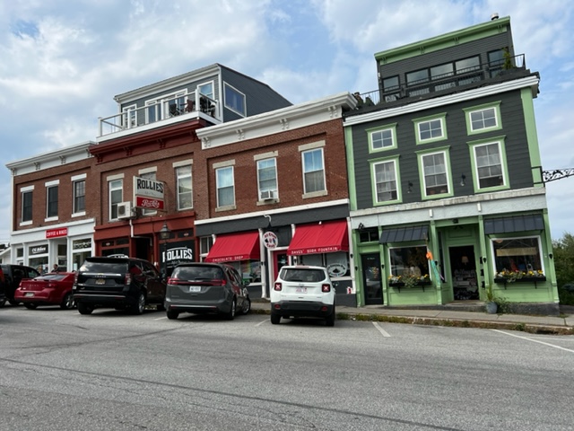
Like so many other towns we have visited throughout the entire trip, Lubec was once a thriving seaport town whose economy was based on industries that have long since waned, died altogether, or moved elsewhere. However, Lubec somehow feels different from many of the other places. The people are upbeat and enthusiastic, and they are optimistic about the future. Due to its off-the-beaten-path location, tourism has not taken hold in a major way. Main Street is not very long, but several of the buildings have been restored; other historic buildings on Main Street and on the waterfront are structurally sound, and restoration seems likely in the not-too-distant future. People seem to be moving into town, as evidenced by the residential renovation and construction that is quite noticeable, likely stimulated in part by a renewed interest in smaller, more remote towns as a result of Covid.
Following are a few images along Main Street:
I couldn’t resist including an image of the small Lubec Brewery, also on Main Street. They brew craft beers which are sold in many parts of Maine, and they also run this pub which seems to be somewhat of a social meeting place for many of the local people:

The views from virtually anywhere in Lubec of the ocean, of the surrounding bays and islands, of Campobello Island in Canada, and even of Grand Manan Island are stunning. Campobello Island is also home to the Roosevelt Campobello International Park, which includes the home and landscaping surrounding the summer retreat of Franklin and Eleanor Roosevelt.
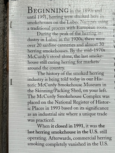
Of all the amazing museums we visited throughout our trip, perhaps the most fascinating was the small but extraordinary McCurdy Smokehouse Museum in Lubec. The following plaque provides an overview of the magnitude of the sardine and smoked herring operations in Lubec in the late 1800’s and the first half of the 1900’s:
McCurdy’s Smokehouse started smoking herring in 1906, and the process, tools, equipment, etc. remained the same the day it closed in 1991 as they were on the day it opened. In the museum today, many of the smokehouse buildings remain exactly as they were the day McCurdy’s closed – all of the tools and operational equipment and mechanisms are completely intact. In addition, the curator who now provides tours (his name is Jim) worked at the smokehouse for years when it was operating; therefore, he provides an incredible and irreplaceable insight into the history and the operation of the smokehouse.
He explained that the herring were processed whole, exactly as they arrived from the boat. The first step was to “brine” the fish for a week or so – the “brining” process meant soaking the fish in a saline solution in vats for the week-long period. When removed from the brining solution, the herring were then strung by hand, one fish at a time, on wooden sticks, which were then hung in the smokehouse. When the smokehouse was filled with thousands of herring hung on the sticks, the workers would start a fire on the gravel floor of the wooden smokehouse (yes, a fire on the floor of the WOODEN smokehouse!). Once the fire built up, they would put sawdust on it to create smoke; the workers would then keep the fire going round the clock for TWO MONTHS in the wooden smokehouse to cure and smoke the herring! After two months, they would take the herring down, remove them from the sticks, and the workers would then remove the guts and strip the skin by hand from each fish. The final step in the process was to pack the smoked, skinless filets by hand into ten-pound wooden boxes for shipment throughout the world.
As described above, in its heyday in the 1920’s, there were 30 such smokehouses operating in Lubec (in addition to about 20 sardine canneries)! Over time, however, the market for the smoked herring declined, possibly because tastes changed or possibly because cheaper smoking processes were developed elsewhere. In any case, by the mid-1970’s, McCurdy’s was the only herring smokehouse still operating in Lubec – all the rest and all of the sardine canneries had closed. McCurdy’s continued to operate until 1991, when the US government decided that it was unsanitary to smoke the herring before they were gutted, and issued regulations to that effect. As a result, McCurdy’s, unable to comply with the new regulations, shut its doors for the last time. It was the last herring smokehouse of its type in operation in the US.
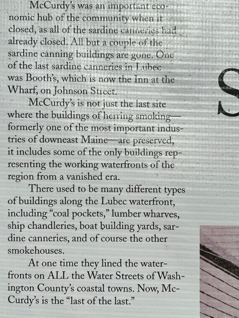
Here is an image of the wooden smokehouse at McCurdy’s; the peak of the roof is vented, so during the smoking operation, smoke poured continuously through the entire length of the peak of the roof, as shown in photographs at the museum:
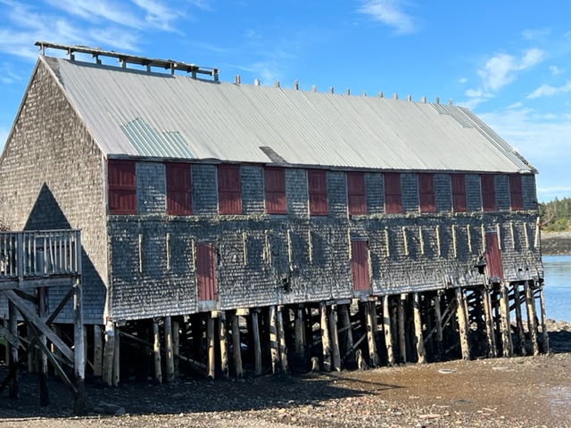
Here are some of the other buildings in the museum that were part of the smokehouse operation, which includes, among others, the Skinning Shed, the Sawdust Shed, and the South Smokehouse:
The museum tells a truly fascinating story and is a unique place to relive a tiny but important piece of our collective history. Today, however, the museum and its machinery, artifacts, and buildings are in danger. The museum is run exclusively by volunteers, and the historic buildings are badly in need of stabilization and repair. The Museum is chronically underfunded, supported only by the $4.00 admission fee and fundraising. If you are interested in historic preservation and might be interested in helping to preserve a unique and irreplaceable piece of our human heritage, you can send a donation to Lubec Landmarks, Inc., 50 water Street, Lubec, ME. 04652. Donations of any size would be appreciated and would help keep the museum alive.
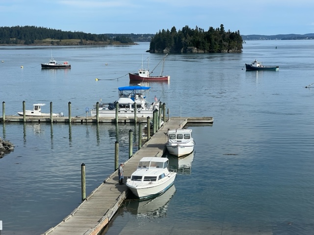
From Lubec, we started the last leg of our journey, heading south toward Boston. Our next stop was the small town of Cutler, 20 miles from Lubec. The harbor actually contains nothing more than many fishing boats on moorings, two active lobster operations, and surrounding residences – there is nothing else on shore except an old empty building that at one time contained a general store.
I had tried to confirm the availability of a mooring ahead of time, but the harbormaster wouldn’t confirm such; he simply said that if we tied to an empty mooring “we should be OK”. So that’s what we did, and no one came to kick us out!
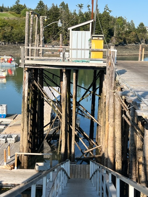
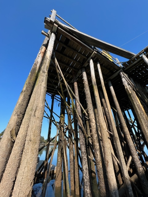
Despite the lack of shore-side facilities, Cutler was still a very interesting place. Heavily influenced by the Bay of Fundy, the tidal range is about 18 feet, which dictates how everything on the waterfront is built and operated. Here are some images:


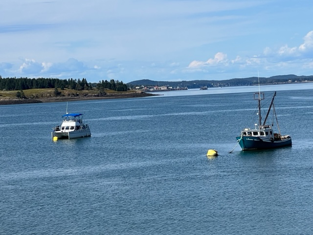
The lobster operations were in full swing, with lobster boats coming to unload their catch throughout the day. Here are some images:

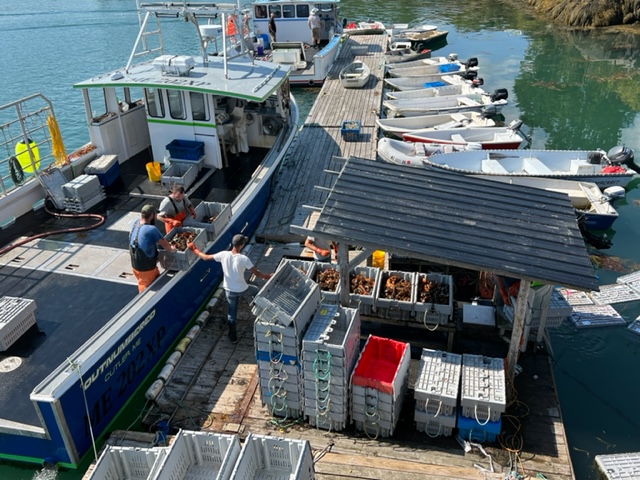
As we watched a lobster boat being unloaded and the catch being sorted, the captain of the boat asked if we wanted to buy some lobsters; we said sure, so he sold us five 1 1/2 pound lobsters for $7.50/pound. They were delicious!!

In the afternoon, Jim, Bob, and I went on a three mile hike through a virgin forest and along the coastline of the narrow bay. While enjoying the scenery before heading back, a small, lone lobster boat captain meandered his boat out of the harbor, checking his traps as he went:

After our hike, Jake and I went out in the dinghy to get a close-up look at a lighthouse on an island that marked the entrance to Cutler Bay. Outside the island was open water, so we got to ride some swells coming in from offshore, but nothing that put us in danger. Here’s Jake and the lighthouse:

That evening, we were treated to a full Harvest Moon rising above the harbor:

Cutler has another interesting distinction, largely unknown outside the local area, as a result of these towers on the Cutler Penninsula:
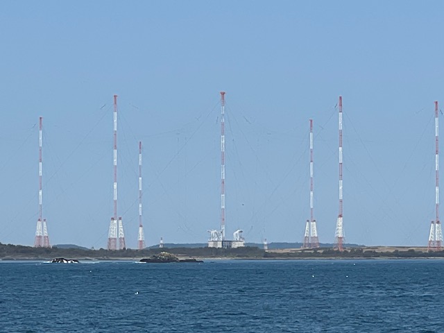
There are 26 of these towers grouped together – they’re Very Low Frequency (VLF) radio towers that communicate with armed US submarines. As a result, Cutler was once grouped with the Pentagon, the White House, and the Stategic Air Command in Omaha, Nebraska as likely first strike targets in a nuclear war!
We moved quickly by….
Our next run was 25 miles to Jonesport, Maine. We were experiencing swells of 5′-6′ from the remnants of Hurrican Earl well offshore; the swells were not steep, so they posed no danger except possibly when entering harbors or unprotected narrow passages, but they provided some eye-catching scenery:
On our way to Jonesport, we ducked into the anchorage area at Roque Island where there is a beautiful sand beach. We exited through the passage known as the Thorofare; the narrow but protected passage bends to the left:

A pretty spot that we passed along the way, but I’m not sure I’d want to be here in a storm:

Since we returned to US waters, a major challenge has been the proliferation of lobster traps. The lobster fishery in Canada runs from November through July 1, so by the time we got to the lobster grounds in Canada, all of the traps had been pulled for the season. However, in the US, the season goes through the summer and fall, so in northern Maine, there are lobster traps EVERYWHERE! Piloting among them take constant vigilance, and we have the helmsman and at least one other person on the bridge at all times when underway to watch for the floats which are attached to the traps. Spotting them is hard enough when there are waves or chop, and/or the sun is reflecting on the water ahead; however, the biggest danger is from traps in which the floats are submerged as they get pulled underwater by the swift current or perhaps just by high tide if the line isn’t long enough. At one point, three of us on the bridge failed to spot a submerged float until it was too late to maneuver around it or stop; fortunately, it passed harmlessly between the two pontoons without getting caught is a propeller.
It’s impossible to capture the true impact of the lobster trap floats in a picture, but this might provide some idea how prolific the floats are:

Avoiding the traps often results in a constant zig-zag course to avoid snagging a trap line on a propeller. Doing so can damage the propeller and/or shaft, and the line usually gets wrapped tightly around the shaft, requiring someone to dive under the boat repeatedly to cut the line off. Doing so can be difficult and cold when the seas are calm, but can be downright dangerous if the boat is bouncing and rocking in rough water.
The course to Jonesport includes passage through a long channel in which the current was running hard. Submerged trap floats were a constant concern, but we came through unscathed – so far!.
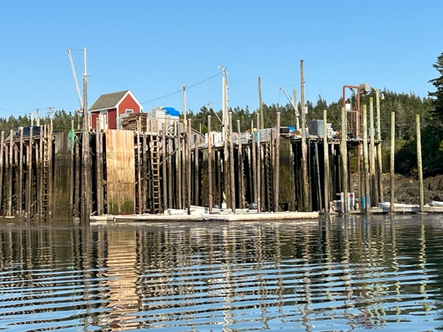
Jonesport and the adjacent Beals Island are another prime example of a depressed area in which former drivers of the economy have largely disappeared or greatly diminished. Lobstering seems to be the only industry that is still viable, though reduced from years gone by. The harbor was filled with lobster boats, again all at moorings, but the boats here were generally smaller and seemed older than the lobster operations elsewhere. It appears that most of boats in Jonesport plied inshore waters rather than the larger boats we’ve seen elsewhere that likely go further out. Along the roadway from the harbor and on Beals Island, many buildings were vacant, boarded up, and in disrepair.
The tidal range in Jonesport is still around 16 feet, producing interesting scenes when the tide is down:


While on the dock, we met a builder of wooden boats named Doug Dodge. He’s a legend around Jonesport, and coincidentally, Paul was reading an article about him in a boating magazine at the time. He invited us to take a look at his shop and the boat he’s currently building. He’s clearly an old-timer both in chronology and spirit, which was reflected prominently in his shop. His tools were all from a different age. At one point, I noticed in his shop a very old combination stove/refrigerator (I’ve never seen one of those before). When I asked about it, he confided that someone he knew was going to throw it out, but it still worked, so he took it. It sits unused in the same spot where he put it 20 years ago.
Doug was gracious and informative, and we thoroughly enjoyed our visit to his shop and his explanations about the boat he’s currently building:

The Harvest moon rose over Jonesport Harbor that night, so I couldn’t resist another image:

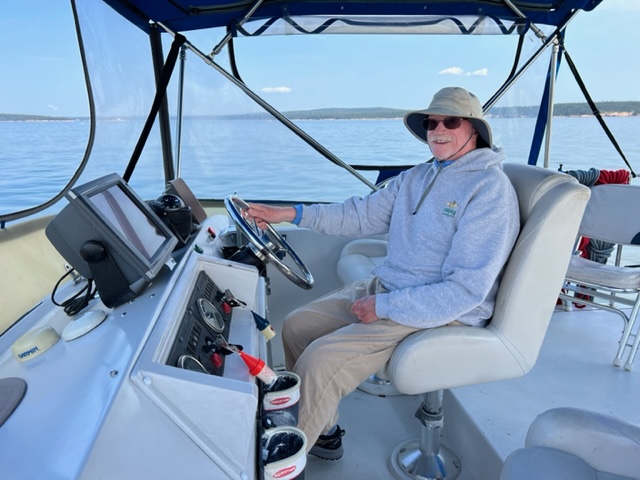
The weather continued to award us beautiful, nearly windless days, so we ran 40 miles the next day to Northeast Harbor on Mt. Desert Island. Here’s an image of Bob at the helm of the Joint Adventure, diligently avoiding lobster pots:

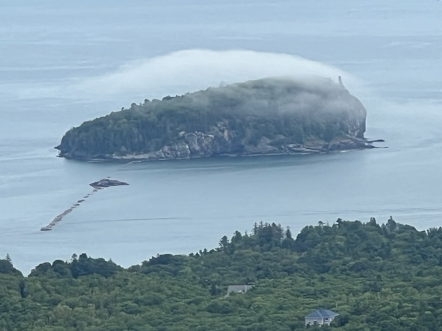
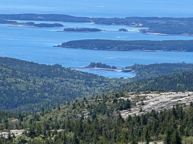
On our way, we passed an iconic rock formation on the Schoodic Penninsula, which is separate from Mt. Desert Island but is still a part of Acadia National Park. If you visit Acadia, be sure to include a day or two in your itinerary for Schoodic. It is every bit as stunning as Mt’ Desert Island, but far less crowded:

Bob had to leave us, so we went first to Bar Harbor where we dropped him off to get a ride back to his car in Lubec. On our way around the east coast of Mt. Desert Island, we passed Cadillac Mountain, the highest peak on the Eastern seaboard of the United States; from October 7 until March 6, it’s the first place in the US to see the sunrise:

For our final run into Northeast Harbor, one of the several harbors within Acadia National Park, Jake took the helm:
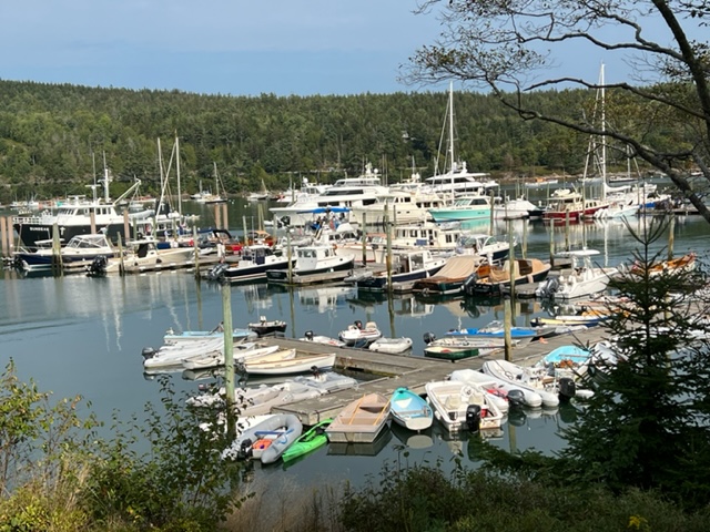
Northeast Harbor (and Bar Harbor) couldn’t be more opposite from Cutler or Jonesport or nearly all of the harbors in Nova Scotia and New Brunswick that we’ve visited over the past couple of months. The only lobster boat in the harbor is one that takes tourists on an excursion to see a few lobster traps being raised. Most of the boats here are vintage or classic boats, most of which are much larger than the Joint Adventure and all of which are much classier – lots of teak and varnished wood! Here’s an image of Northeast Harbor:
Two events coincided to pin us down in Northeast Harbor for four extra days – first, the water pump that sends water from our water tank to the faucets in the galley and the head finally quit. It has been making unusual sounds for weeks (OK, months, actually), but somehow I thought it was going to get us through to Boston. – but to no avail. So we had to stay an extra day for delivery of a new pump, which Jim installed. However, the following three days brought high winds, which forced us to await a better weather window.
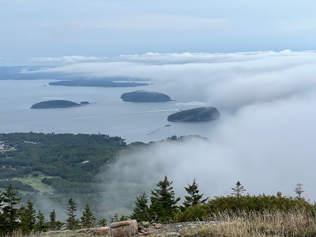
There are many worse places to get pinned down than Acadia National Park, so we used the time to catch up on chores, explore, and sightsee. So I set out to climb Cadillac Mountain, up a 2.2 mile trail to the summit.

This image taken on the way up the mountain shows two cruise ships anchored off Bar Harbor. There were three in the harbor when we dropped Bob off a couple days earlier, and each day one or two seem to leave and a new one or two arrive:

As luck would have it, fog rolled in when I was about 3/4 of the way up the mountain. On the one hand, it deprived me of the opportunity to take in the 360 degree views from the summit. On the other hand, it provided some really cool and unique scenes of the fog rolling in from the ocean:

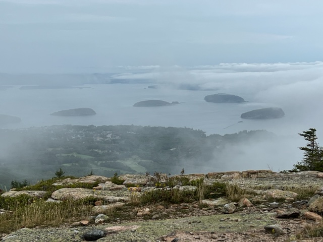
And finally, the view from the summit of Cadillac Mountain:

When I descended from the mountain, I rode the bus back to Bar Harbor and relaxed with a beer and a snack while listening to music from a folk singer on the lawn outside one of the inns in the village. He sang a song that I hadn’t heard in decades, but that most of you over 40 will recognize from the first few lines:
Hello Mudda
Hello Fadda
Here I am at
Camp Granada
I’m surprised at how many of the words I knew! The catchy tune has been running through my head ever since!
Having been deprived of views from the top of Cadilac Mountain, I decided to go back up two days later – but this time, I took the tour bus! So here are images from the fog-free mountain top!


Here is Bar Harbor village from the top of Cadillac Mountain:

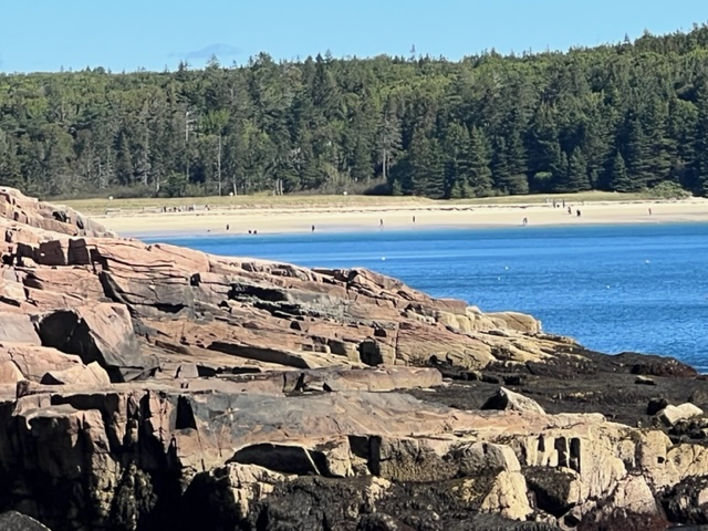
Another premier attraction at Acadia is the beautiful sand beach tucked into the rocky coastline:
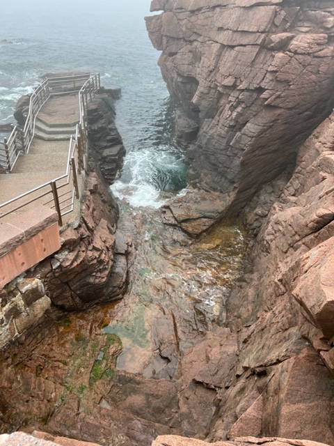
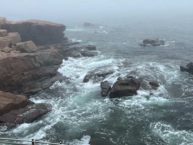
And a visit to Acadia wouldn’t be complete without a visit to Thunder Hole. The rock formations are such that, near high tide, waves wash into the hole and get trapped, causing geysers to shoot into the air and creating loud thunder-like sounds as trapped air is compressed and rushes to escape. I was actually there at low tide so I don’t have pictures of Thunder Hole “performing”, but the rock formations are still quite compelling:
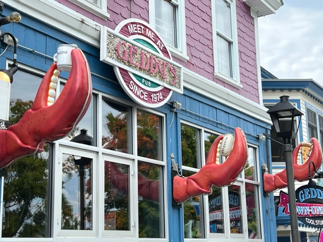
The village of Bar Harbor is a tourist town on steroids. In part due to the cruise ships, there are always lots of people walking around the village, browsing the shops, stopping for a bite to eat or a drink at one of the many restaurants and pubs, etc. Many of the establishments try to outdo each other to catch the attention of the tourists walking by. Here’s an example:
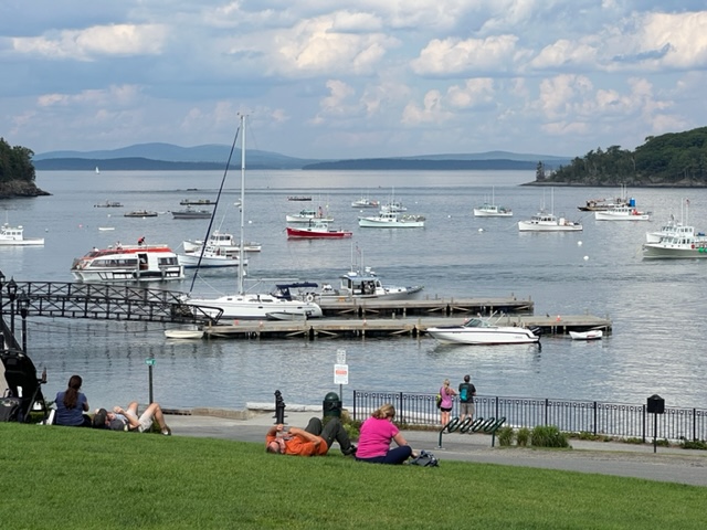
The harbor itself in Bar Harbor is quite picturesque, despite being surrounded on one side by hotels and eating establishments, each vying for attention. Here is the picturesque harbor:
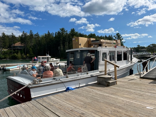
From Northeast Harbor, a “Mailboat” does several runs each day to make deliveries and take passengers to several of the nearby inhabited islands. The next day, Jake and I hopped on the Mailboat to visit Cranberry Island, where we split a pint of Ben & Jerry’s peanut butter cup ice cream at the General Store.
Notice the furniture in boxes tied to the top of the Mailboat, which was delivering them to Cranberry Island (along with the mail, presumably):
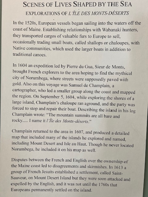
After our Mailboat expedition, Jake and I visited the small Maritime Museum in the small village of Northeast Harbor. This statue outside the front door is made entirely of clam shells:

Two things in particular caught my attention at the museum. The first is this historic plaque with some information about the history of Mt. Desert Island:
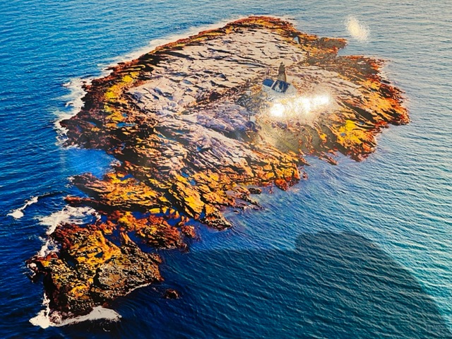
The other exhibit that caught my attention told the story of Mount Desert Rock Lighthouse. Mount Desert Rock is just that – a barren rock outcropping 18 miles out to sea from Mt. Desert Island. The first lighthouse was built on the rock in 1830, and the current one was built in 1847. However, in the early 1900’s, the lighthouse was deemed important enough to be manned year-round. Two houses were built, one with two living units and the other with one. For three years from 1906 to 1909, three families – six adults and four children – lived on the island year-round as caretakers. Here is a brief summary of the story:
Here is a picture of the island, where the lighthouse and one of the houses still stand. The picture shows the extent of the island at low tide; at high tide, just the center portion – excluding the yellowish/orangish portion around the perimeter – is the extent of the island upon which these ten hearty folks lived for three years, including three winters! Amazing!
When the strong winds finally subsided, we headed for our next destination, Buck’s Harbor, about 25 nautical miles down the coast. On our way out of Northeast Harbor, we passed this interesting building, built out over the water:

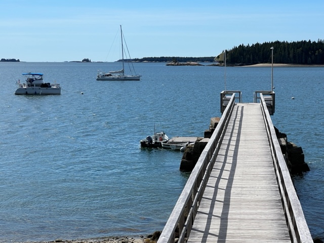
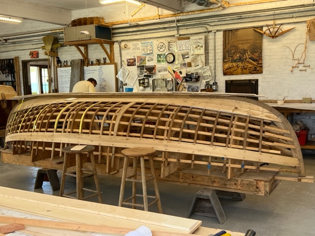
On our way to Buck’s Harbor, we picked up a mooring to visit the WoodenBoat School, which was started in 1981 as an extension of WoodenBoat Magazine. According to their Mission Statement, the purpose of the WoodenBoat School is “to provide access to experience for WoodenBoat enthusiasts in construction, maintenance, repair, design, seamanship, and other related crafts, and to establish a meeting ground for the finest and most knowledgeable boating professionals to share their skills, techniques, and appreciation of craftsmanship in wooden boats.” We took our dinghy into the dock, and were welcome to wander around the campus. Here is an image of the beautiful cove in which the WoodenBoat School is located, including the Joint Adventure at their mooring and their substantial dock:
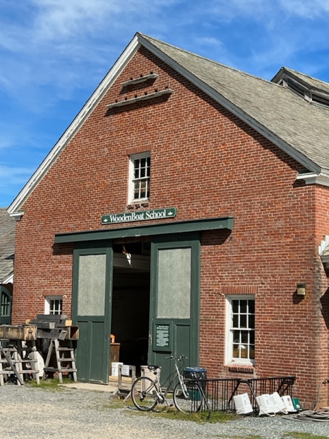
The campus consists of a primary building for the school and for boat construction, as well as a number of sheds and outbuildings that served various functions:
Rough cut lumber for the next boat is set to dry:

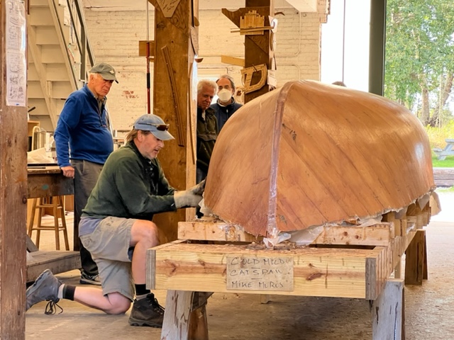
During our visit, various classes were underway, and work was being done on a variety of boats that were in various stages of construction:

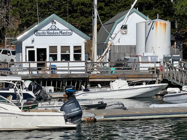
After our visit to the WoodenBoat School, we went on to Buck’s Harbor, which consists of a small but well-kept marina office/store and an adjacent outbuilding with showers, restrooms, etc., combined with a friendly attitude:
The cove is fully protected by an island across the entrance, and is quite active. There is no town per se nearby, but there is a classic New England General Store and an adjacent restaurant a short walk down the road. Unfortunately, the restaurant was closed for the season due to staffing shortages. However, Jim and Paul decided to relax on the porch of the General Store with a coffee:

Jake and I took a ride in the dinghy around the island at the entrance to the cove, then a ride around the mooring field. Here is one of the “boats” moored in the harbor:
The restaurant was closed and we were low on food, but fortunately the marina sold live lobsters; so we had to settle for lobsters that night for dinner, which Jim cooked on the boat.
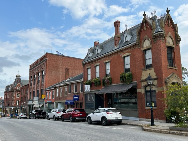
Our next stop was the city of Belfast, Maine – a very interesting place. It has the flavor of a large town rather than a city, since no building is more than four stories in height. The city seems to think of itself in similar terms:

Belfast is located on Penobscot Bay, along with the famous tourist destinations of Camden, Rockport, and Rockland. It’s the furthest inland of the four communities, located at the end of the bay. The city doesn’t possess the fame and cache of the other three towns, but it has an abundance of restaurants, pubs, and other tourist shops. The downtown area was active and vibrant on a Sunday afternoon, with a festive atmosphere. Here are a couple of images of the streetscape with many historic buildings:
This seems to convey the feeling of many of the Mainers that we’ve met so far:
I’m guessing that many of us men have felt this way from time to time (notice the sign on the wall)….

Interestingly, Belfast has a bit of an artsy, hippie-ish, earthy/crunchy feel to it, from the food co-op to the prevalent artwork to the ambiance of some of the shops and small businesses and kiosks. The “Coffeeman”, who did a brisk business, is a good example:
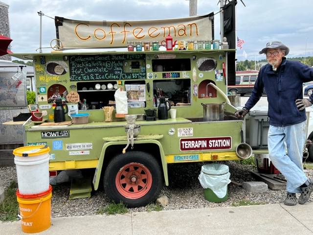
The buckets on the left contain his blended coffee beans which he grinds to order.
All of the chairs that have been placed throughout the city in public places are painted with various artistic designs, some of which are quite ornate:

And some funky shops –

The waterfront is also a working harbor, which contained the biggest travel lift that I have ever seen – notice the sixteen enormous wheels, each taller than I am (OK, I’m not that tall, but they’re still very big for a wheel!). Noticing that the boat on the lift is a catamaran, maybe it could be the next Joint Adventure….

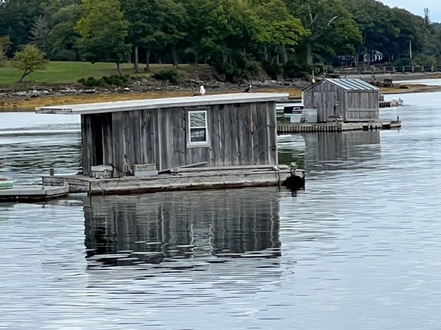
Our next destination was the busy tourist town of Rockland, further up Penobscot Bay. On our way, we took a detour through Broad Cove, where we passed a small working harbor. To make up for a shortage of storage space on shore, a number of floating storage sheds dotted the cove:
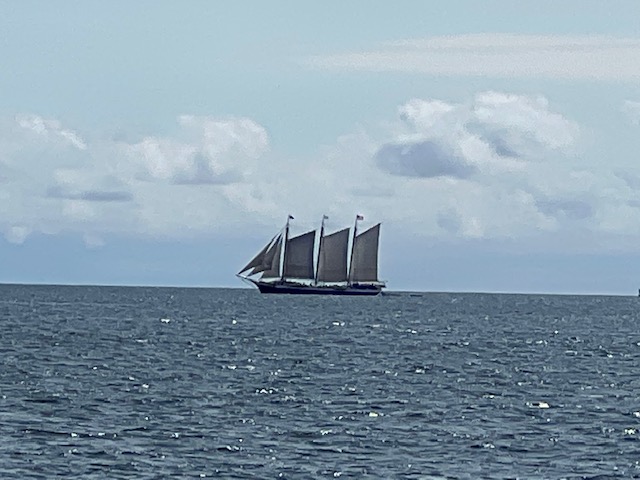
As we approached the Camden/Rockport/Rockland end of Penobscot Bay, we encountered a half dozen large schooners that take visitors out for a day-sails, based in each of the three towns. They are a majestic sight to see, gliding along the waves:

Rockland is the area’s largest city, with both commercial activity and tourism as economic drivers. There is a large facility on the waterfront that processes seaweed and kelp from as far away as South America into food stabilizers and fillers.
The city lacks the quaint, picturesque look that I expected. It’s larger than I anticipated, and the character is noticeably compromised by the fact that the main downtown thoroughfare is, in fact, the two northbound lanes of Route 1. As a result, the through traffic is constant, including a steady flow of large trucks through the downtown retail area. The feeling of congestion is compounded by narrowness of the sidewalks on both sides of the street.
That being said, there are restaurants, pubs, and plenty of shops to explore, as well as four first-rate museums to visit – the Farnsworth Art Museum; the Sail, Power, and Steam Museum; the Owl’s Head Transportation Museum; and the Maine Lighthouse Museum.
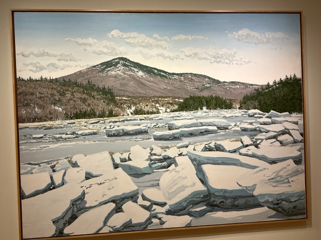
I’m certainly not at all a connoisseur of art, but I thoroughly enjoyed the Farnsworth Art Museum. Following are a few paintings that caught my attention:
By Neil Welliver, 1976:
By Alex Katz, 2008:
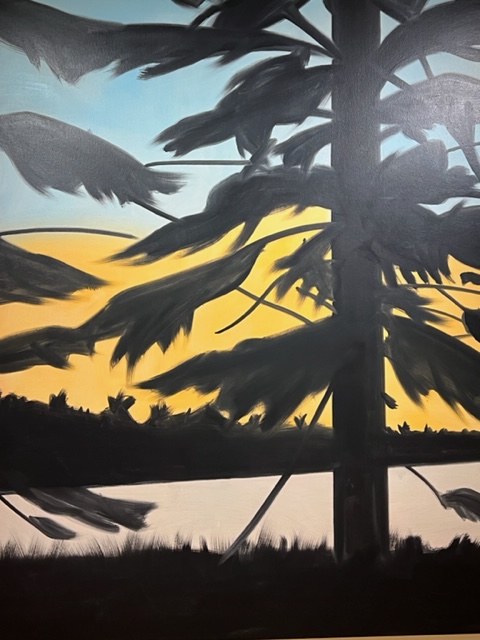
By James Wyatt, 1989:
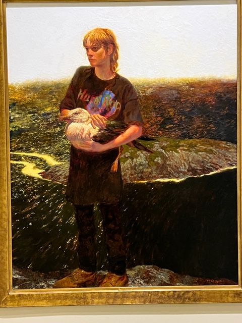
By Stephen Hannook, 2020:

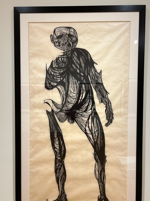
The most compelling exhibit was the works of an artist named Leonard Baskin, whom I had never heard of but learned about in this exhibit. He was an American sculptor and artist who was born in 1922 and died in Northampton, Ma. in 2000. Baskin abhorred the violence, and some of his artwork sought to convey the horrors of war and man’s inhumanity to his fellow man. Later in his career, he created a series of “woodcuts” called the Holocaust Series to focus attention on such horrors. These works are graphic, and I found the exhibit to be quite compelling. Here are some images from the exhibit:

A woodcut, I learned, is a flat sculpture carved into a wide piece of wood, which is then inked and used to print the resulting image on paper. They are large, ranging to perhaps 8′ tall by 4′ wide.
Here are more images from the exhibit:

This Baskin woodcut is called “The Hydrogen Man”, a reference to the nuclear bombing of Hiroshima and Nagasaki:

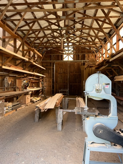
The small Sail, Power, and Steam Museum was closed when we rode our bikes there, but the door was unlocked and the curator was inside working, so he turned the lights on for us and let us explore the museum! It’s small but interesting and very well done. The displays included many very old but restored engines and all sorts of machinery from yesteryear. One room contains an old steam engine from the late 1800’s that has been restored to operate, which is connected by pulleys to a host of other machines, which operate as well. Demonstrations are held when the museum is open.
Here is a picture of wooden band saw in the museum, along with the brief plaque that explains its significance during World War II:


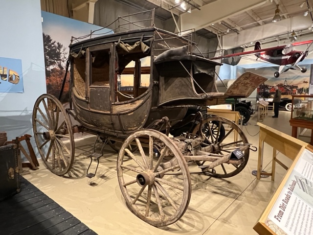
The significant Owl’s Head Transportation Museum contains the largest collections of vintage aircraft, automobiles, motorcycles, and other transportation machines that I’ve seen. In addition, the descriptions, stories, anecdotes, and historical accounts throughout are interesting and informative. Following are just a few examples.
This is an original stagecoach that carried mail and passengers from the mid-west to California before the intercontinental railroad was constructed:
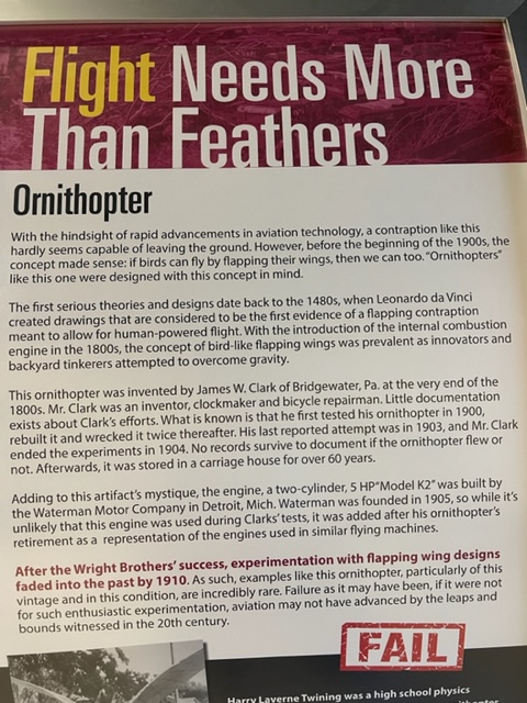
Before the Wright Brothers and others demonstrated the feasibility of powered flight using fixed wings, experimentation with machines with wings that flapped was also being done. The museum contains one of the very few remaining such machines. The wings are literally bird feathers, each of which is painstakingly attached individually to the frame of the wings:

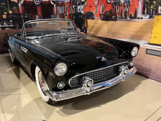
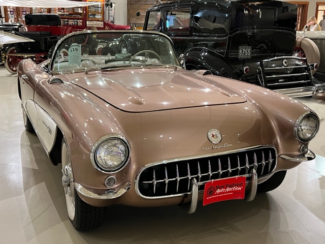
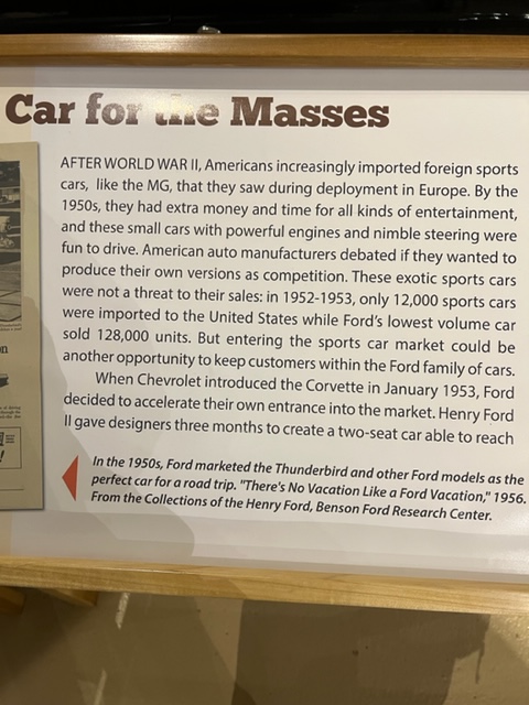
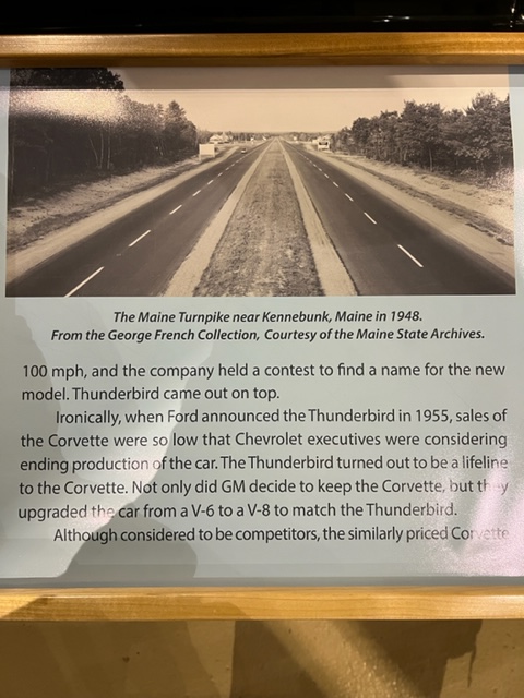
For vintage sports car buffs, here are pictures of an early Ford Thunderbird and an early Chevrolet Corvette, followed by a plaque on three panels that provides a short insight into the inter-relationship of these two classic sports cars:

The Maine Lighthouse Museum is small but well presented. Below is a picture of a 2nd order Fresnel lens, which revolutionized lighthouse design by using multiple prisms to magnify a small light into a powerful beam that was visible many miles out to sea. Invented by Augustin Fresnel in the late 1700’s, it has been called “the invention that saved a million ships”. A 1st order lens weighs up to 6 tons!

Riding our bikes along the waterfront bike path, we came upon this sculpture memorial to the container ship El Faro. You may remember the story – it was lost along with its entire crew of 33 in October 2015 when the captain refused to turn back despite dire warnings that he was heading directly into the eyewall of Hurricane Joaquin with winds of 150 mph. Our visit to the memorial happened to coincide with that of a professor from the Maine Maritime Academy in nearby Castine, Maine; two of the crew members who were lost had been his students at the Academy.
After three straight days of moving south, we stayed an extra day in Rockland due to high winds and monsoon rains. The next morning, we headed out towards Boothbay Harbor. After some initial bumpiness coming out of Penobscot Bay, the ride was smooth and pleasant once we turned southward. We poked in and out of some passages through the many islands along the coast, then decided to poke into New Harbor just to take a look. It is picturesque but small and narrow, and packed with moorings. Here are a few images:


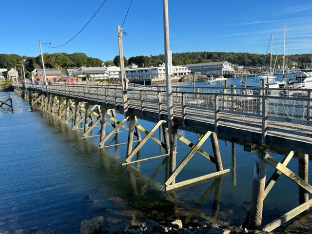
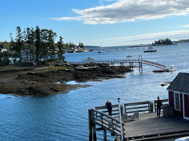
Knowing that Hurricane Fiona was on its way north and would impact the waters in Maine, I called ahead to arrange a secure and protected place to dock in the inner harbor at Boothbay. Here we are, just about as far into the harbor as one can get – for those familiar with Boothbay Harbor, we’re docked just short of the footbridge, from which this picture was taken:

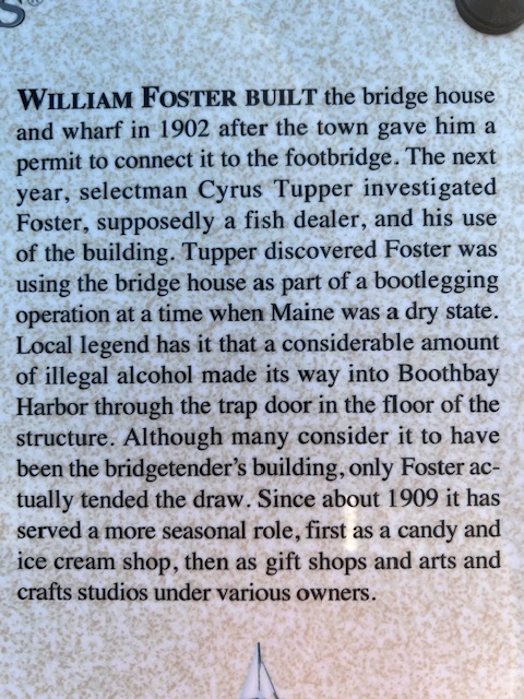
Here is a picture of the footbridge that connects the two sides of the harbor, which was built in 1902:
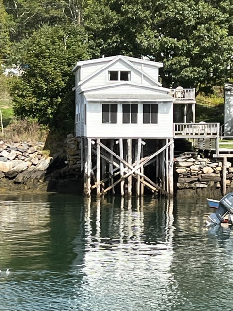
About halfway across the bridge, there is a wooden house on stilts, connected to the bridge; following is a picture of the house and a historical plaque which tells an interesting story about its alleged original use:
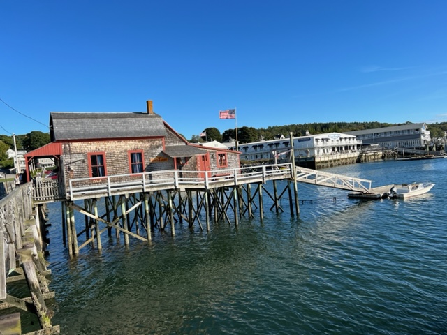
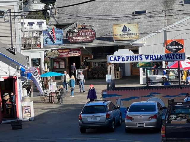
Boothbay Harbor is built for tourists, and the many shops, restaurants, pubs, hotels, lodging houses, etc. along the waterfront attest to its popularity. Here is an example from the waterfront area:
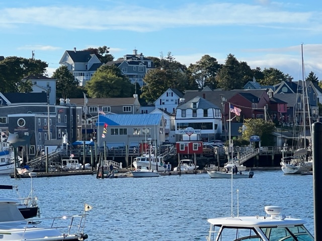
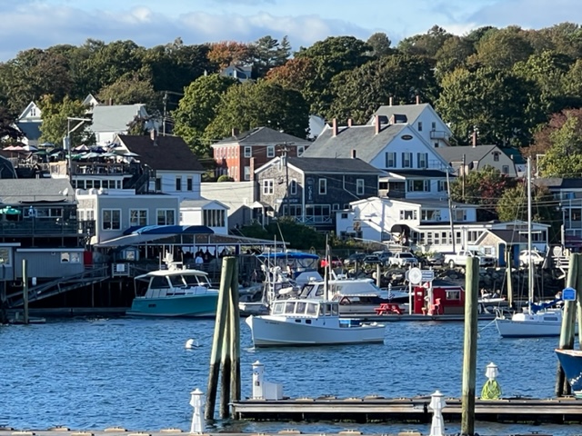
The following two pictures of the waterfront are taken from the opposite shore on the inner harbor, after crossing the footbridge:
Here is a view of an island in the inner harbor; what a spot for a house!
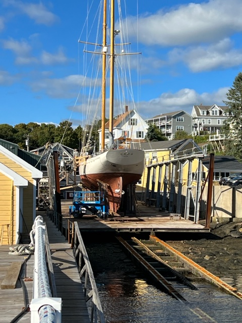
Given the large number of boats of all types in and around the Boothbay area- pleasure boats, lobster boats, sailboats, charter boats, etc. – the waterfront also has several facilities that service and repair boats of all sizes. Here’s an example:
As I write this, Paul, Jim, Jake, and I are hunkered down in the Joint Adventure while being inundated with monsoon rain from the approach of Hurricane Fiona. Being tucked in where we are, we’re mostly protected from the strong winds and rough seas. While the rain is predicted to subside here by tomorrow, strong winds will keep us pinned down for at least three days. I’ll do some more exploring when the rain subsides, and I’ll include it in the next post.
The weather is getting colder up here in Maine, and is becoming more unsettled. We’re on the home stretch, with Boston now less than 200 miles away by water. It’s time to start heading for the barn!
A bit more to come!

Leave a comment