
The Bay of Fundy is known throughout the world for its enormous tides, its roaring currents, and its frequent dense fog. The tide at the end of the Bay is the highest tide in the world, reaching 52 feet – the average tidal range throughout the world is just 3.3 feet. In every 12 hour tidal cycle, 110 billion gallons of water flow in and out of the Bay; that’s equivalent to the flow of 2000 St. Lawrence Rivers! And remember, the St. Lawrence River drains the entire drainage basin of all five of the Great Lakes, from as far west as the Rocky Mountains! For another context, the amount of flow exceeds twice as much as the combined flow from ALL the rivers in the world!
This tremendous movement of water in and out of the Bay every twelve hour cycle produces currents that exceed 8 knots in and around narrow passages; creates turbulence, eddies, upwellings, and whirlpools that can spin a boat around; and can produce dangerous standing waves or moving “tidal bores”.
The enormous tides are caused by the unique combination of configuration and topography of the Gulf of Maine and the Bay of Fundy, which form a funnel-shaped basin that gradually narrows. In addition, the Bay gradually shoals, getting shallower and shallower towards the northern end of the Bay. This shoaling and narrowing causes the water to “pile up” at the end, where it sloshes back and forth, similar to a wave in a bathtub, and providing an extra push as it reaches the end of the Bay.
The upwelling and turbulence causes cold water rich in nutrients from the bottom to rise and mix throughout the water column, feeding a tremendous growth of marine plants and animals called plankton. The abundance of plankton attracts and feeds an incredible variety and quantity of sea life, including krill, herring, squid, mackerel, seabirds, and whales. The Bay of Fundy also supports the best lobster fishing in the world.
Given the dynamics and the reputation of the Bay of Fundy, we approached of crossing with great respect. We planned to cross in the first part of September when the incidence of fog is reduced from an average of sixteen days in June, July, and early August to an average of seven days in late August and September. September also brings lighter winds, on average, than earlier in the summer or than in October, when the weather shifts and the fall weather patterns start to bring more frequent and more violent storms.
We also built extra time into our schedule for the crossing so we could pick our days carefully.
The majority of boats that cross the Bay do so in a single day or an overnight passage, generally riding the current southeast to Cutler, Maine or Mt. Desert Island (Acadia National Park). However, doing so bypasses the Bay itself and bypasses some interesting and unique places that we wanted to visit, so we decided to do the crossing in three separate segments. Here is my feeble attempt to provide a map to help you visualize the route of our crossing:
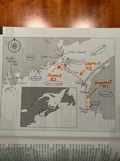
The first segment took us on a northern track from Yarmouth, Nova Scotia to the small fishing village of Westport on Brier Island. The second segment took us on a northwestern track 35 nautical miles to the island of Grand Manan, New Brunswick, where we entered the small fishing village of Seal Cove. The final segment took us 25 nautical miles almost due north to Lubac, Maine, on the Canadian border. From there, we planned to start heading southwest along the coast of Maine, back to Boston.
We timed our departure and our arrival for each segment around the tidal movements in the location where the currents were most critical, planning to transit such passages at or near slack tide as best we could. We also chose our days carefully, looking for days of light wind and only days when the wind blows in the same direction of the current during our passage – wind direction against current direction produces anything from uncomfortable chop to dangerous waves and turbulence, depending on the strength of both the wind and the current.
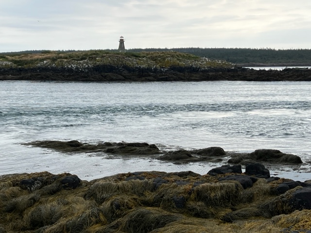
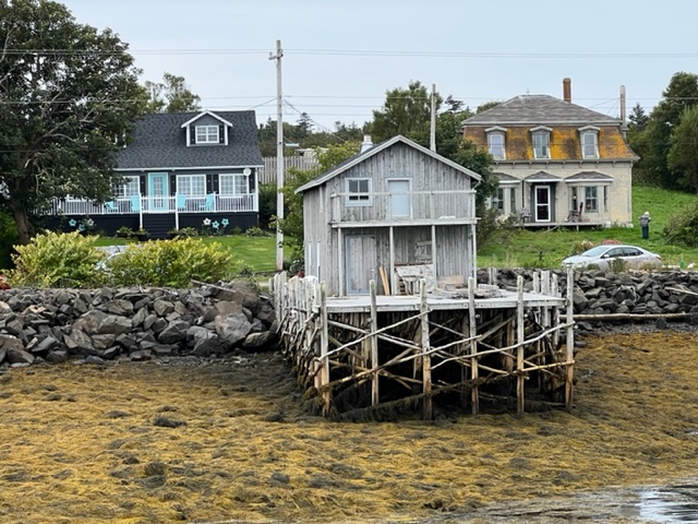
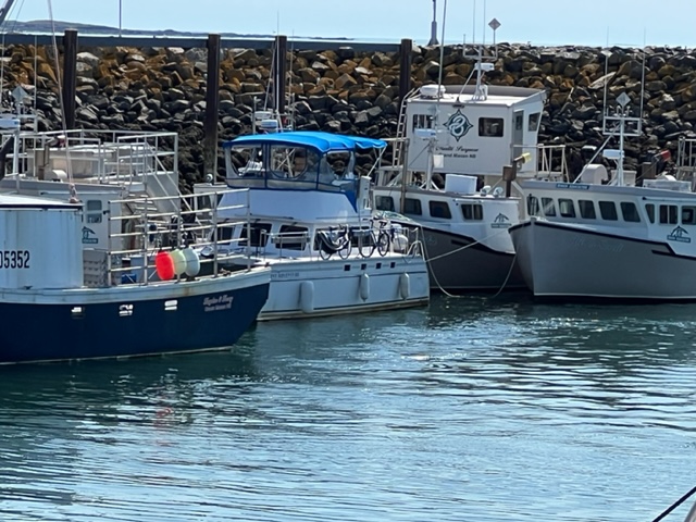
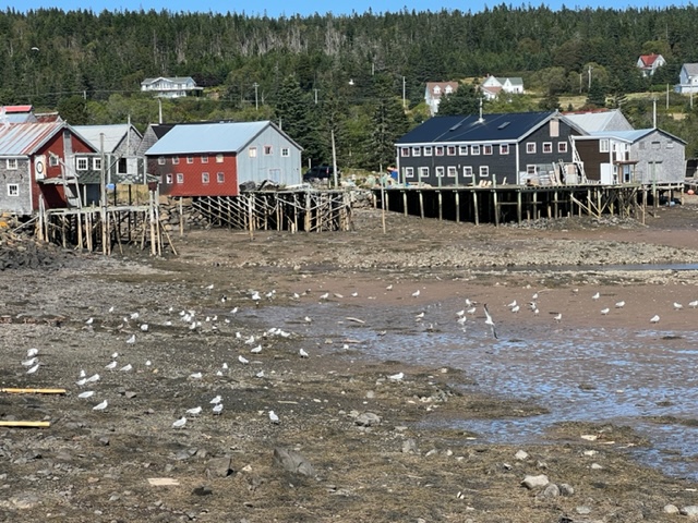
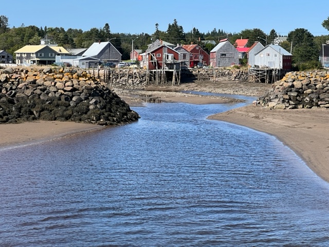
Our first passage was from Yarmouth to Westport on Brier Island. The harbor in Westport is entered through Grand Passage, a narrow pass between Brier Island and Long Island off the coast of mainland Nova Scotia. We timed our departure from Yarmouth to coincide with an incoming (flood) tide to take advantage of the tidal flow in the Bay, and to arrive at slack high tide in Grand Passage. We were very fortunate to have a beautiful, sunny day with virtually no wind. As a result, our passage across the first segment of the Bay of Fundy and our entry through Grand Passage and into Westport Harbor was totally benign and pleasant. We experienced swirling water, eddies, and small whirlpools as the currents passed around headlands and over underwater terrain, but nothing that was uncomfortable.
Here’s an image of our entry into Grand Passage:
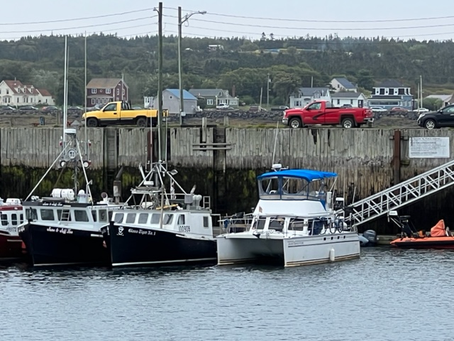
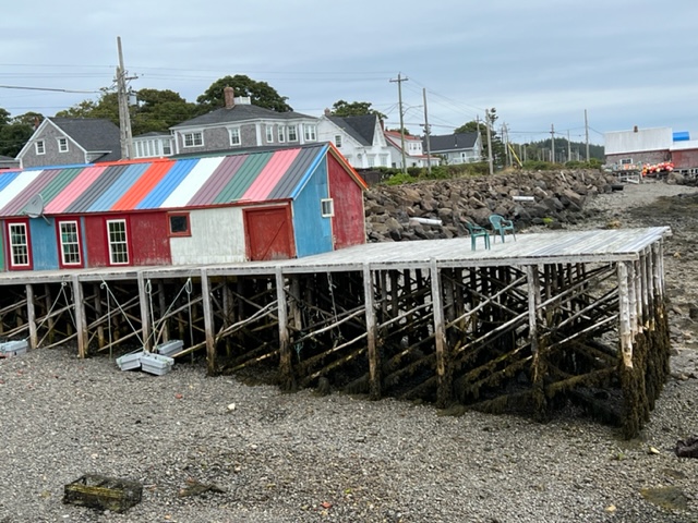
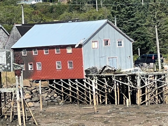
Westport is purely a fishing harbor, and we were the only cruising boat anywhere in the harbor. There was no space along the floating docks or along the harbor walls to tie up, so we chose a fishing boat and rafted to it. The boat that we tied to was the fourth boat in a string of fishing boats rafted to each other, so we were the fifth boat in the row. Here are some images:
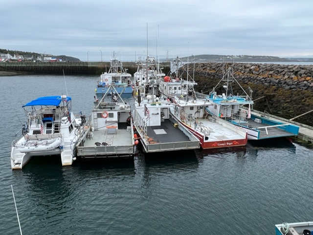
A short time after we rafted, a fisherman who manages the harbor visited us and confirmed that the place we chose to tie up was OK – we weren’t blocking any other working boat from coming in or out, and since the lobster season in Nova Scotia was closed, the four lobster boats in our rafting chain would not be going out. Later that day, Robert, the owner of the boat to which we were rafted and his son Mathew came by to work on their boat. During our pleasant, 20 minute chat, they welcomed us to Brier Island and welcomed us to be tied up to their boat!
The advantage of rafting to a boat rather than tying to a seawall is that we didn’t have to worry about docklines being long enough to accommodate the 14 foot tidal range in the harbor. The downside is that we have to climb across four fishing boats to get on or off the Joint Adventure – and more importantly, we had to drag our bikes across the four boats to get them ashore as well:

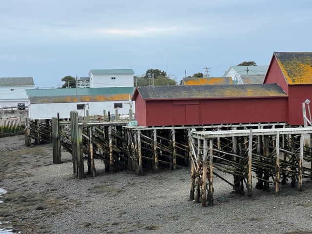
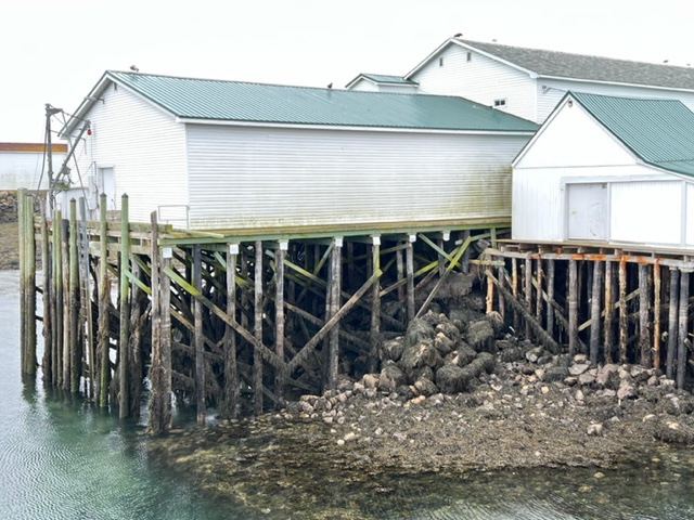
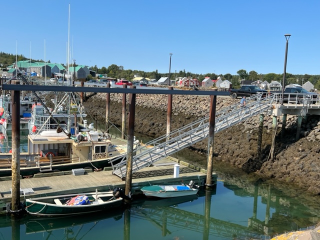
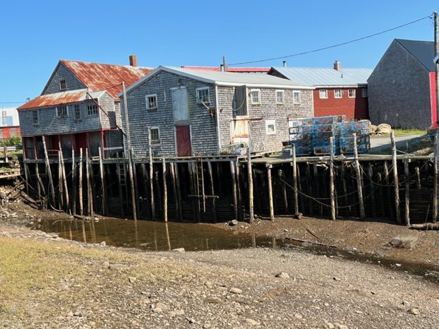
The amazing tidal range creates challenges for any interaction between the land and the water. Land-based facilities had to be above the high tide range, and water-based facilities had to be floating, with long ramps connecting the two, which were quite steep at low tide. Here are some images at low tide:
As it turned out, we had two days of unfavorable winds following our arrival on Brier Island, so we had plenty of time to explore the very small town, ride around the entire island, and meet some of the people. The economy of Westport and Brier Island is based on lobster fishing, aquaculture, and whale watching. Whales surrounding the island are abundant, and the limited number of visitors who come to the island on the ferry go whale watching on inflatable boats that hold about a dozen passengers each.
However, lobstering dominates the island – lawn decorations, Brier Island style:
Some people collect stamps; this guy chose a different hobby. I wonder what his wife thinks of this….
Mildred, how much money did we make renting rooms after expenses this past year??
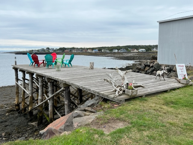
The sign says “Private wharf – by invitation only” – we tried to weasel an invitation, but no one was home!
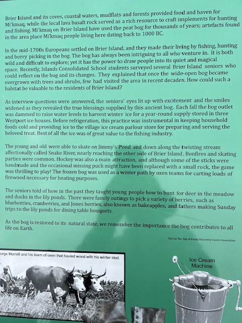
This plaque was adjacent to a boardwalk overlooking an enormous bog that starts near the waterfront and extends into the island. I found the plaque to provide an interesting look into the “olden days” of life on Brier Island:
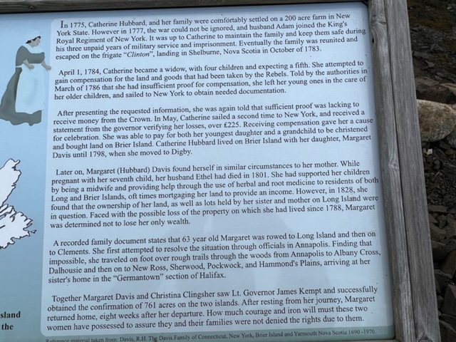
Here’s another plaque that provides a window into the grit of the people who settled and lived on this remote outpost; this plaque was labeled “Petticoat Heroes”:
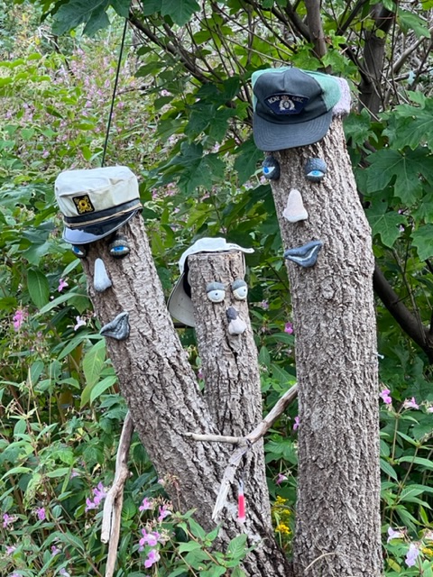
A welcoming entrance to a driveway on the island:
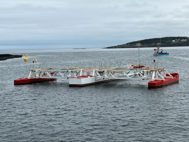
In the last 15 years, the Gulf of Maine has been warming at a rate which is seven times the global average. As a result, there has been a strong effort to generate more electricity with renewable sources to replace fossil fuel. Since water is 800 times denser than air, tidal energy can be a very concentrated form of renewable energy using relatively small turbines for a high power output. Capitalizing on the strong currents in Grand Passage, several electric generating platforms, each containing six small turbines, have been erected in strategic locations in the harbor and the channel to generate electricity. At peak flow, these turbines will generate a total of 420 KW, enough to power all 400 homes on Brier and Long Island. The electricity is transmitted to shore via underwater cables.
Here is what each power-generating platform looks like:
After staying on Brier Island for two extra days waiting for a favorable weather window, we left in the early afternoon to take advantage of slack tide in the channel to start the second segment of our crossing of the Bay of Fundy; this segment was a 35 nautical mile run perpendicular to the Bay, to the small fishing harbor of Seal Cove on Grand Manan Island, New Brunswick. The current on this segment was on our beam, pushing us sideways as we made the crossing; a simple course adjustment compensated for the cross-current. We again were incredibly fortunate to have a perfectly calm, sunny day, so our passage was remarkably routine, noting only some swirling water and turbulence as we passed over underwater obstructions interrupting the current flow and some turbulence as we approached Grand Manan.
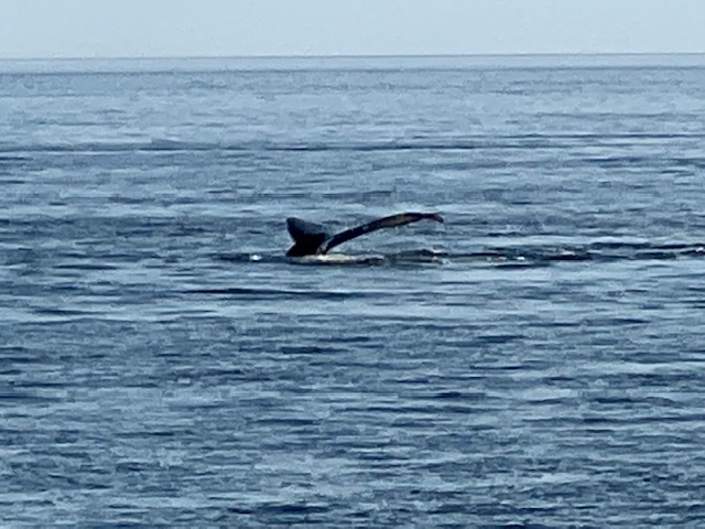
A short distance after we left Brier Island, we spotted a pod of whales about 2 miles off our course. We headed in that direction, and observed the whales feeding on a school of fish. The first image is of fins of the whales protruding above the water as they circled their prey and fed:
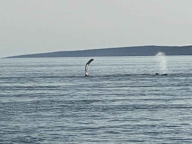
I wasn’t very quick on the lens with this one –
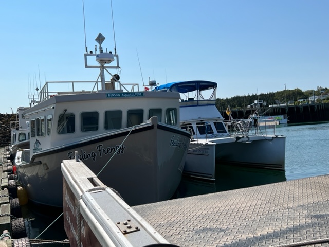
Upon our arrival at Seal Cove, a fisherman who managed the harbor directed us to a large fishing boat to which we could raft. Here are some images:
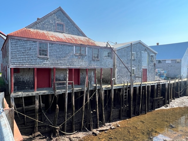
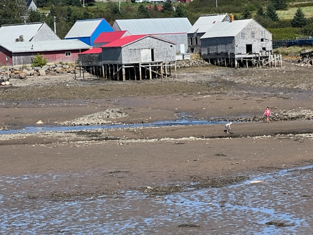
The tidal range at Seal Cove is about 14 feet, so at low tide, the floating docks are way below the level of the land. The posts that hold the docks in place are so tall that they are connected to each other at the top to provide structural stability. In the images below, you can see the steel beams that connect the posts above the high tide level:
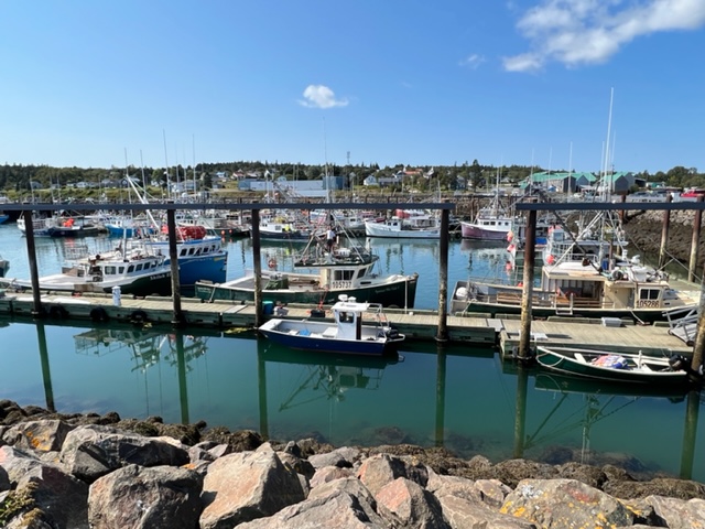
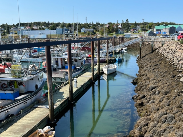
The large harbor seemed to contain somewhere around 75 fishing boats; the Joint Adventure again had identity issues, as she was the only cruising boat in the entire harbor; most of the boats were also much larger and much stronger than her. Most are fishing boats, but a significant number are dedicated to supporting the large fish farms in the cove just outside the harbor.
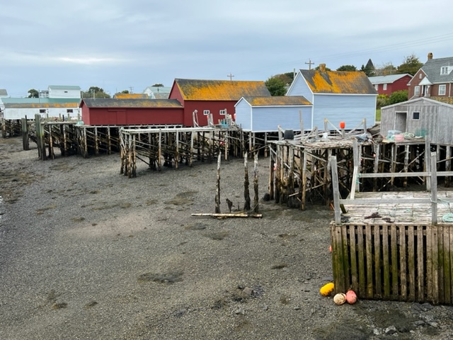
Similar to Westport on Brier Island but even more extreme, the water level at low tide leaves most of the buildings on the waterfront high and dry, creating some almost eerie images:
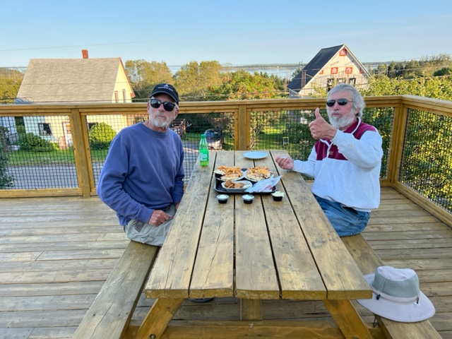
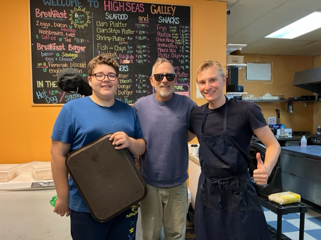
Jim and I rode our bikes around the area surrounding the harbor, which consists only of commercial support facilities for the fishing and aquaculture operations; clusters of homes where fishermen and their families live; and a general store that also serves as a diner of sorts, offering deep fried fish and chips and burgers with picnic tables outside on a deck. Jim and I wanted a change of scenery from eating on the boat, so we decided to have dinner at the diner; however, we wanted our fish pan-fried rather than deep fried. The cook was a young guy who somehow got there from Russia, but spoke heavily-accented English. After some conversation back and forth which included some “how to” instructions from Jim, he agreed to try to pan fry the fish for us, despite the fact that he had never done so before. After a “trial run” which he had us sample, he brought out our pan-fried dinner and beamed when we gave him our hearty approval. We tipped him and his assistant well, and he told us to be sure to come back there the next time we were in town:
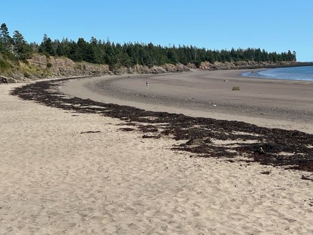
Adjacent to the harbor was a beautiful sand beach; despite water temperatures in the high fifties, there were a few hearty people in the water:
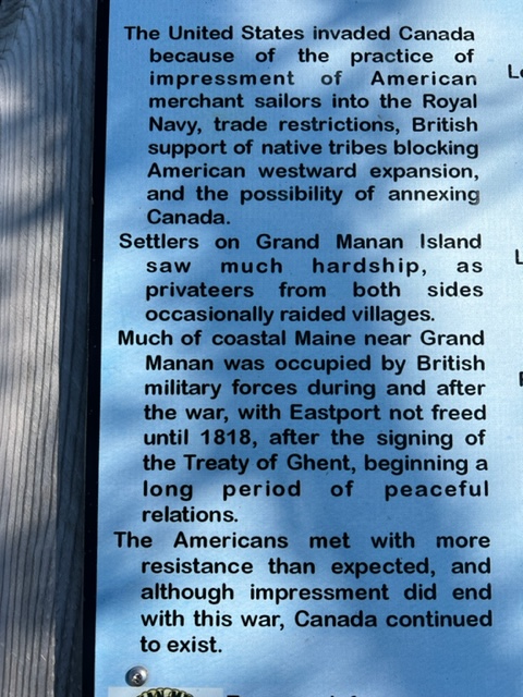
The following historical plaque caught my attention. We don’t seem to focus much on the War of 1812 in history classes, but this plaque provides an interesting perspective from the Canadian side:
Lubec Channel is narrow, crooked, and rock-strewn, and passes under a bridge with concrete piers that anchor the bridge. The current runs through the channel at up to 8 knots, and the turbulence and whirlpools caused by the rocky, crooked channel and the bridge piers make passage dangerous except at or near high slack tide. The tidal range of 20 feet is such that slack tide lasts for just ten minutes.
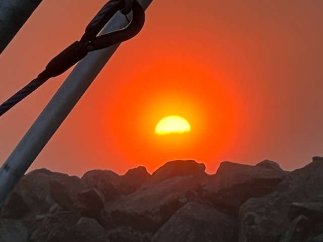
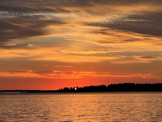
In order to arrive at the channel near high slack tide, we left Grand Manan at first light; here is a picture of the sun rising above the breakwater and a picture of the sunrise as it blossomed:
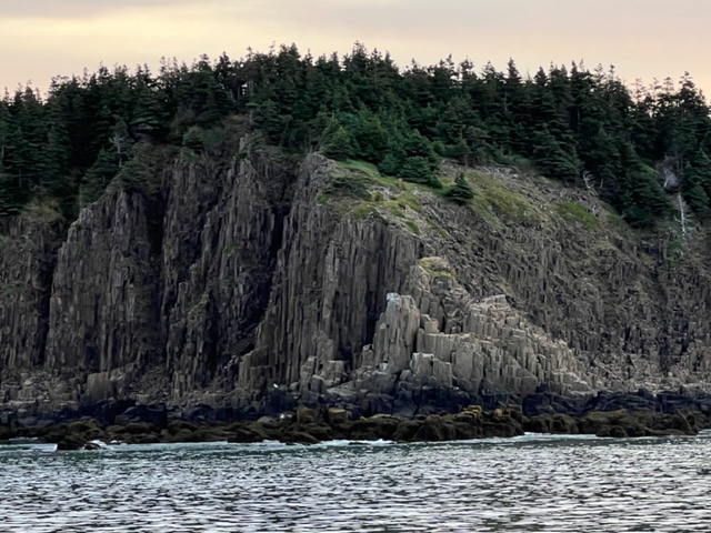
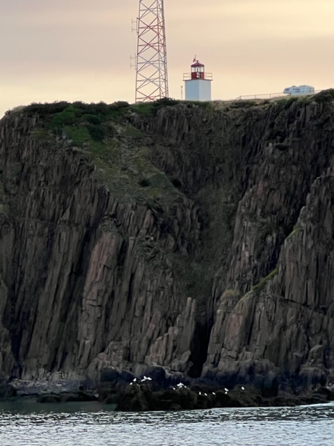
The coast of Grand Manan Island facing Maine is a spectacular bold, rock cliff:
Amazingly, we again had a perfect, sunny day with no wind, so our final passage through the Bay of Fundy was pleasant and uneventful. We arrived at Lubec Channel near high slack tide as planned, and passed though the channel safely despite some unnerving turbulence between the bridge piers.
We’re now back in the USA! We crossed into Canada at Rouse’s Point at the northern end of Lake Champlain on June 10, and traveled through four Canadian provinces before re-entering the US at Lubec on September 8, almost three months to the day – Quebec, New Brunswick, Prince Edward Island, and Nova Scotia. During that time, we traveled 1702 nautical miles (just under 2,000 statute miles) through Canadian waters. We met some of the most amazing, friendly, outgoing, and generous people I’ve met in my lifetime, and we saw some of the most beautiful places in the world.
We now begin the final leg of our journey along the coast of Maine and New Hampshire, and back to Boston.
More to come!

Leave a comment